POWER 475 FT-RESERVOIR 5.8 MILES-INCREDIBLE VIEWS-FORT GARLAND 7.5 MILES
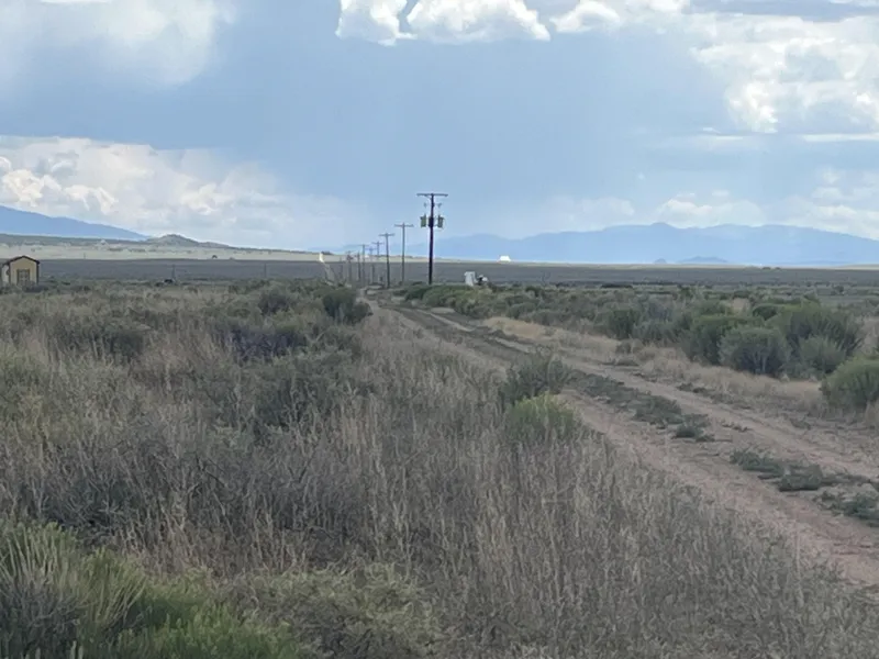
Amazing views of Mt. Blanca, the Sangre de Cristo Mountains, and mesas in every direction from this awesome 4.99 acre property in the San Luis Valley of Colorado. Power lines run across the street about 475 feet south of this lot. This beautiful land is on the corner of two county dirt roads in the Top of the World subdivision of Fort Garland called Budweiser Road and Amy Lane. This property has been surveyed, and the plat map is on file with the Costilla County Assessor's office. The County Assessor has put an actual value of $6,250 on this property. Drive only 5.8 miles north around the mesa and you come to Mountain Home Reservoir where you can boat, kayak, canoe, fish, and swim. This land is zoned estate residential and is buildable. Short term camping is also allowed, or you can just hold onto the land for investment; there is no time limit to build. This great property is only about 1.5 miles east of paved 2-lane paved Highway 159. This parcel is only 7.5 miles from Fort Garland to the north traveling on Highway 159, and 14 miles from the oldest town in Colorado, San Luis, traveling south on Highway 159. These towns have a few restaurants, post office, dollar store, gas stations, and grocery stores that will provide all of your necessities. Fort Garland also has an old fort built in 1858 along with a museum and cultural center that you can visit. From the land, you are a quick commute of only 32 miles by highway driving to the larger town of Alamosa with a population of about 9,600 people that has larger box stores, local restaurants and grocery stores, a regional hospital, a regional airport, hotels, a Starbucks, and a small university. The geography of this area of Colorado is very unique and offers some incredible outdoor recreation opportunities. Here are some distances from this property to a few of the area towns and exciting outdoor adventure venues:
Fort Garland- 7.5 miles
San Luis- 14 miles
Alamosa- 32 miles
Blanca- 12 miles
Mountain Home Reservoir- 5.8 miles
Sangre de Cristo Mountains-2 miles
Smith Reservoir-11 miles
Mt. Blanca (4th highest peak in the Rocky Mountains)-15 miles
Sanchez Stabilizing Reservoir-20 miles
Sanchez Reservoir-23 miles
Ute Mountain in New Mexico-43 miles
The Rio Grande River-19 miles
San Luis Hills Wildlife Area-32 miles
Lobatos Bridge and 1000's of acres of public land for recreational use- 38 miles
Great Sand Dunes National Park-34 miles
Zapata Falls- 33 miles
And much more!
This great property is located in the desirable Top of the World subdivision in Fort Garland, Colorado. There is no HOA; only Costilla County Planning and Zoning guidelines apply. If you decide to build, a septic system and permanent water source (well or water cistern) needs to be installed before building. Homes need to be a minimum of 600 square feet in size with most home types permitted. Accessory structures such as a shed, pole barn, greenhouse, etc., can be placed on the land once the residence is built. Power would by solar, wind, gas/propane generator, or a combination of any of these power sources. Heating a home in winter would be by a propane heating system and/or a wood burning furnace. There is no time limit to build. You can camp on this land for 14 days every 3 months without a camping permit. You can purchase long-term camping permits from the County once you have a septic system and permanent water source installed. Taxes on the property are $135.64 per year and paid current. You as the new landowner will not have to pay taxes again until early 2026. There are no liens on the land. The legal description of the property is TOP OF THE WORLD UNIT 4 LOT 1. The County Assessor's parcel number is 70602122. We will convey this land to the new landowner through a Warranty Deed. Please visit our home business website for much more information about this great property by clicking on the Property Website link or Seller Website link at the end of this listing. Please contact us with any questions. Thanks for looking! Bart and Lori Leu, Westward Ho! Land Investments LLC
From elevation to risk assessment
Search for detailed parcel information including; Elevation & Vegetation Maps, Ownership Information, Detailed Parcel Information, Crop History Map, Soil Survey Productivity Data, and more.
Research Parcel InformationDirections
Travel south on Highway 159 out of Fort Garland for 4.7 miles, then turn left on County Lane 6. Go 1.5 miles, then turn right on Amy Lane for 1 mile to arrive at the NW west corner of the property, with GPS coordinates of 37.3447, -105.4050. The lot will be on your left side (east).
Resources
Land for Sale by Bart and Lori Leu
Costilla County Properties By Type
- Undeveloped Land for Sale in Costilla County, Colorado
- Residential Property for Sale in Costilla County, Colorado
- Riverfront Property for Sale in Costilla County, Colorado
- Ranches for Sale in Costilla County, Colorado
- Lakefront Property for Sale in Costilla County, Colorado
- Hunting Land for Sale in Costilla County, Colorado
- Farms for Sale in Costilla County, Colorado
- Recreational Property for Sale in Costilla County, Colorado
- Timberland for Sale in Costilla County, Colorado
- Horse Property for Sale in Costilla County, Colorado
- Commercial Property for Sale in Costilla County, Colorado
- Beachfront Property for Sale in Costilla County, Colorado
Properties for Sale Nearby Counties
Costilla County Properties By City
- Blanca, Colorado Land for Sale
- Chama, Colorado Land for Sale
- Fort Garland, Colorado Land for Sale
- Jaroso, Colorado Land for Sale
- San Luis, Colorado Land for Sale
- Garcia, Colorado Land for Sale
- Los Fuertes, Colorado Land for Sale
- Mesita, Colorado Land for Sale
- San Pablo, Colorado Land for Sale
- San Pedro, Colorado Land for Sale
- Eastdale, Colorado Land for Sale
- Fir, Colorado Land for Sale
- More