1.16 Acres for Less Than Your Daily Latte
OWNER FINANCING AVAILABLE:
$50 down (plus the $250 doc fee)
$85/mo for 60 months
---------------------------------
Life in the city getting overwhelming? The constant noise, traffic, and cramped spaces can wear anyone down. The daily grind of urban living takes its toll on your peace of mind, leaving you yearning for something more meaningful and spacious to call your own.
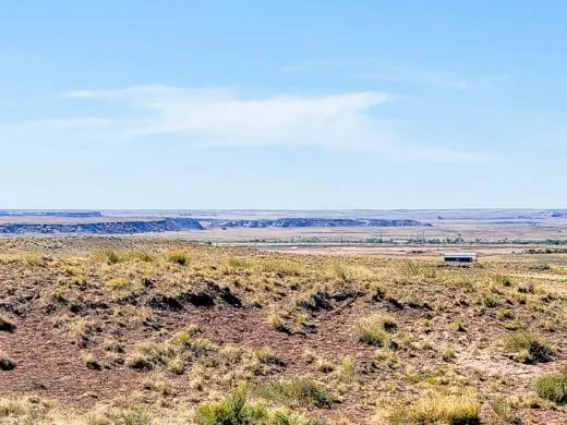
But there's a solution waiting for you: 1.16 acres of pristine land in Petrified Forest Estates. This generous parcel offers the freedom and tranquility you've been missing, just 2 miles from Petrified Forest National Park. Here, the stunning desert landscapes and natural vegetation create your personal sanctuary away from urban chaos.
Located 1.2 miles south of HWY 40, this versatile property welcomes both agricultural and residential projects. Build your dream home without size restrictions, start a small ranch, or create that garden you've always wanted. No rushed timelines - develop your space at your own pace.
Our satisfied landowners speak for themselves - visit our testimonials to hear their stories. Purchase with complete confidence, backed by our 100% money-back guarantee. If this property doesn't meet your expectations, we'll make it right.
Transform your lifestyle today with this rare opportunity to own a piece of American heritage. This land isn't just a property - it's your gateway to the life you've imagined, where space, freedom, and natural beauty become your daily reality.
Contact us now to make this remarkable property yours and begin writing your next chapter in Petrified Forest Estates.
SUBDIVISION: PETRIFIED FOREST ESTATES UNIT 3
STREET ADDRESS: N/A Near N7912, Holbrook, AZ 86025
STATE: AZ
COUNTY: Apache County, AZ
ZIP: 86025
SIZE: 1.16 acres
LOT DIMENSIONS: 172 feet x 310 feet
APN: 211-34-129
LEGAL DESCRIPTION: Lot 129, Petrified Forest Estates, Unit 2, according to the recorded plat of record in the Recorder's Office, APACHE County, ARIZONA
LAT/LONG COORDINATES:
NW: 35.007929, -109.842175
NE: 35.007923, -109.841617
SW: 35.007091, -109.842182
SE: 35.007085, -109.841628
ELEVATION: 6,797 feet
ANNUAL TAXES: Approx. $28 per year
ZONING: Agricultural - No time limit to build. No restrictions on dwelling size. You can build anything for residential purposes such as Single Family, Mobile or Manufactured home.Camping & RV's are okay as well (permits required for long-term stay, more than 30 days).RV's should be at least four hundred (400) square feet, constructed to be towed on its own chassis and designed so as to be installed with or without a permanent foundation for human retail occupancy and/or dwelling residence.Camping in an RVs must be inspected by the Planning and Zoning office to ensure all plumbing and electrical is in working order prior to application approval. It could long term as long as it was approved by the Apache Health Office.Please contact the Apache County Planning & Zoning Dept. through Devin Brown at (928) 337-7547.
LAND USE:
***BUILDING INFORMATION***
Time Limit to Build: No
Site Built Homes Allowed: Yes
Modular Homes Allowed: Yes
Manufactured Homes Allowed: Yes
Mobile Homes Allowed: Yes
Tiny Homes Allowed: Yes
***ALLOWABLE USES***
Full-Time RV Living: No
RV on the property while you build: Yes
Camping in a RV: 30 days without permit. RV's should be at least four hundred (400) square feet, constructed to be towed on its own chassis and designed so as to be installed with or without a permanent foundation for human retail occupancy and/or dwelling residence.
Camping in a Tent: Yes
FLOOD ZONE: No
HOA/POA: No
IMPROVEMENTS: None
ACCESS: The property can be accessed via N7912.
WATER: Would be a well, water haul and holding tank or other similar option
SEWER: Would be by Septic
UTILITIES: Power by solar, wind or generator, Phone by cellular, satellite TV/Internet/Phone
From elevation to risk assessment
Search for detailed parcel information including; Elevation & Vegetation Maps, Ownership Information, Detailed Parcel Information, Crop History Map, Soil Survey Productivity Data, and more.
Research Parcel InformationDirections
ACCESS: The property can be accessed via N7912.
Resources
Land for Sale by Landopia
Apache County Properties By Type
- Undeveloped Land for Sale in Apache County, Arizona
- Ranches for Sale in Apache County, Arizona
- Residential Property for Sale in Apache County, Arizona
- Farms for Sale in Apache County, Arizona
- Hunting Land for Sale in Apache County, Arizona
- Recreational Property for Sale in Apache County, Arizona
- Lakefront Property for Sale in Apache County, Arizona
- Riverfront Property for Sale in Apache County, Arizona
- Beachfront Property for Sale in Apache County, Arizona
- Horse Property for Sale in Apache County, Arizona
- Timberland for Sale in Apache County, Arizona
- Commercial Property for Sale in Apache County, Arizona
Properties for Sale Nearby Counties
- Catron County, Arizona Land for Sale
- Cibola County, Arizona Land for Sale
- Graham County, Arizona Land for Sale
- Greenlee County, Arizona Land for Sale
- McKinley County, Arizona Land for Sale
- Montezuma County, Arizona Land for Sale
- Navajo County, Arizona Land for Sale
- San Juan County, Arizona Land for Sale
- San Juan County, Arizona Land for Sale
Apache County Properties By City
- Alpine, Arizona Land for Sale
- Chambers, Arizona Land for Sale
- Chinle, Arizona Land for Sale
- Concho, Arizona Land for Sale
- Dennehotso, Arizona Land for Sale
- Eagar, Arizona Land for Sale
- Fort Defiance, Arizona Land for Sale
- Ganado, Arizona Land for Sale
- Greer, Arizona Land for Sale
- Houck, Arizona Land for Sale
- Lukachukai, Arizona Land for Sale
- Lupton, Arizona Land for Sale
- More
- Many Farms, Arizona Land for Sale
- Mcnary, Arizona Land for Sale
- Nazlini, Arizona Land for Sale
- Nutrioso, Arizona Land for Sale
- Rock Point, Arizona Land for Sale
- Round Rock, Arizona Land for Sale
- Saint Johns, Arizona Land for Sale
- Saint Michaels, Arizona Land for Sale
- Sanders, Arizona Land for Sale
- Springerville, Arizona Land for Sale
- Teec Nos Pos, Arizona Land for Sale
- Vernon, Arizona Land for Sale
- Window Rock, Arizona Land for Sale
- Concho Valley, Arizona Land for Sale
- Cornfields, Arizona Land for Sale
- Greasewood, Arizona Land for Sale
- Klagetoh, Arizona Land for Sale
- Mexican Water, Arizona Land for Sale
- Red Mesa, Arizona Land for Sale
- Richville, Arizona Land for Sale
- Rough Rock, Arizona Land for Sale
- Salado, Arizona Land for Sale
- Salina, Arizona Land for Sale
- Steamboat Canyon, Arizona Land for Sale
- Sunrise Springs, Arizona Land for Sale
- Tahchee, Arizona Land for Sale
- Toyei, Arizona Land for Sale
- Adamana, Arizona Land for Sale
- Allentown, Arizona Land for Sale
- Boneyard, Arizona Land for Sale
- Bonita Trading Post, Arizona Land for Sale
- Burnside, Arizona Land for Sale
- Chetco, Arizona Land for Sale
- Correjo Crossing, Arizona Land for Sale
- Cove, Arizona Land for Sale
- Coyote Springs, Arizona Land for Sale
- Crosby Crossing, Arizona Land for Sale
- Del Muerto, Arizona Land for Sale
- Diamond Fields, Arizona Land for Sale
- El Tule, Arizona Land for Sale
- Emmanuel Mission, Arizona Land for Sale
- Feaster, Arizona Land for Sale
- Flat Rock, Arizona Land for Sale
- Green Spot, Arizona Land for Sale
- Greer Place, Arizona Land for Sale
- Hawley Lake, Arizona Land for Sale
- Heap Place, Arizona Land for Sale
- Hunt, Arizona Land for Sale
- Hunters Point, Arizona Land for Sale
- Junction Overlook, Arizona Land for Sale
- Kinlichee, Arizona Land for Sale
- Kinney Junction, Arizona Land for Sale
- Los Burros, Arizona Land for Sale
- Lower Wheatfields, Arizona Land for Sale
- Maverick, Arizona Land for Sale
- Mexican Water Trading Post, Arizona Land for Sale
- Milkwater, Arizona Land for Sale
- Navajo, Arizona Land for Sale
- Northwoods, Arizona Land for Sale
- Oak Springs, Arizona Land for Sale
- Paulcell Place, Arizona Land for Sale
- Pine Springs, Arizona Land for Sale
- Pinta, Arizona Land for Sale
- Potter Place, Arizona Land for Sale
- Rosebud, Arizona Land for Sale
- Sand Springs, Arizona Land for Sale
- Sehili, Arizona Land for Sale
- Steamboat, Arizona Land for Sale
- Tanner Springs, Arizona Land for Sale
- Tes Nez Iah, Arizona Land for Sale
- Three Forks, Arizona Land for Sale
- Totacon, Arizona Land for Sale
- Troweek, Arizona Land for Sale
- Tsintaa Yiti Ii, Arizona Land for Sale
- Twin Falls, Arizona Land for Sale
- Upper Wheatfields, Arizona Land for Sale
- Wheatfields, Arizona Land for Sale
- White Clay, Arizona Land for Sale
- Wide Ruins, Arizona Land for Sale
- Wood Springs, Arizona Land for Sale
- Woodspring Trading Post, Arizona Land for Sale
- Yazzi, Arizona Land for Sale
