White River Gold Mine
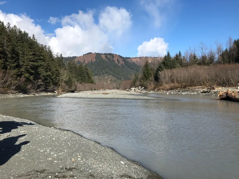
The White River Basin Area Claim Group (WRCG), located near Cape Yakataga in South Central Alaska, comprises 154 mining claims across approximately 11,320 acres. The region is centered around the White River, a seven-mile glacial stream believed to be the source of significant gold reserves. Historically, over 15,000 ounces of placer gold were mined in the early 1900s, primarily from rich beach and bench gravels. However, much of the auriferous material remains unmined, with promising initial sampling and geological studies confirming the presence of gold-bearing alluvial and uplifted beach deposits.
The area's complex geologycharacterized by Tertiary sedimentary rocks over older igneous formations, extensive glacial deposition, and tectonic uplifthas created an ideal environment for placer gold accumulation. Stream gradients ranging from 33 to 50 feet per mile, as well as the replenishing ruby sands of the current beach (one of the most energetic in the world), point to the areas high potential. Gold-bearing sediments have been identified at depths beyond standard excavating capabilities, suggesting the possibility of deeper reserves.
Access to the WRCG is limited to bush planes, barges, and small boats, with Yakutat Airport serving as the main regional hub. Satellite communication is mandatory due to the absence of cellular service, though a new tower is planned. Despite logistical hurdles, the region offers a long operating season (910 months annually) and remains largely untouched. Economic projections indicate that modern mechanized mining, including large suction dredges, could make development highly profitable. Further sampling and analysis are required to define the full extent of the placer gold deposits and determine the feasibility of large-scale operations. WRCG represents a compelling opportunity for mineral exploration and investment.
From elevation to risk assessment
Search for detailed parcel information including; Elevation & Vegetation Maps, Ownership Information, Detailed Parcel Information, Crop History Map, Soil Survey Productivity Data, and more.
Research Parcel InformationDirections
Resources
Land for Sale by Troy Dana
Yakutat Borough Properties By Type
- Undeveloped Land for Sale in Yakutat Borough, Alaska
- Beachfront Property for Sale in Yakutat Borough, Alaska
- Riverfront Property for Sale in Yakutat Borough, Alaska
- Commercial Property for Sale in Yakutat Borough, Alaska
- Hunting Land for Sale in Yakutat Borough, Alaska
- Horse Property for Sale in Yakutat Borough, Alaska
- Lakefront Property for Sale in Yakutat Borough, Alaska
- Farms for Sale in Yakutat Borough, Alaska
- Ranches for Sale in Yakutat Borough, Alaska
- Recreational Property for Sale in Yakutat Borough, Alaska
- Residential Property for Sale in Yakutat Borough, Alaska
- Timberland for Sale in Yakutat Borough, Alaska