Auction Information
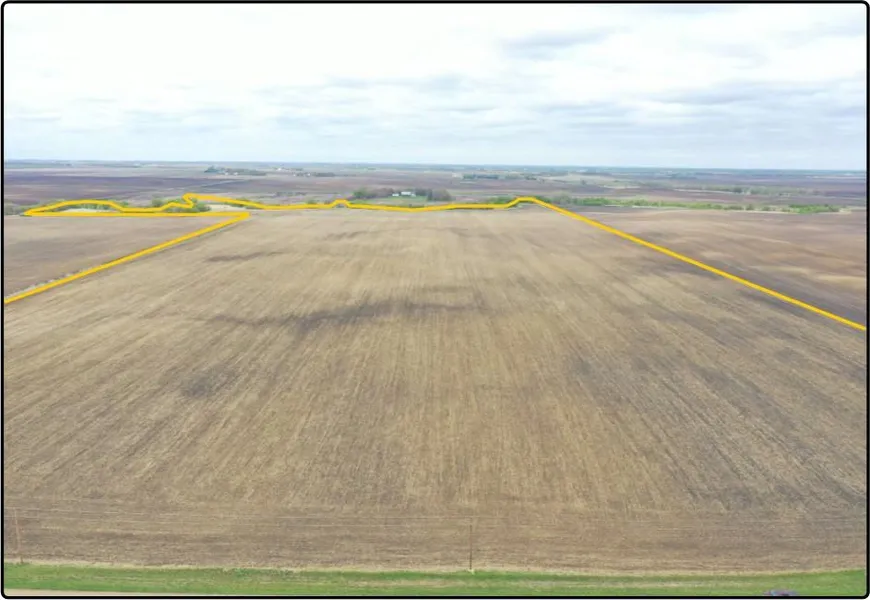
Cottonwood Co., MN - 117.30 Ac. (190-0004-02)
117.30 acres, m/l, located approximately 7 miles southwest of Sanborn, MN on the west side of 450th Ave., 1/2 mile south of Co. Rd. 11.
This level to gently rolling farm has 102.26 estimated FSA crop acres with a CPI of 89.80. There are a total of 7.20 acres enrolled in 6 CRP contract. Contact agent for contract detail. Farm is leased for 2021 crop year. Crop lease payment will be prorated to date of closing.
From elevation to risk assessment
Search for detailed parcel information including; Elevation & Vegetation Maps, Ownership Information, Detailed Parcel Information, Crop History Map, Soil Survey Productivity Data, and more.
Research Parcel InformationDirections
From Sanborn go east on Co. Rd. 15
toward US 71. Turn south at the first cross
street onto US 71 for 2.9 miles. Go west
on Co. Rd. 11 for 3 miles, then south on
450th Ave. for mile. Property is on the
west side of 450th Ave
Resources
Land for Sale by Hertz Real Estate Services
Cottonwood County Properties By Type
- Farms for Sale in Cottonwood County, Minnesota
- Lakefront Property for Sale in Cottonwood County, Minnesota
- Commercial Property for Sale in Cottonwood County, Minnesota
- Hunting Land for Sale in Cottonwood County, Minnesota
- Ranches for Sale in Cottonwood County, Minnesota
- Undeveloped Land for Sale in Cottonwood County, Minnesota
- Residential Property for Sale in Cottonwood County, Minnesota
- Recreational Property for Sale in Cottonwood County, Minnesota
- Horse Property for Sale in Cottonwood County, Minnesota
- Beachfront Property for Sale in Cottonwood County, Minnesota
- Riverfront Property for Sale in Cottonwood County, Minnesota
- Timberland for Sale in Cottonwood County, Minnesota