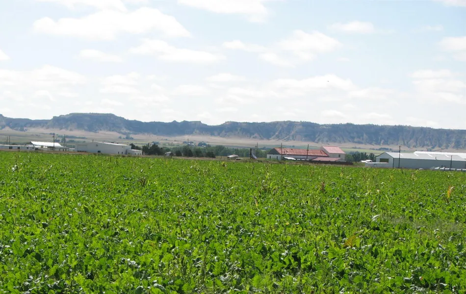
141.16 acres in Scotts Bluff County, Nebraska
Location: 1 mile west of Scottsbluff, Nebraska on Hwy 26 to County Road 19.
Legal Description: N1/2S1/2 Section 9-T22N-R55W of the 6th P.M., Scotts Bluff County, Nebraska., (excluding that portion platted as Shaver Addition, Hwy 26 & Burlington Northern Rail Road ROWs, the
Scottsbluff Drain and an Enterprise Irrigations District Lateral.)
Acres: 141.16 tax assessed acres
Taxes: 2013 taxes payable in 2014 - $3,631.16
FSA Info: 135.2 Ac. DCP Cropland - 135.2 Ac. Flood Irrigated with 84.5 Ac. Corn base at 99 Bu yield.
Water: This property has 140 acres water allocation from the Enterprise Canal. The 29 acre tract south of the highway does have an irrigation well registered with the State of Nebraska Registration #G-021519 but the North Platte NRD shows no certified irrigated acres with that well.
Soils: 13.9% Class I McCook loam, 51.6% Class II Haverson, Glenburg & Tripp fine sandy loams, 33.6% Class III Yockey, Alice & Las Animas fine sandy loams.
Price: $825,000
Comments: This property has excellent access from State Highway 26, paved County Road 20, and County Road 19. There is commercial development potential with several accesses from Highway 26. There is excellent housing development potential with a housing subdivision adjacent to the property. This farm is a very level, productive farm. It could be re-sold into 4 different parcels for development (see map).
Contact: Roger Luehrs, Co-Listing Agent; 308-631-2506
Mike Polk, Co-Listing Agent; 308-539-4446
Bruce Dodson, Greg Polk, Tony Eggleston, Jerry Weaver, Chase Dodson, Don Walker
From elevation to risk assessment
Search for detailed parcel information including; Elevation & Vegetation Maps, Ownership Information, Detailed Parcel Information, Crop History Map, Soil Survey Productivity Data, and more.
Research Parcel InformationResources
Land for Sale by Tony Eggleston
Scotts Bluff County Properties By Type
- Farms for Sale in Scotts Bluff County, Nebraska
- Ranches for Sale in Scotts Bluff County, Nebraska
- Hunting Land for Sale in Scotts Bluff County, Nebraska
- Commercial Property for Sale in Scotts Bluff County, Nebraska
- Residential Property for Sale in Scotts Bluff County, Nebraska
- Riverfront Property for Sale in Scotts Bluff County, Nebraska
- Lakefront Property for Sale in Scotts Bluff County, Nebraska
- Undeveloped Land for Sale in Scotts Bluff County, Nebraska
- Horse Property for Sale in Scotts Bluff County, Nebraska
- Recreational Property for Sale in Scotts Bluff County, Nebraska
- Timberland for Sale in Scotts Bluff County, Nebraska
- Beachfront Property for Sale in Scotts Bluff County, Nebraska
Properties for Sale Nearby Counties
Scotts Bluff County Properties By City
- Gering, Nebraska Land for Sale
- Lyman, Nebraska Land for Sale
- Mcgrew, Nebraska Land for Sale
- Melbeta, Nebraska Land for Sale
- Minatare, Nebraska Land for Sale
- Mitchell, Nebraska Land for Sale
- Morrill, Nebraska Land for Sale
- Scottsbluff, Nebraska Land for Sale
- Haig, Nebraska Land for Sale
- Henry, Nebraska Land for Sale
- Stegall, Nebraska Land for Sale
- Terrytown, Nebraska Land for Sale
- More
- Baxter, Nebraska Land for Sale
- Bradley, Nebraska Land for Sale
- Carlson, Nebraska Land for Sale
- Costin, Nebraska Land for Sale
- Covert, Nebraska Land for Sale
- Doyle, Nebraska Land for Sale
- Hartman, Nebraska Land for Sale
- Heldt, Nebraska Land for Sale
- Hillerage, Nebraska Land for Sale
- Hubbard Corner, Nebraska Land for Sale
- James, Nebraska Land for Sale
- Jane, Nebraska Land for Sale
- Janise, Nebraska Land for Sale
- Joyce, Nebraska Land for Sale
- Mintle, Nebraska Land for Sale
- Pelton, Nebraska Land for Sale
- Redus, Nebraska Land for Sale
- Sears, Nebraska Land for Sale
- South Mitchell, Nebraska Land for Sale
- South Morrill, Nebraska Land for Sale
- Tony, Nebraska Land for Sale
- Trout, Nebraska Land for Sale