143 acres in Coosa County, Alabama
Description
Located in northern Coosa County about 40 minutes from the intersection of US Hwy 280 and US Hwy 231 at Sylacauga
About 89 ac south of the creek is young natural pine timber release-sprayed 10 years ago. About 54 ac north of creek is mature natural pine and hardwood.
About 1/3 mile of frontage on former county road. Locked gate so call for combo
Great hunting with 4 green-fields
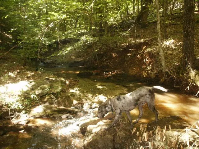
Over mile of creek flows through the property
From elevation to risk assessment
Search for detailed parcel information including; Elevation & Vegetation Maps, Ownership Information, Detailed Parcel Information, Crop History Map, Soil Survey Productivity Data, and more.
Research Parcel InformationDirections
Directions from the intersection of US Hwy 280 and US Hwy 231 at Sylacauga: (40 minutes to the property)
From the intersection of US Hwy 280 and US Hwy 231 go 11.6 miles south on US Hwy 231 towards Rockford to Co. Rd. 59. Take a right and go 1.2 miles to Co. Rd. 34. Take a right and go 3.5 miles to Co. Rd 18. Take a left and go 1.9 miles to a dirt road on the right (former county road). Take a right and go 3/4 mile to a locked gate. Proceed another mile to the south line of the property on the right. Look for the Cyprus Partners sign. Property is on the right for the next 1/3 mile. You are welcome to look on your own (use topo map as a guide) or you can set up an appointment. Call for gate combo. The south line of the property is located at Lat: 325703.49 N. Lon: 861643.25 W.
Environmental Factors
Resources
Coosa County Properties By Type
- Undeveloped Land for Sale in Coosa County, Alabama
- Hunting Land for Sale in Coosa County, Alabama
- Farms for Sale in Coosa County, Alabama
- Timberland for Sale in Coosa County, Alabama
- Lakefront Property for Sale in Coosa County, Alabama
- Residential Property for Sale in Coosa County, Alabama
- Riverfront Property for Sale in Coosa County, Alabama
- Ranches for Sale in Coosa County, Alabama
- Commercial Property for Sale in Coosa County, Alabama
- Recreational Property for Sale in Coosa County, Alabama
- Horse Property for Sale in Coosa County, Alabama
- Beachfront Property for Sale in Coosa County, Alabama
Properties for Sale Nearby Counties
Coosa County Properties By City
- Equality, Alabama Land for Sale
- Goodwater, Alabama Land for Sale
- Kellyton, Alabama Land for Sale
- Rockford, Alabama Land for Sale
- Weogufka, Alabama Land for Sale
- Nixburg, Alabama Land for Sale
- Bentleyville, Alabama Land for Sale
- Bradford, Alabama Land for Sale
- Cottage Grove, Alabama Land for Sale
- Crewsville, Alabama Land for Sale
- Dollar, Alabama Land for Sale
- Fishpond, Alabama Land for Sale
- More
- Gold Branch, Alabama Land for Sale
- Hanover, Alabama Land for Sale
- Hatchet, Alabama Land for Sale
- Hidden Valley, Alabama Land for Sale
- Hillwood, Alabama Land for Sale
- Hissop, Alabama Land for Sale
- Holman Crossroads, Alabama Land for Sale
- Jon, Alabama Land for Sale
- Kellys Crossroads, Alabama Land for Sale
- Keyno, Alabama Land for Sale
- Lyle, Alabama Land for Sale
- Marble Valley, Alabama Land for Sale
- Moriah, Alabama Land for Sale
- Parkdale, Alabama Land for Sale
- Pentonville, Alabama Land for Sale
- Quinsey, Alabama Land for Sale
- Ray, Alabama Land for Sale
- Richville, Alabama Land for Sale
- Schley, Alabama Land for Sale
- Sehoya, Alabama Land for Sale
- Socapatoy, Alabama Land for Sale
- Soleo, Alabama Land for Sale
- Speed, Alabama Land for Sale
- Stewartville, Alabama Land for Sale
- Strickland Crossroads, Alabama Land for Sale
- Travelers Rest, Alabama Land for Sale
- Unity, Alabama Land for Sale