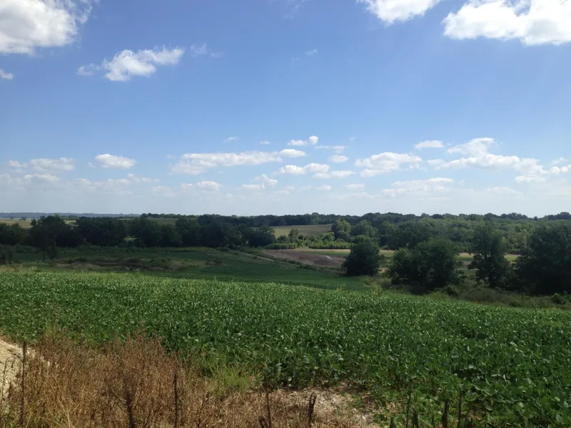
148 acres in Saline County, Missouri
This property is a great combination of row crop and recreational. Approximately 50% is currently row crop; 11 acres in CRP. This property also has approximately 58 acres in the bottom which are eligible for WRP. The WRP program and the availability of funds varies from year to year, but the last estimate would have resulted in a one time payment of approximately $175,000, additionally the costs would be covered for the wetland construction. The adjacent farm entered approximately 50 acres into the program within the last 5 years. Highway P forms the east border of the farm; County gravel roads form the southern boarder and one half of the southwestern boarder providing easy access. Water on the property consists of several small ponds and Fish Creek, which runs through the middle of the property and has water all year.
From elevation to risk assessment
Search for detailed parcel information including; Elevation & Vegetation Maps, Ownership Information, Detailed Parcel Information, Crop History Map, Soil Survey Productivity Data, and more.
Research Parcel InformationEnvironmental Factors
More Land for Sale in Saline County
Saline County Properties By Type
- Farms for Sale in Saline County, Missouri
- Hunting Land for Sale in Saline County, Missouri
- Residential Property for Sale in Saline County, Missouri
- Undeveloped Land for Sale in Saline County, Missouri
- Ranches for Sale in Saline County, Missouri
- Commercial Property for Sale in Saline County, Missouri
- Lakefront Property for Sale in Saline County, Missouri
- Timberland for Sale in Saline County, Missouri
- Riverfront Property for Sale in Saline County, Missouri
- Recreational Property for Sale in Saline County, Missouri
- Horse Property for Sale in Saline County, Missouri
- Beachfront Property for Sale in Saline County, Missouri
Properties for Sale Nearby Counties
Saline County Properties By City
- Arrow Rock, Missouri Land for Sale
- Blackburn, Missouri Land for Sale
- Gilliam, Missouri Land for Sale
- Malta Bend, Missouri Land for Sale
- Marshall, Missouri Land for Sale
- Miami, Missouri Land for Sale
- Nelson, Missouri Land for Sale
- Slater, Missouri Land for Sale
- Sweet Springs, Missouri Land for Sale
- Cretcher, Missouri Land for Sale
- Grand Pass, Missouri Land for Sale
- Marshall Junction, Missouri Land for Sale
- More
- Napton, Missouri Land for Sale
- Saline City, Missouri Land for Sale
- Sharon, Missouri Land for Sale
- Blue Lick, Missouri Land for Sale
- Cambridge, Missouri Land for Sale
- Fairville, Missouri Land for Sale
- Hardeman, Missouri Land for Sale
- Herndon, Missouri Land for Sale
- Montague Hill, Missouri Land for Sale
- Mount Leonard, Missouri Land for Sale
- New Frankfort, Missouri Land for Sale
- Norton, Missouri Land for Sale
- Orearville, Missouri Land for Sale
- Ridge Prairie, Missouri Land for Sale
- Salt Springs, Missouri Land for Sale
- Shackleford, Missouri Land for Sale
- Stanhope, Missouri Land for Sale
- West Glasgow, Missouri Land for Sale
- Wilton Springs, Missouri Land for Sale