E½SE¼, SE¼NE¼ 10-148-83 (LE), Coleharbor, ND 58531 - McLean County
Auction Information

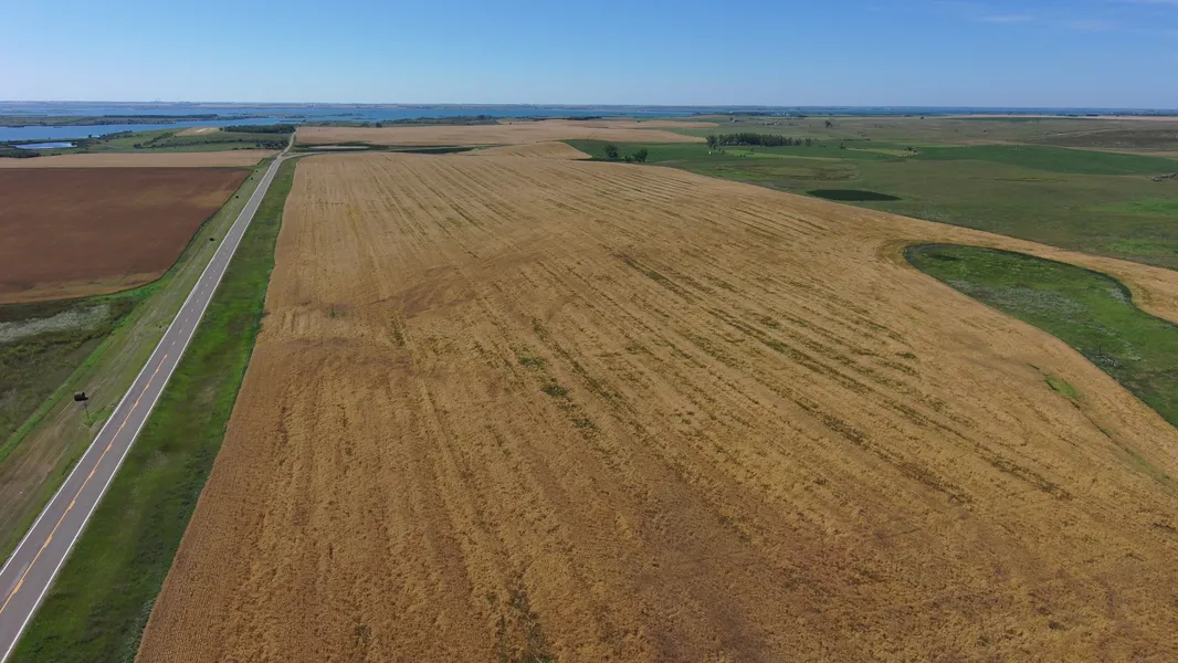
151.98 Acres - McLean County, ND
Description
Land Auction
151.98 Acres - McLean County, ND
Tuesday, October 21, 2025 - 11:00 AM
Auction Location: Sleep Inn & Suites - Minot, ND
Auction Note: This auction features 151.98 +/- acres of quality McLean County land selling in two parcels. The cropland features Soil Productivity Indexes (SPI) in the 70s and offers mostly Class IIe and IIIe Soils. These two parcels have Hwy. #8 frontage and are next to Audubon Management Area.
Contact: Alan Butts at 701.400.8858
Parcel 1
Acres: 112.46 +/-
Legal: E½SE¼, SE¼NE¼ 10-148-83 (LE)
FSA Crop Acres: 98.19 +/-
Taxes: $862.55 (2024)
Parcel 1 is well suited for many crops, with Williams- Zahl, Williams-Bowbells, and Makoti Silty clay loam soils, with an average SPI of 72.8. There is electrical power, rural water, and fiber nearby.
Parcel 2
Acres: 39.52 +/-
Legal: SW¼SW¼ 11-148-83 (LE)
FSA Crop Acres: 36.62 +/-
Taxes: $347.46 (2024)
Parcel 2 contains similar soils to parcel 1, but with slightly stronger soils, with a SPI of 78.7. Parcel 2 contains approximately 2.66 +/- acres of trees in the southeast corner of the 39.52 +/- acres, and the whole parcels offers other non-agricultural potential uses.
Owner: Lonna Augustadt, etal
From elevation to risk assessment
Search for detailed parcel information including; Elevation & Vegetation Maps, Ownership Information, Detailed Parcel Information, Crop History Map, Soil Survey Productivity Data, and more.
Research Parcel InformationDirections
Parcel 1: From the intersection of Hwy. #83, and ND Hwy. #37, and County Rd. #8, travel 2.75 miles east where the road starts to curve north and you will be at the southwest corner of parcel 1.
Parcel 2: From parcel 1, continue around the curve and parcel 2 is on the east side of Hwy. #8.
Environmental Factors
Resources
McLean County Properties By Type
- Farms for Sale in McLean County, North Dakota
- Commercial Property for Sale in McLean County, North Dakota
- Lakefront Property for Sale in McLean County, North Dakota
- Residential Property for Sale in McLean County, North Dakota
- Undeveloped Land for Sale in McLean County, North Dakota
- Ranches for Sale in McLean County, North Dakota
- Recreational Property for Sale in McLean County, North Dakota
- Hunting Land for Sale in McLean County, North Dakota
- Horse Property for Sale in McLean County, North Dakota
- Beachfront Property for Sale in McLean County, North Dakota
- Riverfront Property for Sale in McLean County, North Dakota
- Timberland for Sale in McLean County, North Dakota
Properties for Sale Nearby Counties
- Burleigh County, North Dakota Land for Sale
- Dunn County, North Dakota Land for Sale
- McHenry County, North Dakota Land for Sale
- Mercer County, North Dakota Land for Sale
- Mountrail County, North Dakota Land for Sale
- Oliver County, North Dakota Land for Sale
- Sheridan County, North Dakota Land for Sale
- Ward County, North Dakota Land for Sale
McLean County Properties By City
- Benedict, North Dakota Land for Sale
- Butte, North Dakota Land for Sale
- Coleharbor, North Dakota Land for Sale
- Garrison, North Dakota Land for Sale
- Max, North Dakota Land for Sale
- Mercer, North Dakota Land for Sale
- Riverdale, North Dakota Land for Sale
- Roseglen, North Dakota Land for Sale
- Ruso, North Dakota Land for Sale
- Turtle Lake, North Dakota Land for Sale
- Underwood, North Dakota Land for Sale
- Washburn, North Dakota Land for Sale
- More