Northwest 150th Road and Northwest 110th Avenue, Lot#WP001, Olmitz, KS 67564 - Barton County
Hunting And Cropland On Blood Creek In Barton County
Description
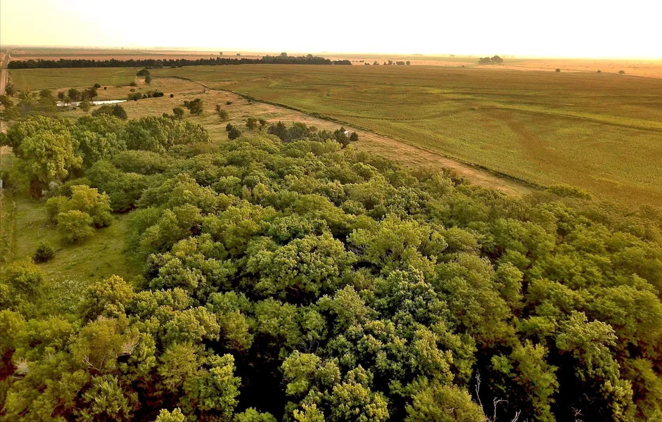
If you’re looking to consistently have the opportunity to harvest a trophy whitetail in Kansas and also generate income on the farming side of things, this property fits the mold. With over 30 acres of timber and pasture along Blood Creek, this tract is loaded with deer sign and situated in the heart of whitetail country. The creek meanders throughout the southwest end of the property providing some of the best timber and cedar cover in the area. Approximately 128 acres of crops sit just to the east of the timberline making it an ideal setup for a Kansas whitetail or springtime turkey hunt. This tract is surrounded by high caliber properties on both sides providing a constant flow of wildlife throughout the season. The cropland is currently planted to milo and on cash rent. Blacktop frontage along the entire northern boundary makes for excellent access at all times. Power exists on the property, making for a great building site with a nice pond just off the county road. Make sure to view the recent trail cam pics showing this property's potential. Contact the listing agent today to set up a private showing of this Blood Creek property.
Property Features:
- Located 4 miles south of Galatia, Kansas and approximately 14 miles west of Hoisington, Kansas
- Top notch whitetail and turkey hunting with numerous setups and various types of terrain
- 128 acres of cropland providing annual income. Crop acreage is currently being cash rented
- Blacktop frontage on the north side of the property
- Blood creek winds throughout the west side of property providing water all year
- Locked chain gate at entrance
- Thick timber and cedar trees provide cover for all wildlife
- Great property for both archery and firearm deer hunting
- Located only 2 ½ miles north of Highway 4 this property has great access
- Mineral rights will not be included with this sale
From elevation to risk assessment
Search for detailed parcel information including; Elevation & Vegetation Maps, Ownership Information, Detailed Parcel Information, Crop History Map, Soil Survey Productivity Data, and more.
Research Parcel InformationEnvironmental Factors
Resources
Barton County Properties By Type
- Ranches for Sale in Barton County, Kansas
- Farms for Sale in Barton County, Kansas
- Recreational Property for Sale in Barton County, Kansas
- Commercial Property for Sale in Barton County, Kansas
- Lakefront Property for Sale in Barton County, Kansas
- Residential Property for Sale in Barton County, Kansas
- Undeveloped Land for Sale in Barton County, Kansas
- Hunting Land for Sale in Barton County, Kansas
- Timberland for Sale in Barton County, Kansas
- Horse Property for Sale in Barton County, Kansas
- Beachfront Property for Sale in Barton County, Kansas
- Riverfront Property for Sale in Barton County, Kansas
Properties for Sale Nearby Counties
Barton County Properties By City
- Albert, Kansas Land for Sale
- Claflin, Kansas Land for Sale
- Ellinwood, Kansas Land for Sale
- Great Bend, Kansas Land for Sale
- Hoisington, Kansas Land for Sale
- Olmitz, Kansas Land for Sale
- Pawnee Rock, Kansas Land for Sale
- Beaver, Kansas Land for Sale
- Dundee, Kansas Land for Sale
- Heizer, Kansas Land for Sale
- Odin, Kansas Land for Sale
- Susank, Kansas Land for Sale
- More
- Anchorway, Kansas Land for Sale
- Boyd, Kansas Land for Sale
- Dartmouth, Kansas Land for Sale
- Dubuque, Kansas Land for Sale
- Farhman, Kansas Land for Sale
- Hitschmann, Kansas Land for Sale
- Kanbrick, Kansas Land for Sale
- Millard, Kansas Land for Sale
- Redwing, Kansas Land for Sale
- South Hoisington, Kansas Land for Sale
- Stickney, Kansas Land for Sale