160 acres in Blaine County, Oklahoma
Description
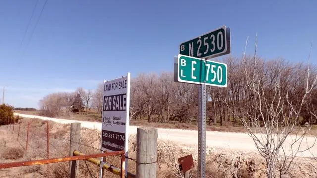
FOR SALE
160 ACRES * BLAINE COUNTY, OKLAHOMA
WATONGA AREA * CATTLE FARM * DEER HUNTING
This very nice quarter section of land consists of approximately 160 acre more or less. The land carries a rolling terrain with 41.9 acres in cropland (Winter Wheat) with the balance of the farm in native grass pastures and timber. The farm is also improved with an older home site consisting of a small 3 bedroom frame home (1,200 sq. ft), detached garage, pole hay barn, and other smaller buildings. There is a small pipe corral with fenced cattle catch lanes. The farm is improved with good perimeter and cross fencing. There are two pond located on south side of the farm. If you have been looking for a very nice cattle farm with excellent deer hunting (1/2 mile north of the Canadian River), then be sure to view this property!
List Price: $320,000
Access: Good rock county roads on the south and east.
Legal Description: SE/4 of 20-17N-12 W.I.M. Blaine County
Directions: From Hwy 51A & 8A (west of Roman Nose State Park, North of Watonga, OK. 73772) go 2 miles west. Or from Hwy 8 & 51A north of Watonga, OK. (Airport) Go 4 miles west and then north to the intersection of Hwy 51A & 8A then 2 miles west.
Previewing: must be done by daylight hours, please close gates behind you!!
Longitude/Latitude: 35 55 58N; 98 29 42.8 W
Taxes: $554.57
Farm Service Agency: 41.9 DCP, no base or yield.
Water: water well drilled in 2008 (40ft. deep)
Utilities: Electric, water well and septic system.
Soil Types: Cyril Fine Sandy Loam, 0 to 1% slopes, class II; Lovedale Fine Sandy Loam, 0 to 3% and 3 to 5% slopes, class II & III; Edna Loamy Fine Sand, 0 to 3% and 3 to 8 % slopes, class III & IV; Waldeck Fine Sandy Loam, 0 to 1% slopes, class III and some Tivoli Fine Sand 5 to 30% slopes, class VII
Possession: is July 1, 2013 or with a 60 day notice after that.
Minerals: surface rights only
From elevation to risk assessment
Search for detailed parcel information including; Elevation & Vegetation Maps, Ownership Information, Detailed Parcel Information, Crop History Map, Soil Survey Productivity Data, and more.
Research Parcel InformationDirections
Directions: From Hwy 51A & 8A (west of Roman Nose State Park, North of Watonga, OK. 73772) go 2 miles west. Or from Hwy 8 & 51A north of Watonga, OK. (Airport) Go 4 miles west and then north to the intersection of Hwy 51A & 8A then 2 miles west.
Environmental Factors
Blaine County Properties By Type
- Hunting Land for Sale in Blaine County, Oklahoma
- Lakefront Property for Sale in Blaine County, Oklahoma
- Undeveloped Land for Sale in Blaine County, Oklahoma
- Farms for Sale in Blaine County, Oklahoma
- Commercial Property for Sale in Blaine County, Oklahoma
- Ranches for Sale in Blaine County, Oklahoma
- Residential Property for Sale in Blaine County, Oklahoma
- Recreational Property for Sale in Blaine County, Oklahoma
- Horse Property for Sale in Blaine County, Oklahoma
- Timberland for Sale in Blaine County, Oklahoma
- Riverfront Property for Sale in Blaine County, Oklahoma
- Beachfront Property for Sale in Blaine County, Oklahoma
Properties for Sale Nearby Counties
Blaine County Properties By City
- Canton, Oklahoma Land for Sale
- Geary, Oklahoma Land for Sale
- Greenfield, Oklahoma Land for Sale
- Hitchcock, Oklahoma Land for Sale
- Longdale, Oklahoma Land for Sale
- Okeene, Oklahoma Land for Sale
- Southard, Oklahoma Land for Sale
- Watonga, Oklahoma Land for Sale
- Bucher, Oklahoma Land for Sale
- Carleton, Oklahoma Land for Sale
- Carlton, Oklahoma Land for Sale
- Darrow, Oklahoma Land for Sale
- More