Auction Information
Coyne Creek Ranch Flint Hills of Chase County KS 915 Acres, 3 Tracts
Description
Coyne Creek Ranch Located in the Scenic Flint Hills of Chase County KS 915 Acres, 3 Tracts
Auction Date: THURSDAY NOVEMBER 15, 2018 6:00 PM
Auction Location: SWOPE PARK, 220 BROADWAY, COTTONWOOD FALLS KS 66845
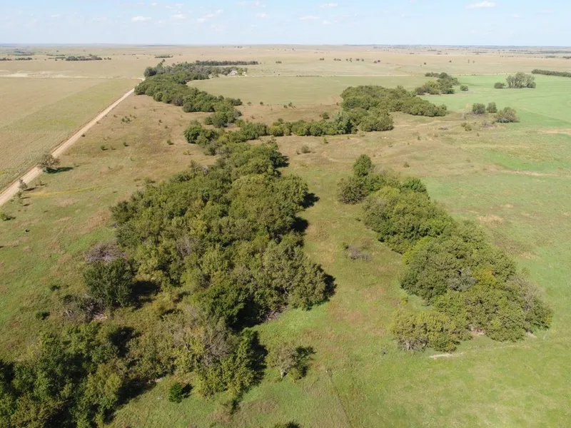
Tract 3 of 3:
PROPERTY DESCRIPTION: 160+- acres consisting of approximately 74 acres of Brome grass, 33 acres of Alfalfa, and the balance in native pasture and timber. Water is provided by a small creek and a water well. Good property to utilize for hay production and winter livestock pasture. Dont overlook the high quality hunting on this property! Past hunting tenants have been very successful on this property.
LEGAL DESCRIPTION: The Northwest 1/4 of Section 20, Township 21, Range 7 East of the 6th P.M., Chase County, Kansas.
2017 REAL ESTATE TAXES: $868.87.
EARNEST MONEY: $25,000.
TERMS: Earnest money is specified above and due at the conclusion of the Auction with the balance due upon Sellers submission of merchantable title and closing. Closing date shall be on or before December 17, 2018. Closing fee and title Insurance fee will be split 50/50 between Seller and Buyer. Selling subject to easements, restrictions, roadways and rights of way. This property is not selling subject to financing or inspections. Interested buyers need to view the property prior to the date of the auction and have financing available and any inspections performed prior to bidding. All pertinent information is available upon request. All announcements made the day of the auction take precedence over any other announcements or printed material.
From elevation to risk assessment
Search for detailed parcel information including; Elevation & Vegetation Maps, Ownership Information, Detailed Parcel Information, Crop History Map, Soil Survey Productivity Data, and more.
Research Parcel InformationDirections
LAND LOCATION: From US-50 HWY at the Clements exit, South on G Rd 6 Miles to 100th Rd, then East 2 Miles.
Environmental Factors
Resources
Chase County Properties By Type
- Ranches for Sale in Chase County, Kansas
- Farms for Sale in Chase County, Kansas
- Recreational Property for Sale in Chase County, Kansas
- Residential Property for Sale in Chase County, Kansas
- Undeveloped Land for Sale in Chase County, Kansas
- Commercial Property for Sale in Chase County, Kansas
- Riverfront Property for Sale in Chase County, Kansas
- Lakefront Property for Sale in Chase County, Kansas
- Timberland for Sale in Chase County, Kansas
- Hunting Land for Sale in Chase County, Kansas
- Horse Property for Sale in Chase County, Kansas
- Beachfront Property for Sale in Chase County, Kansas
Properties for Sale Nearby Counties
Chase County Properties By City
- Cedar Point, Kansas Land for Sale
- Cottonwood Falls, Kansas Land for Sale
- Elmdale, Kansas Land for Sale
- Matfield Green, Kansas Land for Sale
- Strong City, Kansas Land for Sale
- Clements, Kansas Land for Sale
- Bazaar, Kansas Land for Sale
- Ellinor, Kansas Land for Sale
- Gladstone, Kansas Land for Sale
- Hymer, Kansas Land for Sale
- Neva, Kansas Land for Sale
- Rockland, Kansas Land for Sale
- More