Auction Information
160 acres in Dickinson County, Iowa
160 Acres Dickinson County
Section 36 Westport Township
*** Click the 'Helpful Files' tab above for complete brochure ***
Thursday - May 29, 2014 - 10:00 am
Milford Community Center, Milford, Iowa
Location: From Milford 3 miles south on Hwy 71, then 7 miles west on A43
From Everly 7 miles north on M27, then 2 miles east on A43
Legal: Northwest Quarter (NW1/4) of Section Thirty-six (36), Township
Ninety-eight (98) North, Range Thirty-eight (38) West of the 5th PM,
Dickinson County, Iowa. Tracts to be surveyed by sale day.
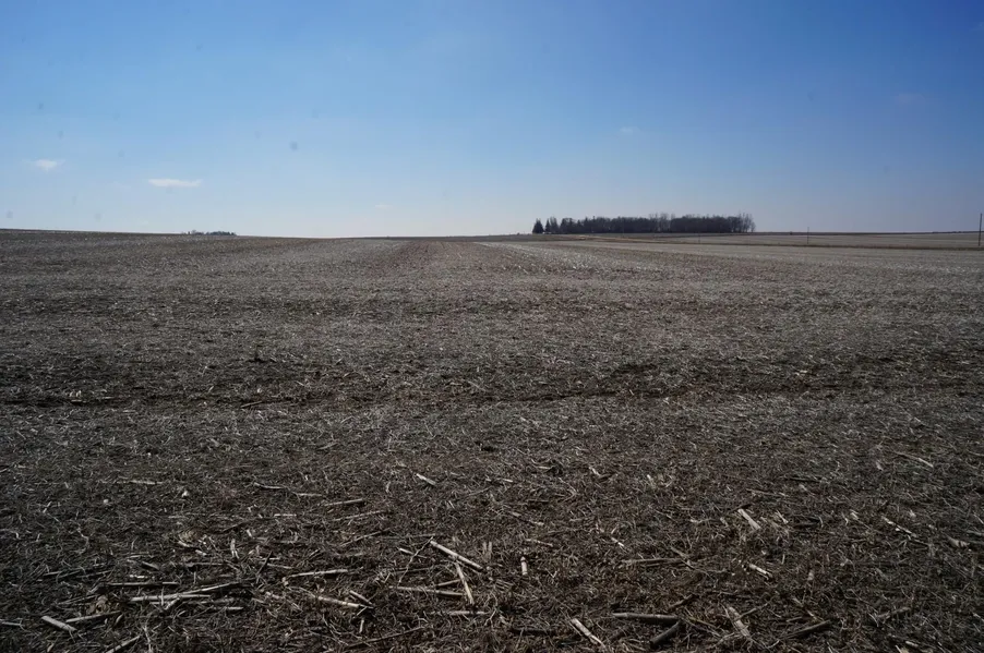
Description: This farm is an attractive, nearly level to gently rolling farm.
The farm contains 148.75 crop acres in one large field. A small 1.81 acre
building site with a machine shed and two grain bins is located in Tract 1.
A 2.17 acre grass waterway is located in Tract 2. The farm is bordered on
the north by county road A43 and on the west by 150th Ave., a gravel road.
Soils: Sac, Everly, Wilmonton, McCreath, Ocheyedan, Fostoria, Letri, Ransom
Ave CSR2 92.6 Ave CSR 74.7
Acres Crop acres CSR CSR2 Taxes
Tract 1 80 m/l 73.56 (est) 75 92.9 $1202
Tract 2 80 m/l 75.19 (est) 74.4 92.4 $1194
Method of Sale: Successful Bidder will have choice of either or both tracts.
Terms: 10 percent down sale day. Balance due at close July 1, 2014.
Possession: At close, subject to a crop share lease for 2014. Successful
Bidder will pay one half of the seed and fertilizer expense. The
Successful Bidder will receive the landlords share of the 2014 crop.
Brokers Note: Cotton Grave Farm Management and The ACRE Co. are
pleased to be selling this Dickinson County farm at public auction. Land
Buyers, whether you are looking to buy an attractive, nearly all tillable 80
acre tract or an entire quarter section, this farm would make an
outstanding investment or addition to any family farming operation.
Call Jon Hjelm or Gary Grave for more information.
We look forward to seeing you sale day!
Fostoria Farm Partnership owners
Attorney: Chris Bjornstad, Spencer, IA
Cornwall, Avery, Bjornstad, & Scott
From elevation to risk assessment
Search for detailed parcel information including; Elevation & Vegetation Maps, Ownership Information, Detailed Parcel Information, Crop History Map, Soil Survey Productivity Data, and more.
Research Parcel InformationResources
Land for Sale by Jon Hjelm
Dickinson County Properties By Type
- Farms for Sale in Dickinson County, Iowa
- Hunting Land for Sale in Dickinson County, Iowa
- Lakefront Property for Sale in Dickinson County, Iowa
- Ranches for Sale in Dickinson County, Iowa
- Commercial Property for Sale in Dickinson County, Iowa
- Undeveloped Land for Sale in Dickinson County, Iowa
- Residential Property for Sale in Dickinson County, Iowa
- Riverfront Property for Sale in Dickinson County, Iowa
- Recreational Property for Sale in Dickinson County, Iowa
- Timberland for Sale in Dickinson County, Iowa
- Horse Property for Sale in Dickinson County, Iowa
- Beachfront Property for Sale in Dickinson County, Iowa
Properties for Sale Nearby Counties
Dickinson County Properties By City
- Arnolds Park, Iowa Land for Sale
- Lake Park, Iowa Land for Sale
- Milford, Iowa Land for Sale
- Okoboji, Iowa Land for Sale
- Spirit Lake, Iowa Land for Sale
- Superior, Iowa Land for Sale
- Terril, Iowa Land for Sale
- Egralharve, Iowa Land for Sale
- Montgomery, Iowa Land for Sale
- Old Town, Iowa Land for Sale
- Triboji Beach, Iowa Land for Sale
- Wahpeton, Iowa Land for Sale
- More