Auction Information
160 acres in Ellis County, Kansas
Description
LEGAL DESCRIPTION:
SE/4 OF SECTION 34-14-20
LAND LOCATION: From the intersection of Hwys 183 and Old Hwy 40 in Hays, Kansas, go 5 miles South to Antonino Road, then 11 miles west to the SE corner of the property OR from I-70 exit 145 at Ellis, Kansas, go 11 miles South to Antonino Road, then 1 miles East to the SW corner of the property. SIGNS WILL BE POSTED!
MANNER OF SALE: This real estate will be offered in one tract. Auction procedure and increments of bidding are at the discretion of the auction company.
TERMS: 10% down day of sale, with the balance to be paid on or before February 24, 2012, or upon such terms as may be acceptable to the Seller. Personal and corporate checks are acceptable for the down payment with the final payment to be made in certified funds. All funds will be held by the auction company in their trust account or by an identified title/escrow company. Bidding is not contingent upon financing. Financing, if necessary, needs to be arranged and approved prior to the auction. Announcements made day of sale will take precedence over printed material and previously made oral statements.
MINERAL RIGHTS: All of the Sellers interest will transfer to the Buyer at closing.
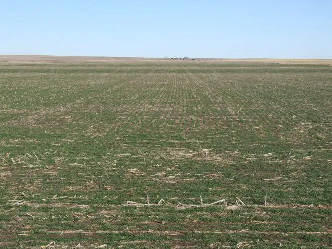
CROPS: There are 80 acres planted to wheat. Buyer will receive the landlords 40% share of the crop, and will pay the landlords 40% share of the expenses.
FSA PAYMENTS: Cropland acres - 156.0
BASE ACRES DCP YIELD
Wheat 120.2 31
Grain Sorghum 26.9 49
Buyer will receive the landlords 40% share of all FSA wheat payments and 100% of all FSA feed grain payments associated with the 2012 crop year.
CLOSING: Closing will be on or before February 24, 2012.
POSSESSION: Date of closing, subject to the tenants rights on the 2012 wheat crop.
REAL ESTATE TAXES: Seller will pay taxes for all of 2011 and prior years. Taxes for 2012 will be the responsibility of the Buyer. (2011 taxes = $574.10)
ACREAGES: Acreage figures are considered to be approximate and are from reliable sources, based on (USDA) FSA figures. All FSA information is subject to change. FSA acres may not be the same as deeded acres or county appraiser acres.
ACCEPTANCE OF BIDS: The successful bidder will be required to enter into a real estate purchase contract immediately following the auction. Copies of the contract will be available from the auction company prior to the sale.
EVIDENCE OF TITLE: Seller will provide title insurance on the real estate to the Buyer in the amount of the purchase price with the premium to be paid one-half by the Buyer and one-half by the Seller. Title evidence will be provided on sale day.
INSPECTIONS: Each potential bidder is responsible for conducting their own independent inspections and due diligence concerning pertinent facts about the property. Neither Seller nor Farm & Ranch Realty, Inc., its agents or representatives, are making any warranties about the property, either expressed or implied.
EASEMENTS: This sale is subject to all rights-of-way and easements, whether recorded or not, and to oil and gas leases of record, if any.
AGENCY: Farm & Ranch Realty, Inc., its agents and representatives, are the Exclusive Agents of the Seller.
INTERNET BIDDING AVAILABLE!
Register by January 13, 2012. CALL FOR DETAILS!
AUCTIONEERS NOTE: The Seller of this quarter has owned this land for many years and has now decided to sell at ABSOLUTE PUBLIC AUCTION.
This excellent quarter of Ellis County cropland was previously flood irrigated and has been bench leveled. The land is bordered by improved county roads, and is located close-in to commercial grain handling facilities. This property also includes a Behlen 38x70 building with concrete floor.
From elevation to risk assessment
Search for detailed parcel information including; Elevation & Vegetation Maps, Ownership Information, Detailed Parcel Information, Crop History Map, Soil Survey Productivity Data, and more.
Research Parcel InformationEnvironmental Factors
Resources
Ellis County Properties By Type
- Farms for Sale in Ellis County, Kansas
- Hunting Land for Sale in Ellis County, Kansas
- Ranches for Sale in Ellis County, Kansas
- Commercial Property for Sale in Ellis County, Kansas
- Residential Property for Sale in Ellis County, Kansas
- Undeveloped Land for Sale in Ellis County, Kansas
- Lakefront Property for Sale in Ellis County, Kansas
- Horse Property for Sale in Ellis County, Kansas
- Timberland for Sale in Ellis County, Kansas
- Recreational Property for Sale in Ellis County, Kansas
- Beachfront Property for Sale in Ellis County, Kansas
- Riverfront Property for Sale in Ellis County, Kansas
Properties for Sale Nearby Counties
Ellis County Properties By City
- Catharine, Kansas Land for Sale
- Ellis, Kansas Land for Sale
- Hays, Kansas Land for Sale
- Pfeifer, Kansas Land for Sale
- Schoenchen, Kansas Land for Sale
- Victoria, Kansas Land for Sale
- Walker, Kansas Land for Sale
- Antonino, Kansas Land for Sale
- Emmeram, Kansas Land for Sale
- Hog Back, Kansas Land for Sale
- Munjor, Kansas Land for Sale
- Toulon, Kansas Land for Sale
- More