Auction Information

2/2 Auction 160 Acres Cropland & Grassland
Description
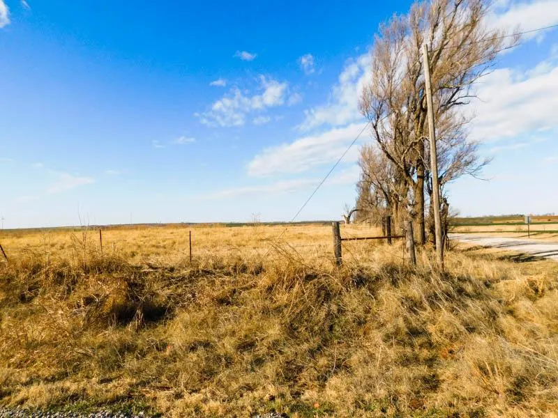
160 ACRES * CARRIER/HILLSDALE AREA * GRASSLAND * CROPLAND * CATTLE FARM
KAROLYN KAY MILLS AUCTION
TUESDAY FEBRUARY 2ND 2021 10:00AM
AUCTION LOCATION: Lippard Auctioneers office, 2609 N. Van Buren Enid, Oklahoma
DIRECTIONS TO FARM: From Carrier, Oklahoma, go north 4 miles to the Goltry Blacktop (Holden Rd), then 3 miles west to Sheridan Rd, then 2.5 miles north.
This tract of land consists of approximately 160 acres more or less. According to the county Farm Service Agency, there is 108.65 DCP cropland with a 102.80 acre wheat base and a 39 bushel yield. The balance of the farm lies in good grass pasture with live creek and scattered timber. Principal Soils are: Pond Creek Silt Loam, 0-1% slopes, class I; Grant Silt Loam 1-5% slopes, class II & III; Port Silt Loam, 0-1% slopes, class II; and some Grainola-Ashport classVI
Legal Description: NE/4 of Section (8), Township (24) North, Range (8), W.I.M. Garfield County, Oklahoma
Taxes: $581.00
Minerals: selling surface rights only
Possession: will be given at closing
Pre Bid Offers: no pre-auction offers will be accepted on this auction
Viewing the Property: will be during daylight hours.
Internet Bidding: will be available by logging on to our website to register. Neither the auction company nor the seller is responsible in the event of loss of signal by either side.
Terms/Conditions: 10% of the total purchase price is to be placed in escrow the day of the auction with the balance being due at closing. All information has been taken from sources believed reliable; however, no guarantee is being made by the Auction Company nor the Seller. Buyers should satisfy themselves as to any inspections prior to bidding. All financing must be in order prior to bidding. Any announcements made the day of the auction shall supersede all advertising or comments.
SELLER: KAROLYN KAY MILLS
From elevation to risk assessment
Search for detailed parcel information including; Elevation & Vegetation Maps, Ownership Information, Detailed Parcel Information, Crop History Map, Soil Survey Productivity Data, and more.
Research Parcel InformationDirections
From Carrier, Oklahoma, go north 4 miles to the Goltry Blacktop (Holden Rd), then 3 miles west to Sheridan Rd, then 2.5 miles north.
Environmental Factors
Resources
Garfield County Properties By Type
- Farms for Sale in Garfield County, Oklahoma
- Ranches for Sale in Garfield County, Oklahoma
- Horse Property for Sale in Garfield County, Oklahoma
- Undeveloped Land for Sale in Garfield County, Oklahoma
- Commercial Property for Sale in Garfield County, Oklahoma
- Lakefront Property for Sale in Garfield County, Oklahoma
- Timberland for Sale in Garfield County, Oklahoma
- Hunting Land for Sale in Garfield County, Oklahoma
- Residential Property for Sale in Garfield County, Oklahoma
- Recreational Property for Sale in Garfield County, Oklahoma
- Beachfront Property for Sale in Garfield County, Oklahoma
- Riverfront Property for Sale in Garfield County, Oklahoma
Properties for Sale Nearby Counties
Garfield County Properties By City
- Bison, Oklahoma Land for Sale
- Carrier, Oklahoma Land for Sale
- Covington, Oklahoma Land for Sale
- Douglas, Oklahoma Land for Sale
- Drummond, Oklahoma Land for Sale
- Enid, Oklahoma Land for Sale
- Fairmont, Oklahoma Land for Sale
- Garber, Oklahoma Land for Sale
- Hillsdale, Oklahoma Land for Sale
- Hunter, Oklahoma Land for Sale
- Kremlin, Oklahoma Land for Sale
- Lahoma, Oklahoma Land for Sale
- More
- Waukomis, Oklahoma Land for Sale
- Barr, Oklahoma Land for Sale
- Blanton, Oklahoma Land for Sale
- Breckinridge, Oklahoma Land for Sale
- Callahan, Oklahoma Land for Sale
- Cropper, Oklahoma Land for Sale
- Etna, Oklahoma Land for Sale
- Hayward, Oklahoma Land for Sale
- Imo, Oklahoma Land for Sale
- Ituna, Oklahoma Land for Sale
- Jonah, Oklahoma Land for Sale
- North Enid, Oklahoma Land for Sale
- Shea, Oklahoma Land for Sale