Waynoka Hunting Farm On Dead-End Road
Description
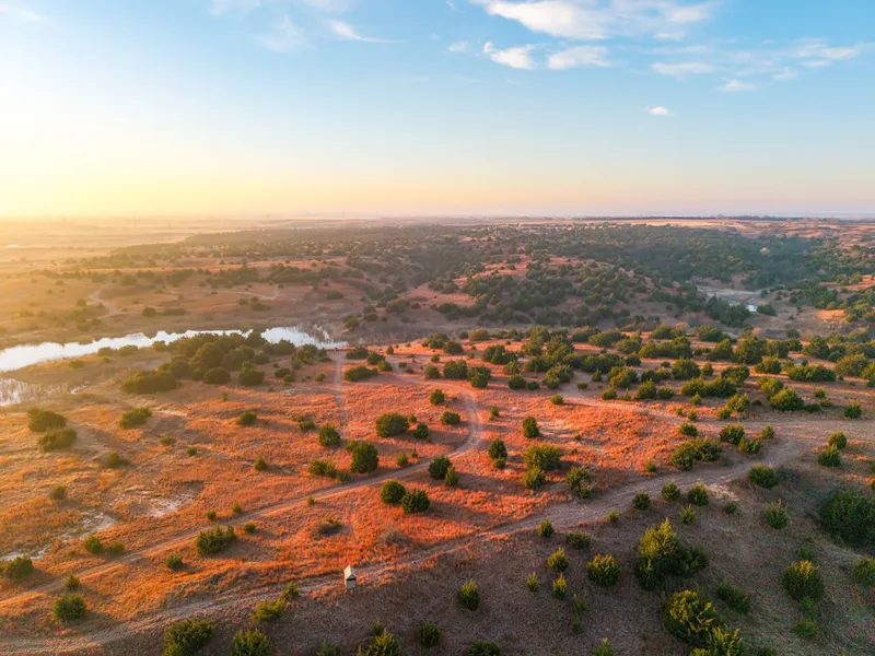
Tucked away at the end of a dead-end road, this 160+/- acre tract in Woods County, Oklahoma offers excellent seclusion and strong recreational appeal! The rolling topography and natural draws create travel corridors that promote consistent deer movement across the property. Taking a look at the trail camera photos, you will see the caliber of a hunting farm this property is! Native grasses and scattered cedar trees provide solid cover and bedding for wildlife, and two ponds on the property offer dependable water sources. These ponds, along with surrounding water in the area, keep turkeys using this property. Quail and dove have also been known to frequent this tract. The ponds hold fish, including giant catfish, adding another layer of recreational appeal. During a recent visit, dozens of ducks were observed using the secluded pond in the southwest corner of the property, showing the waterfowl potential this tract offers. The layout, habitat, and water makes this property a strong setup for a variety of outdoorsmen. The property is located approximately 9+/- miles north of Waynoka, 23+/- miles southwest of Alva, 49+/- miles northeast of Woodward, and 80+/- miles northwest of Enid. Note: Any stands or feeders currently on the property do not convey with the sale. All showings are by appointment only. If you would like more information or would like to schedule a private viewing please contact Jacob Lemons (580) 727-5019 .
Disclaimer: The boundary lines shown are approximate and are provided for general reference only. Arrowhead Land Company makes no representations or warranties, express or implied, as to the accuracy, completeness, or reliability of those property lines. Buyers are advised to obtain an independent survey to verify exact property boundaries.
From elevation to risk assessment
Search for detailed parcel information including; Elevation & Vegetation Maps, Ownership Information, Detailed Parcel Information, Crop History Map, Soil Survey Productivity Data, and more.
Research Parcel InformationDirections
Environmental Factors
Resources
Woods County Properties By Type
- Ranches for Sale in Woods County, Oklahoma
- Hunting Land for Sale in Woods County, Oklahoma
- Undeveloped Land for Sale in Woods County, Oklahoma
- Commercial Property for Sale in Woods County, Oklahoma
- Farms for Sale in Woods County, Oklahoma
- Residential Property for Sale in Woods County, Oklahoma
- Horse Property for Sale in Woods County, Oklahoma
- Recreational Property for Sale in Woods County, Oklahoma
- Riverfront Property for Sale in Woods County, Oklahoma
- Lakefront Property for Sale in Woods County, Oklahoma
- Timberland for Sale in Woods County, Oklahoma
- Beachfront Property for Sale in Woods County, Oklahoma
Properties for Sale Nearby Counties
Woods County Properties By City
- Alva, Oklahoma Land for Sale
- Dacoma, Oklahoma Land for Sale
- Freedom, Oklahoma Land for Sale
- Hopeton, Oklahoma Land for Sale
- Waynoka, Oklahoma Land for Sale
- Capron, Oklahoma Land for Sale
- Avard, Oklahoma Land for Sale
- Brink, Oklahoma Land for Sale
- Cora, Oklahoma Land for Sale
- Edith, Oklahoma Land for Sale
- Fairvalley, Oklahoma Land for Sale
- Heman, Oklahoma Land for Sale
- More