Arikaree Recreation
Location: 17 miles southeast of Wray, Colorado - bordered on the west by County Road RR at Road 24. This site is 1/2 mile east of the Arikaree River.
Legal Description: NE1/4 Section 4-T2S-R42W of the 6th P.M., Yuma County, Colorado.
Acres: 160 tax assessed acres
Taxes: 2015 taxes payable in 2016 - $274
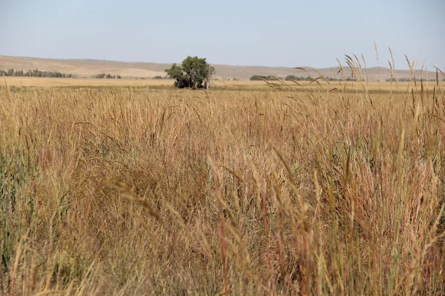
Land Use: 30.85 acres enrolled in USDA CRP contract through September 30, 2026. Annual payment $1,133 with 2/3s of payment to landowner. 129.15 acres in excellent warm season grass (prior CRP) with excellent sloping terrain varying to drainway to the river, and some native rangeland. Some trees/bushes in the drainway for excellent wildlife habitat (pheasant, grouse, deer).
Soils: Colby silt loam, Manter sandy loam, areas of prior CRP include excellent Class II Kuma loam.
Price: $128,000 including Owners interest in the oil/gas well located at the center of the property - 2015 payment to Landowner $2,488
Comments: Excellent recreation/hunting property with very good access. Income from CRP contract and producing gas/oil well. Excellent wildlife terrain includes a drainway to the Arikaree River.
Contact: John Childears; Listing Agent 308-539-4450
Agri Affiliates - Providing Farm, Ranch Real Estate Services
From elevation to risk assessment
Search for detailed parcel information including; Elevation & Vegetation Maps, Ownership Information, Detailed Parcel Information, Crop History Map, Soil Survey Productivity Data, and more.
Research Parcel InformationResources
Land for Sale by Tony Eggleston
Yuma County Properties By Type
- Farms for Sale in Yuma County, Colorado
- Hunting Land for Sale in Yuma County, Colorado
- Undeveloped Land for Sale in Yuma County, Colorado
- Recreational Property for Sale in Yuma County, Colorado
- Ranches for Sale in Yuma County, Colorado
- Horse Property for Sale in Yuma County, Colorado
- Lakefront Property for Sale in Yuma County, Colorado
- Commercial Property for Sale in Yuma County, Colorado
- Residential Property for Sale in Yuma County, Colorado
- Timberland for Sale in Yuma County, Colorado
- Beachfront Property for Sale in Yuma County, Colorado
- Riverfront Property for Sale in Yuma County, Colorado
Properties for Sale Nearby Counties
Yuma County Properties By City
- Eckley, Colorado Land for Sale
- Idalia, Colorado Land for Sale
- Joes, Colorado Land for Sale
- Kirk, Colorado Land for Sale
- Vernon, Colorado Land for Sale
- Wray, Colorado Land for Sale
- Yuma, Colorado Land for Sale
- Hale, Colorado Land for Sale
- Laird, Colorado Land for Sale
- Abarr, Colorado Land for Sale
- Alvin, Colorado Land for Sale
- Armel, Colorado Land for Sale
- More