17.9 acres in Botetourt County, Virginia
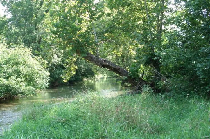
17.9 level acres along 2000' of Looney Mill Creek. Property is currently an agricultural hayfield but has a flood elevation survey for building purposes in the flood plain. Great views, adjoins the locally popular Blue Hole.
From elevation to risk assessment
Search for detailed parcel information including; Elevation & Vegetation Maps, Ownership Information, Detailed Parcel Information, Crop History Map, Soil Survey Productivity Data, and more.
Research Parcel InformationEnvironmental Factors
Contact Seller
Listing provided by
Jane Harris
James River Realty - Lexington(540) 463-2117
Listing last updated: February 2, 2022 at 11:14 AM
Report this listing
More Land for Sale in Botetourt County
Botetourt County Properties By Type
- Farms for Sale in Botetourt County, Virginia
- Commercial Property for Sale in Botetourt County, Virginia
- Residential Property for Sale in Botetourt County, Virginia
- Ranches for Sale in Botetourt County, Virginia
- Hunting Land for Sale in Botetourt County, Virginia
- Horse Property for Sale in Botetourt County, Virginia
- Undeveloped Land for Sale in Botetourt County, Virginia
- Lakefront Property for Sale in Botetourt County, Virginia
- Riverfront Property for Sale in Botetourt County, Virginia
- Recreational Property for Sale in Botetourt County, Virginia
- Timberland for Sale in Botetourt County, Virginia
- Beachfront Property for Sale in Botetourt County, Virginia
Properties for Sale Nearby Counties
Botetourt County Properties By City
- Blue Ridge, Virginia Land for Sale
- Buchanan, Virginia Land for Sale
- Cloverdale, Virginia Land for Sale
- Daleville, Virginia Land for Sale
- Eagle Rock, Virginia Land for Sale
- Fincastle, Virginia Land for Sale
- Glen Wilton, Virginia Land for Sale
- Oriskany, Virginia Land for Sale
- Troutville, Virginia Land for Sale
- Haymakertown, Virginia Land for Sale
- Hollins, Virginia Land for Sale
- Lithia, Virginia Land for Sale
- More
- Amsterdam, Virginia Land for Sale
- Apple Tree Village, Virginia Land for Sale
- Arcadia, Virginia Land for Sale
- Baldwin, Virginia Land for Sale
- Bessemer, Virginia Land for Sale
- Botetourt East, Virginia Land for Sale
- British Woods, Virginia Land for Sale
- Coyner Mountain Overlook, Virginia Land for Sale
- Coyner Springs, Virginia Land for Sale
- Daggers Springs, Virginia Land for Sale
- Dillon, Virginia Land for Sale
- Fork Mountain, Virginia Land for Sale
- Gala, Virginia Land for Sale
- Glebe Mills, Virginia Land for Sale
- Greyledge, Virginia Land for Sale
- Haden, Virginia Land for Sale
- Harvey, Virginia Land for Sale
- Heatherstone, Virginia Land for Sale
- Hipes, Virginia Land for Sale
- Howell Mills, Virginia Land for Sale
- Kyles Mills, Virginia Land for Sale
- Laymantown, Virginia Land for Sale
- Lignite, Virginia Land for Sale
- Mount Union, Virginia Land for Sale
- Munford, Virginia Land for Sale
- Nace, Virginia Land for Sale
- Oldfields, Virginia Land for Sale
- Parr, Virginia Land for Sale
- Pico, Virginia Land for Sale
- Rocky Point, Virginia Land for Sale
- Runaway Village, Virginia Land for Sale
- Salisbury, Virginia Land for Sale
- Solitude, Virginia Land for Sale
- Spec, Virginia Land for Sale
- Springwood, Virginia Land for Sale
- Stepping Stone, Virginia Land for Sale
- Strom, Virginia Land for Sale
- Surber, Virginia Land for Sale
- Trinity, Virginia Land for Sale
- Webster, Virginia Land for Sale