Auction Information
Everett and Maxine Grieger Family Farm LLC
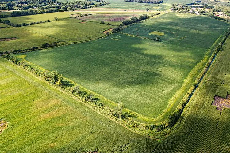
Total Acres 186.49
Tillable Acres179.060
Other Acres7.430
Other Acres Notes2.25 of other acres on Tract 2 should be designated as owned access
Tracts 2
Type of Sale Auction
Owner Everett and Maxine Grieger Family Farm LLC
Status New
HLS Number JAM - 12550
Key Features Productive Farmland
Location Clinton Township, LaPorte County, IN
New Durham Township, LaPorte County, IN
Property Information
Farm Name Everett and Maxine Grieger Family Farm LLC
Type of Operation Farm
Current Zoning Agricultural
School System Tract 1: South Central Community School Corporation Tract 2: New Durham Twp Metropolitan School District
Annual Taxes Tract 1: 3,689.06 Tract 2: 1,320.66
Topography Level To Gently Rolling
Soil Elston loam, Tracy sandy loam, Palms muck,
Property Location
Property Address 6100 S 1100 W, Westville, IN
Region IN
General Location Southeast corner of the intersection of CR 1100 W and CR 600 S and on the north side of 600 S, approximately 1/3 mile east of LP/Porter County Line
Legal Description 41.13 acres in the SW 1/4 of the NE 1/4 and in the fractional NW 1/4 all in Section 31, Township 36 North, Range 4 West, described as follows: Commencing at the SE corner of the SW 1/4 of the NE 1/4 of said Section 31, thence running West 24.17 chains; thence North 22 degrees 50 minutes East along the center of an old ditch 10.96 chains; thence North 18 degrees 15 minutes East along the center of the old ditch 4.91 chains; thence North 9 degrees 30 minutes West along the center of said old ditch 5.44 chains to the North line of thw SW 1/4 of the NE 1/4 of said Section; thence East on said line 19.23 chains to the NE corner of said SW 1/4 of the NE 1/4; thence South 20 chains to the place of beginning. Also a piece of land 25 feet wide and 150 rods long described as follows: Commencing at the NW corner of the SW 1/4 of the NE 1/4 of said Section 31, Township 36 North, Range 4 West, and running thence East 25 feet along the North line of said quarter quater section; thence running North 150 rods more or less to the old "Joliet Road", now known as State Road No. 2, where said highway crosses Section 30 in said Township; thence running Westerly along the South line of said highway approximately 25 feet to the center line of said Section 30; thence South 150 rods more or less to the point of beginning. ALSO a strip of land 42 feet of equal width in and along the Orr Ditch in Section 31, Township 36 North, Range 4 West; said strip of land to commence in the center of said Orr Ditch on South line of said Section and running thence in a Northeasterly direction in said center of said ditch to a point where said ditch enters the SW corner of the SW 1/4 of the NE 1/4 of said Section 31, thence East 42 feet, thence in the Southwesterly direction parallel with the center of said Orr Ditch to the South line of said Section 31, thence West along said line 42 feet to the place of beginning, containing about 2 acres. ALSO a triangular parcel of land described as commencing at a point on the North line of the SW 1/4 of the NE 1/4 which is 19.23 chains West from the NE corner of the SW 1/4 of the NE 1/4 and running West to the NW corner of the SW 1/4 of the NE 1/4; thence South along the West line of the SW 1/4 of the NE 1/4 to the center of the old ditch as referred to in the foregoing description of said 41.13 acre parcel; thence NE along the center of said old ditch to the place of beginning, all in Section 31, Township 36 North, Range 4 West, LaPorte County, Indiana.
Start Auction Date November 16, 2020 Start Auction Time 8:00 AM CST
End Auction Date November 17, 2020 End Auction Time 6:00 PM CST
Auction Location online only
From elevation to risk assessment
Search for detailed parcel information including; Elevation & Vegetation Maps, Ownership Information, Detailed Parcel Information, Crop History Map, Soil Survey Productivity Data, and more.
Research Parcel InformationDirections
Property Address 6100 S 1100 W, Westville, IN
Region IN
General Location Southeast corner of the intersection of CR 1100 W and CR 600 S and on the north side of 600 S, approximately 1/3 mile east of LP/Porter County Line
Resources
Land for Sale by Pat Karst
LaPorte County Properties By Type
- Undeveloped Land for Sale in LaPorte County, Indiana
- Lakefront Property for Sale in LaPorte County, Indiana
- Farms for Sale in LaPorte County, Indiana
- Hunting Land for Sale in LaPorte County, Indiana
- Commercial Property for Sale in LaPorte County, Indiana
- Ranches for Sale in LaPorte County, Indiana
- Horse Property for Sale in LaPorte County, Indiana
- Recreational Property for Sale in LaPorte County, Indiana
- Residential Property for Sale in LaPorte County, Indiana
- Timberland for Sale in LaPorte County, Indiana
- Beachfront Property for Sale in LaPorte County, Indiana
- Riverfront Property for Sale in LaPorte County, Indiana
Properties for Sale Nearby Counties
LaPorte County Properties By City
- Hanna, Indiana Land for Sale
- Kingsbury, Indiana Land for Sale
- Kingsford Heights, Indiana Land for Sale
- La Crosse, Indiana Land for Sale
- La Porte, Indiana Land for Sale
- Michigan City, Indiana Land for Sale
- Rolling Prairie, Indiana Land for Sale
- Union Mills, Indiana Land for Sale
- Wanatah, Indiana Land for Sale
- Westville, Indiana Land for Sale
- Hudson Lake, Indiana Land for Sale
- Long Beach, Indiana Land for Sale
- More
- Michiana Shores, Indiana Land for Sale
- Otis, Indiana Land for Sale
- Pinhook, Indiana Land for Sale
- South Wanatah, Indiana Land for Sale
- Thomaston, Indiana Land for Sale
- Trail Creek, Indiana Land for Sale
- Wellsboro, Indiana Land for Sale
- Alida, Indiana Land for Sale
- Ambler, Indiana Land for Sale
- Andry, Indiana Land for Sale
- Beattys Corner, Indiana Land for Sale
- Birchim, Indiana Land for Sale
- Byron, Indiana Land for Sale
- Davis, Indiana Land for Sale
- Door Village, Indiana Land for Sale
- Duneland Beach, Indiana Land for Sale
- Durham, Indiana Land for Sale
- Haskell, Indiana Land for Sale
- Hesston, Indiana Land for Sale
- Hicks, Indiana Land for Sale
- Hillside, Indiana Land for Sale
- Holmesville, Indiana Land for Sale
- Kankakee, Indiana Land for Sale
- Lake Park, Indiana Land for Sale
- Lalimere, Indiana Land for Sale
- LaPorte, Indiana Land for Sale
- Magee, Indiana Land for Sale
- Merrick, Indiana Land for Sale
- Monroe Manor, Indiana Land for Sale
- Orchard Highlands, Indiana Land for Sale
- Pinola, Indiana Land for Sale
- Pottawattamie Park, Indiana Land for Sale
- Riverside, Indiana Land for Sale
- Runnymede, Indiana Land for Sale
- Salem Heights, Indiana Land for Sale
- Smith, Indiana Land for Sale
- South Center, Indiana Land for Sale
- South LaPorte, Indiana Land for Sale
- Stillwell, Indiana Land for Sale
- Tee Lake, Indiana Land for Sale
- Town of Pines, Indiana Land for Sale
- Tracy, Indiana Land for Sale
- Union Center, Indiana Land for Sale
- Waterford, Indiana Land for Sale
- Wilders, Indiana Land for Sale
- Mill Creek, Indiana Land for Sale