Pike 20
Description
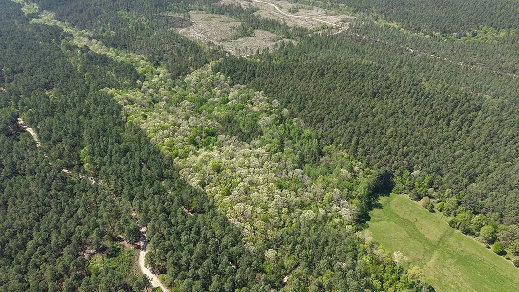
The Pike 20 is a property about as unique as you will find! Located near Langley, Arkansas, this 20 acre Pike County tract is surrounded on three sides by the Ouachita National Forest. The acreage is heavily wooded, with white oaks being the predominant species of tree, which is a known favorite of the local wildlife. Over the years, the current owner has harvested several mature bucks and has obtained photos of many other mature bucks along with black bears and turkeys. The food source here is what every hunter is looking for to harvest a good buck or bear in the fall or a gobbling turkey in the spring. The acreage offers an interior trail system that makes entering your stand locations easy without disturbing the setup for your hunt. Another characteristic of the Pike 20 is the ability to use supplemental feed and attractants that are not allowed on the adjoining national forest, increasing your odds of success not afforded on the public ground. There is no road frontage, which makes it protected from any traffic on the Forest Service Road used to access the property. This tract is conveniently located within a 10-minute walk to the Little Missouri River, one of the most scenic rivers in the area and a feeder into Lake Greeson. Additionally, the property is just a short drive from Shady Lake, Caddo River, Albert Pike Rec Area, Little Missouri Falls, and the Wolf Pen Gap ATV trails. Outdoor adventure is in every direction from this great place! For a personal tour and to learn more about the Pike 20, call Luke Alston today!
Location:
OBar Lane
Langley, AR 71952
Pike County
1.5 Miles E of the Little Missouri River
13 Miles SE of the Shady Lake Rec Area
21 Miles W of Glenwood
21 Miles W of the Caddo River
36 Miles SE of Cove
Coordinates:
34.32593, -93.89997
Property Use:
Hunting
Recreation
Potential Cabin Site
Property Information:
20 Acres
Mature Hardwood Timber
Established Trail System
Bordered by the Ouachita National Forest on 3 Sides
Tax Information:
Parcel 001-06054-000: $24
From elevation to risk assessment
Search for detailed parcel information including; Elevation & Vegetation Maps, Ownership Information, Detailed Parcel Information, Crop History Map, Soil Survey Productivity Data, and more.
Research Parcel InformationDirections
Environmental Factors
Resources
Pike County Properties By Type
- Undeveloped Land for Sale in Pike County, Arkansas
- Lakefront Property for Sale in Pike County, Arkansas
- Residential Property for Sale in Pike County, Arkansas
- Ranches for Sale in Pike County, Arkansas
- Riverfront Property for Sale in Pike County, Arkansas
- Farms for Sale in Pike County, Arkansas
- Recreational Property for Sale in Pike County, Arkansas
- Timberland for Sale in Pike County, Arkansas
- Hunting Land for Sale in Pike County, Arkansas
- Horse Property for Sale in Pike County, Arkansas
- Commercial Property for Sale in Pike County, Arkansas
- Beachfront Property for Sale in Pike County, Arkansas
Properties for Sale Nearby Counties
Pike County Properties By City
- Antoine, Arkansas Land for Sale
- Delight, Arkansas Land for Sale
- Glenwood, Arkansas Land for Sale
- Kirby, Arkansas Land for Sale
- Langley, Arkansas Land for Sale
- Murfreesboro, Arkansas Land for Sale
- Newhope, Arkansas Land for Sale
- Billstown, Arkansas Land for Sale
- Bowen, Arkansas Land for Sale
- Caney Valley, Arkansas Land for Sale
- Kimberley, Arkansas Land for Sale
- Lodi, Arkansas Land for Sale
- More