Auction Information

Prime Development Opportunity In Shawnee Co KS
Description
Live and Online at Ranchandfarmauctions
Auction Date: 08/07/2024 Auction Time: 10:00 AM CT
Auction Venue Location: Lake Shawnee Golf Course, 4141 SE East Edge Road, Topeka, KS 66609
Entire Farm Description:
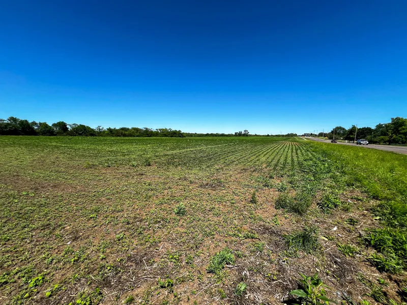
Welcome to an exceptional development opportunity located at the prime corner of SE Croco Rd and SE 45th St. This expansive 20-acre plot, zoned Commercial C3, offers endless possibilities for forward-thinking developers and investors. Currently utilized for soybean farming, this property is ripe for transformation into a commercial hub, benefiting from its strategic location and ample frontage on two major roads.
Situated in the prestigious RockFire At The Lake subdivision, this plot boasts a coveted position just a mile from the serene Lake Shawnee, providing a perfect blend of commercial potential and natural beauty.
Enjoy unparalleled access to major transportation hubs. The Topeka Regional Airport is only a few miles away, ensuring smooth connectivity for business operations and travel.
With extensive frontage on both SE Croco Rd and SE 45th St, this property ensures high visibility and accessibility, making it ideal for a variety of commercial developments such as retail centers, office complexes, or mixed-use projects.
Details:
Soil Types: Ladysmith silty clay loam, Pawnee clay loam
CRP Acres/payment: No CRP
Taxes: $3588
Lease Status: Open Tenancy for 2025 crop year
Possession: Immediate possession subject to current tenant's rights for 2024
Survey needed?: No survey needed
Brief Legal: Rockfire At The Lake Sub, S22, T12, R16, Block D, Lot 1, Acres 20, Blk D Lot 1 Rockfire At The Lake Sub
PIDs: 135-22-0-40-06-001-000
Lat/Lon: 38.9873, -95.61711
Zip Code: 66609
From elevation to risk assessment
Search for detailed parcel information including; Elevation & Vegetation Maps, Ownership Information, Detailed Parcel Information, Crop History Map, Soil Survey Productivity Data, and more.
Research Parcel InformationEnvironmental Factors
Resources
Shawnee County Properties By Type
- Farms for Sale in Shawnee County, Kansas
- Undeveloped Land for Sale in Shawnee County, Kansas
- Residential Property for Sale in Shawnee County, Kansas
- Ranches for Sale in Shawnee County, Kansas
- Lakefront Property for Sale in Shawnee County, Kansas
- Recreational Property for Sale in Shawnee County, Kansas
- Commercial Property for Sale in Shawnee County, Kansas
- Timberland for Sale in Shawnee County, Kansas
- Riverfront Property for Sale in Shawnee County, Kansas
- Horse Property for Sale in Shawnee County, Kansas
- Hunting Land for Sale in Shawnee County, Kansas
- Beachfront Property for Sale in Shawnee County, Kansas
Properties for Sale Nearby Counties
Shawnee County Properties By City
- Auburn, Kansas Land for Sale
- Berryton, Kansas Land for Sale
- Dover, Kansas Land for Sale
- Rossville, Kansas Land for Sale
- Silver Lake, Kansas Land for Sale
- Tecumseh, Kansas Land for Sale
- Topeka, Kansas Land for Sale
- Wakarusa, Kansas Land for Sale
- Cullen Village, Kansas Land for Sale
- Elmont, Kansas Land for Sale
- Grove, Kansas Land for Sale
- Highland Park, Kansas Land for Sale
- More
- Kiro, Kansas Land for Sale
- Mathews Park, Kansas Land for Sale
- Menoken, Kansas Land for Sale
- North Topeka, Kansas Land for Sale
- Oakland, Kansas Land for Sale
- Pauline, Kansas Land for Sale
- Richland, Kansas Land for Sale
- Spencer, Kansas Land for Sale
- Terra Heights, Kansas Land for Sale
- Valencia, Kansas Land for Sale
- Watson, Kansas Land for Sale
- Willard, Kansas Land for Sale