West Fork Ranch
Located in the western portion of Coleman County, the West Fork Ranch offers approximately 203.46 acres of scenic and versatile land well-suited for hunting, recreation, or mixed-use enjoyment. The property lies about 15 minutes west of Coleman, Texas, and 40 minutes from Brownwood, with easy access from County Road 404. This region of Central Texas is known for its rolling terrain, oak-covered ridges, and diverse wildlife habitat, and this ranch exemplifies those characteristics.
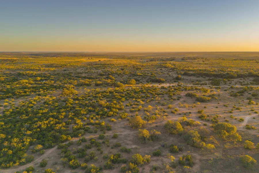
The landscape features a gentle roll with about 60 feet of elevation change, ranging from approximately 1,870 to 1,930 feet above sea level. These changes in elevation create a variety of vantage points and natural draws that add both scenic beauty and wildlife value. The higher elevations in the northern and southwestern portions of the property provide expansive views of the surrounding countryside, while the lower drainage area through the center of the property supports a seasonal creek and abundant tree cover.
Vegetation across the property includes mature Live Oak and Post Oak trees interspersed with native grasses and brush, providing excellent cover for deer, turkey, hogs, and other native species. Several clearings throughout the ranch have been established for food plots, enhancing the habitat diversity and attracting game. The blend of wooded and open areas contributes to an enjoyable and functional hunting environment.
Surface water on the West Fork Ranch consists of two earthen stock tanks that are located on the eastern side of the tract, fed in part by a small watershed that begins near the center of the property. These ponds are valuable for supporting wildlife and livestock and enhance the overall utility of the ranch. Average annual rainfall in this region is approximately 27 inches, providing adequate moisture for the areas vegetation and water sources.
Accessibility throughout the property is provided by an established network of interior trails suitable for vehicles and UTVs, allowing convenient travel to multiple hunting areas, clearings, and water sources. The main improvement area is positioned on one of the higher elevations, offering views across much of the ranch.
Utilities are available, with water service provided by the Coleman County Special Utility District line running along County Road 404 and electric service nearby. There is approximately 2,150 feet of road frontage on the southern boundary, providing convenient entry points and potential for future development.
The propertys location offers both seclusion and accessibility. It sits just five minutes north of Valera, about 15 minutes from Coleman, and within easy reach of larger communities such as Brownwood (40 minutes) and Abilene (approximately one hour).
Whether your goals include hunting, weekend recreation, or establishing a country retreat, the MDX Ranch provides a diverse landscape and valuable natural features in a desirable portion of Coleman County. The combination of rolling topography, mature oaks, surface water, and available utilities offers a solid foundation for multiple land-use possibilities.
DETAILS:
Rolling topography with about 60 feet of elevation change
Mature live oak and post oak trees throughout
2 ponds
Interior trail system for easy access across the ranch
Abundant deer, turkey, hogs, and dove
Water and electricity available
Approximately 2,150 feet of County Road 404 frontage
15 minutes from Coleman and 40 minutes from Brownwood
The information contained herein is deemed reliable but is not warranted or guaranteed by the Broker, its Agents, or the Seller. Access to property, access to utilities, or any measurements including but not limited to, acreage, square footage, frontage, and mapping boundary lines shared herein has not been independently verified and is for purposes of marketing only. If exact measurements, access to property, or access to utilities is a concern, the property should be independently measured or investigated by the prospective buyer.
From elevation to risk assessment
Search for detailed parcel information including; Elevation & Vegetation Maps, Ownership Information, Detailed Parcel Information, Crop History Map, Soil Survey Productivity Data, and more.
Research Parcel InformationDirections
Call agent for directions.
Environmental Factors
Resources
Land for Sale by Colton Hutchins
Coleman County Properties By Type
- Ranches for Sale in Coleman County, Texas
- Hunting Land for Sale in Coleman County, Texas
- Farms for Sale in Coleman County, Texas
- Horse Property for Sale in Coleman County, Texas
- Riverfront Property for Sale in Coleman County, Texas
- Recreational Property for Sale in Coleman County, Texas
- Lakefront Property for Sale in Coleman County, Texas
- Undeveloped Land for Sale in Coleman County, Texas
- Residential Property for Sale in Coleman County, Texas
- Commercial Property for Sale in Coleman County, Texas
- Timberland for Sale in Coleman County, Texas
- Beachfront Property for Sale in Coleman County, Texas
Properties for Sale Nearby Counties
Coleman County Properties By City
- Burkett, Texas Land for Sale
- Coleman, Texas Land for Sale
- Goldsboro, Texas Land for Sale
- Gouldbusk, Texas Land for Sale
- Novice, Texas Land for Sale
- Rockwood, Texas Land for Sale
- Santa Anna, Texas Land for Sale
- Talpa, Texas Land for Sale
- Valera, Texas Land for Sale
- Voss, Texas Land for Sale
- Echo, Texas Land for Sale
- Fisk, Texas Land for Sale
- More
- Leaday, Texas Land for Sale
- Mozelle, Texas Land for Sale
- Silver Valley, Texas Land for Sale
- Whon, Texas Land for Sale
- Chaffin Crossing, Texas Land for Sale
- Glen Cove, Texas Land for Sale
- Hamrick, Texas Land for Sale
- Military Crossing, Texas Land for Sale
- Mitchell Crossing, Texas Land for Sale
- Obregon, Texas Land for Sale
- San Angelo Junction, Texas Land for Sale
- Shields, Texas Land for Sale
- Trickham, Texas Land for Sale
- Walker Crossing, Texas Land for Sale
- Webbville, Texas Land for Sale
