Auction Information
203.48 acres in Clay County, Minnesota
Description
LAND AUCTION / FARMSTEAD / RIVER FRONTAGE
203.48 +/- Acres - Clay County, MN
Tuesday, January 22, 2019 11:00 a.m.
Auction Location: Courtyard By Marriott - Moorhead, MN
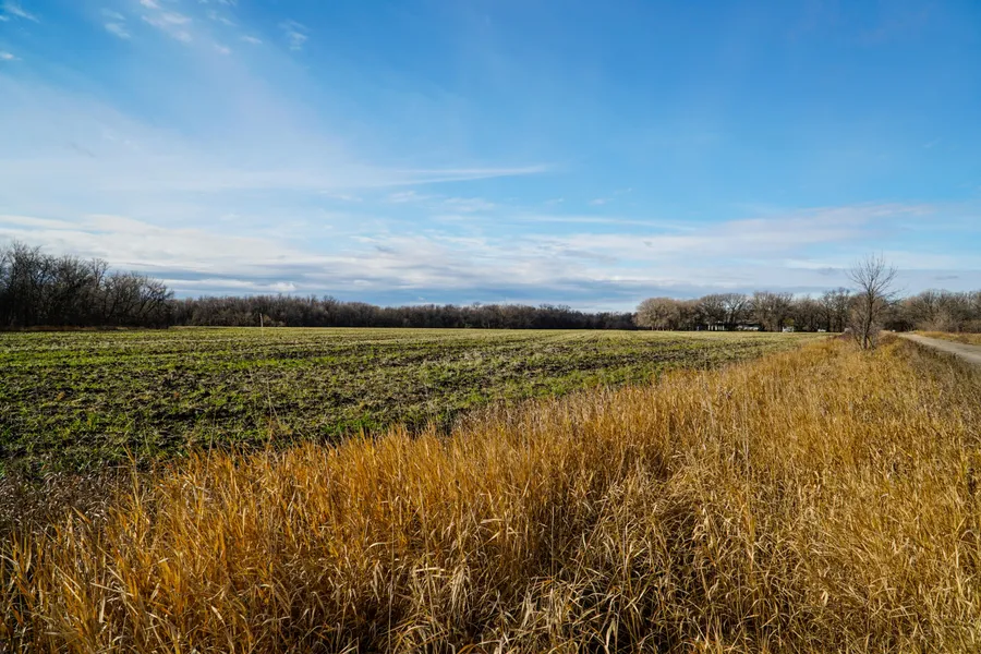
Auction Note: This is remarkably productive Red River Valley Farmland in Oakport Township, Clay County, Minnesota. This is very diverse cropland with Soil Productivity Indexes (SPI) consistently in the mid-80s. Whats more, this farm has Red River frontage featuring trees and grassland ideal for hunting. There is also a homestead with a Rambler Home on Parcel 3 with 56.3 acres.
Contact: Kevin Pifer at 701.238.5810.
Property Information:
Parcel One
Acres: 47.47 +/-
Legal: W NE less SLY 24.2 AC & 8.27 AC W NE Less SLY 24.26 AC in Section 18-140-48.
Cropland Acres: 47.47 +/-
Taxes (2018): $2,228.00
Parcel Note: This parcel features 47.47 +/- cropland acres with Wahpeton Silty Clay and Fargo Silty Clay soils with an SPI of 85.8. This parcel has access from County Road #93.
Parcel Two
Acres: 99.71 +/-
Legal: W SW Section 7-140-48 and Lot 1 Section 12-140-49.
Cropland Acres: 76.7 +/-
Taxes (2018): $3,236.00
Parcel Note: This parcel features 76.7 +/- cropland acres with Wahpeton Silty Clay soil with an SPI of 84. Whats more this parcel has exceptional wildlife habitat along the Red River.
Parcel Three
Acres: 56.3 +/-
Legal: Lot 1 Section 18-140-48 & Lot 1 Section 13-140-49.
Cropland Acres: 31.16 +/-
Taxes (2018): $3,413.00
Parcel Note: This parcel features the building site with rambler home and 31.16 +/- acres of excellent cropland with an SPI of 84. This parcel has 70th Ave. NW access.
OWNER: Rose Kopperud Estate
From elevation to risk assessment
Search for detailed parcel information including; Elevation & Vegetation Maps, Ownership Information, Detailed Parcel Information, Crop History Map, Soil Survey Productivity Data, and more.
Research Parcel InformationDirections
Driving Directions: All within one mile +/- of the intersection of Broadway St. NW and County Road #93 (70th Ave. NW), approximately three miles northwest of Moorhead, Minnesota.
Environmental Factors
Resources
Clay County Properties By Type
- Farms for Sale in Clay County, Minnesota
- Lakefront Property for Sale in Clay County, Minnesota
- Residential Property for Sale in Clay County, Minnesota
- Undeveloped Land for Sale in Clay County, Minnesota
- Hunting Land for Sale in Clay County, Minnesota
- Ranches for Sale in Clay County, Minnesota
- Riverfront Property for Sale in Clay County, Minnesota
- Recreational Property for Sale in Clay County, Minnesota
- Commercial Property for Sale in Clay County, Minnesota
- Horse Property for Sale in Clay County, Minnesota
- Timberland for Sale in Clay County, Minnesota
- Beachfront Property for Sale in Clay County, Minnesota
Properties for Sale Nearby Counties
Clay County Properties By City
- Barnesville, Minnesota Land for Sale
- Comstock, Minnesota Land for Sale
- Dilworth, Minnesota Land for Sale
- Felton, Minnesota Land for Sale
- Georgetown, Minnesota Land for Sale
- Glyndon, Minnesota Land for Sale
- Hawley, Minnesota Land for Sale
- Hitterdal, Minnesota Land for Sale
- Moorhead, Minnesota Land for Sale
- Sabin, Minnesota Land for Sale
- Ulen, Minnesota Land for Sale
- Averill, Minnesota Land for Sale
- More
- Baker, Minnesota Land for Sale
- Dale, Minnesota Land for Sale
- Downer, Minnesota Land for Sale
- Kragnes, Minnesota Land for Sale
- Rollag, Minnesota Land for Sale
- Finkle, Minnesota Land for Sale
- Greenwood Communities, Minnesota Land for Sale
- Manitoba Junction, Minnesota Land for Sale
- Muskoda, Minnesota Land for Sale
- Rustad, Minnesota Land for Sale
- Tansem, Minnesota Land for Sale
- Winnipeg Junction, Minnesota Land for Sale