205.79 acres in Highland County, Virginia
Description
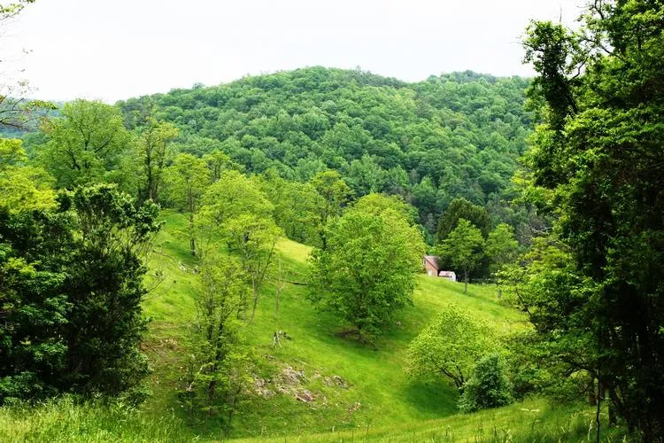
Hike, hunt, horseback ride, and enjoy this 205 acres of lush meadows and pastures which extend from Rt. 250 to the top of Bullpasture Mountain. 360 degree views at the top of the mountain provide a long range view of the Town of McDowell, the Bullpasture River Valley, and the surrounding mountains. The meadows and pastures are ideal for livestock grazing and woodlands provide recreational opportunities. A private setting with a 1170 square foot cabin make this property a once in a life time opportunity to have it all. A special point of interest is during the Civil War Battle of McDowell in 1862, the 12th Ohio Infantry had a gun placement on this land. A Conservation easement in place.
205.79 acres
Real Estate tax for 2013 $2,121.20
Zoned A2 & C1
Instrument number 20060000524
Tax map 58A54 and 58A54A
Electric provider is BARC
Installed conventional septic system for 2 bedrooms
Conservation measures are in place
and a copy is
available upon
request
Telephone and high Speed DSL provider is MGW Telephone
Water is provided from natural springs and well at house
Kitchen range conveys with sale
Cabin room measurements
1,170 sq. ft.
Kitchen 11.0x8.0 vinyl flooring
Sitting/dining 25.0x13.10 with carpet
Ground floor bedroom 13.8x11.10 w/carpet
Bathroom on ground floor 7.6x6.4 vinyl flooring
Bedroom on second floor 11.10x9.6 carpet flooring
Half bath on second floor
Cabin was built in 1994
2 bedroom
One full bathroom on ground floor with shower only
Half bath on second floor
Second floor has bedroom and small sitting space
Kitchen appliances convey
Flooring consists of carpet and vinyl
From elevation to risk assessment
Search for detailed parcel information including; Elevation & Vegetation Maps, Ownership Information, Detailed Parcel Information, Crop History Map, Soil Survey Productivity Data, and more.
Research Parcel InformationDirections
Rt. 250 west out of Staunton VA cross Shenandoah Mtn., Shaws Ridge, Bullpasture Mtn. and watch for sign at foot of Bullpasture Mtn looking to the right.
Environmental Factors
Highland County Properties By Type
- Farms for Sale in Highland County, Virginia
- Undeveloped Land for Sale in Highland County, Virginia
- Residential Property for Sale in Highland County, Virginia
- Lakefront Property for Sale in Highland County, Virginia
- Timberland for Sale in Highland County, Virginia
- Hunting Land for Sale in Highland County, Virginia
- Horse Property for Sale in Highland County, Virginia
- Commercial Property for Sale in Highland County, Virginia
- Riverfront Property for Sale in Highland County, Virginia
- Recreational Property for Sale in Highland County, Virginia
- Ranches for Sale in Highland County, Virginia
- Beachfront Property for Sale in Highland County, Virginia
Properties for Sale Nearby Counties
Highland County Properties By City
- Blue Grass, Virginia Land for Sale
- Doe Hill, Virginia Land for Sale
- Monterey, Virginia Land for Sale
- Mustoe, Virginia Land for Sale
- Hightown, Virginia Land for Sale
- Mcdowell, Virginia Land for Sale
- Mill Gap, Virginia Land for Sale
- Bethel, Virginia Land for Sale
- Clover Creek, Virginia Land for Sale
- Hardscrabble, Virginia Land for Sale
- Meadowdale, Virginia Land for Sale
- New Hampden, Virginia Land for Sale
- More