Auction Information

232.7 acres in Washington County, Kansas
Description
Selling by Sealed Bid only.
Bid via the online portal, download the sealed bid form or calling for a sealed bid packet.
Bids due by 11/29/22 at 5:00 PM
Open Tenancy for 2023 Season
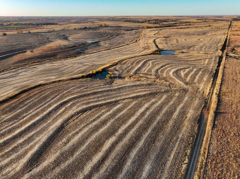
237.2 acres with 2 Reinke 2065 Pref Tech Pivot Irrigators. Fed by 2 new wells utilized at 450 gpm with Water Rights #50417 with 288 authorized acres. There are a total of 4 wells on the property. Two new pumps were installed (15 HP 4 DISC Stairs Pumps 230 gpm and 2 new 15HP 3 Phase 460V Motors) in 2022 and new electrical work was complete to move the control panel to an easily accessible area near the road. Owner or producer is responsible for supplying the diesel powered generator. The well has a new line ran to first irrigator and this farm is fully irrigatable. Extensive excavation has been recently done to improve the waterway, terraces and irrigators to run more smoothly. Highly productive gently rolling irrigated acres that are consistent producers of some of the best crops in the area. Access on North from 27th Rd less than mile east of Rt 15 and from East side from Liberty Rd. Electricity has been run to the NW property line making it possible to convert from Diesel power to electric in the future
Deeded acres: 237.2+/- acres
FSA Farmland Acres: 229.36+/- acres
DCP Cropland Acres: 229.36+/- acres
Soil Types: Lancaster Loam, Crete silty clay loam, Hobbs silt loam
Soil PI/NCCPI/CSR2: NCCPI 57
CRP Acres/payment: No CRP
Taxes: $3625.65
Lease Status: Open Tenancy for 2023 crop year
Possession: Immediate possession subject to current tenants rights for 2022
Survey needed: No survey needed
Brief Legal: 237.20 +/- ACRES LOCATED S24 T1S R2E IN WASHINGTON CO, KS WITH PARCEL ID 046-24-0-00-00-001.00-0
Lat/Lon: 39.9538, -97.1488
From elevation to risk assessment
Search for detailed parcel information including; Elevation & Vegetation Maps, Ownership Information, Detailed Parcel Information, Crop History Map, Soil Survey Productivity Data, and more.
Research Parcel InformationEnvironmental Factors
Resources
Washington County Properties By Type
- Ranches for Sale in Washington County, Kansas
- Farms for Sale in Washington County, Kansas
- Recreational Property for Sale in Washington County, Kansas
- Hunting Land for Sale in Washington County, Kansas
- Undeveloped Land for Sale in Washington County, Kansas
- Riverfront Property for Sale in Washington County, Kansas
- Residential Property for Sale in Washington County, Kansas
- Commercial Property for Sale in Washington County, Kansas
- Timberland for Sale in Washington County, Kansas
- Horse Property for Sale in Washington County, Kansas
- Lakefront Property for Sale in Washington County, Kansas
- Beachfront Property for Sale in Washington County, Kansas
Properties for Sale Nearby Counties
Washington County Properties By City
- Barnes, Kansas Land for Sale
- Clifton, Kansas Land for Sale
- Greenleaf, Kansas Land for Sale
- Haddam, Kansas Land for Sale
- Hanover, Kansas Land for Sale
- Hollenberg, Kansas Land for Sale
- Linn, Kansas Land for Sale
- Mahaska, Kansas Land for Sale
- Morrowville, Kansas Land for Sale
- Palmer, Kansas Land for Sale
- Washington, Kansas Land for Sale
- Brantford, Kansas Land for Sale
- More