242 acres in Nevada County, Arkansas
Description
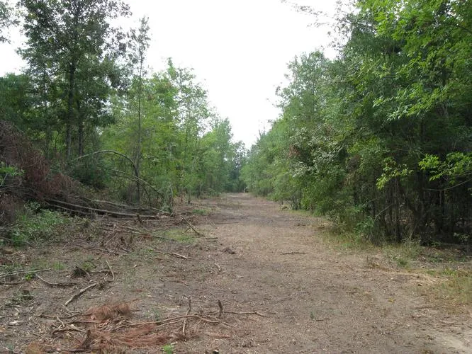
Kingwood Forestry Services, Inc. has been authorized by Milestone Farms, LLC to offer this 242-acre hunting/timberland investment property for sale at $296,000.00. This property is conveniently located just north of Interstate 30 between Little Rock and Texarkana. The property lies in the Little Missouri River bottoms and the entire southern boundary is Number One Bayou. Timber on the property was recently thinned. Approximately 90 acres have been cleared and are ready to be reforested or converted to bottomland pasture or food plots. Several wide and long shooting lanes, radiating from strategic stand locations, have been cleared and are ready for deer season. The current owners are hunters and timberland investors. Their hunting experiences and trail camera surveys indicate an excellent population of deer, turkeys and wild hogs. A recent inventory of merchantable and pre-merchantable timber, conducted by Kingwood Forestry Services, indicates approximately 150 acres of mixed oak-pine with a fair amount large enough for harvest and a very large number of pre-merchantable hardwood trees which will be a future bottomland hardwood forest. Any person or group looking for a place with plenty of hunting and forest investment potential to call their own should seriously consider this property. Don’t let this one get away. The property is reasonably priced. Hunting season is just around the corner!
From elevation to risk assessment
Search for detailed parcel information including; Elevation & Vegetation Maps, Ownership Information, Detailed Parcel Information, Crop History Map, Soil Survey Productivity Data, and more.
Research Parcel InformationDirections
From Exit 46 (Prescott Exit) on I-30, go NORTH on Highway 19 towards Delight for approximately 8.1 miles. Immediately after crossing Number One Bayou bridge, turn RIGHT (east) onto gravel access road (marked with signs and pink flagging). Highway 19 is western boundary of property. Gravel access road continues in an easterly direction and ends in northeastern part of property.
Nevada County Properties By Type
- Residential Property for Sale in Nevada County, Arkansas
- Farms for Sale in Nevada County, Arkansas
- Hunting Land for Sale in Nevada County, Arkansas
- Lakefront Property for Sale in Nevada County, Arkansas
- Ranches for Sale in Nevada County, Arkansas
- Riverfront Property for Sale in Nevada County, Arkansas
- Timberland for Sale in Nevada County, Arkansas
- Commercial Property for Sale in Nevada County, Arkansas
- Undeveloped Land for Sale in Nevada County, Arkansas
- Recreational Property for Sale in Nevada County, Arkansas
- Horse Property for Sale in Nevada County, Arkansas
- Beachfront Property for Sale in Nevada County, Arkansas
Properties for Sale Nearby Counties
Nevada County Properties By City
- Bluff City, Arkansas Land for Sale
- Cale, Arkansas Land for Sale
- Emmet, Arkansas Land for Sale
- Prescott, Arkansas Land for Sale
- Rosston, Arkansas Land for Sale
- Willisville, Arkansas Land for Sale
- Laneburg, Arkansas Land for Sale
- Ames, Arkansas Land for Sale
- Azor, Arkansas Land for Sale
- Bodcaw, Arkansas Land for Sale
- Boughton, Arkansas Land for Sale
- Cummings Springs, Arkansas Land for Sale
- More
- Delta, Arkansas Land for Sale
- Dills Mills, Arkansas Land for Sale
- Falcon, Arkansas Land for Sale
- Glenville, Arkansas Land for Sale
- Gum Grove, Arkansas Land for Sale
- Irma, Arkansas Land for Sale
- Iron Springs, Arkansas Land for Sale
- Mendenhall, Arkansas Land for Sale
- Morris, Arkansas Land for Sale
- Nevark, Arkansas Land for Sale
- Redland, Arkansas Land for Sale
- Sanders, Arkansas Land for Sale
- Stockton, Arkansas Land for Sale
- Sutton, Arkansas Land for Sale
- Waterloo, Arkansas Land for Sale
- Young, Arkansas Land for Sale