Auction Information

Top Notch Tillable In Richardson Co, NE
Description
Live and Online
Auction Date: 02/21/2023 Auction Time: 11:00 AM
Auction Location: Falls City Elks Lodge, 1417 Stone Street, Falls City, NE 68355
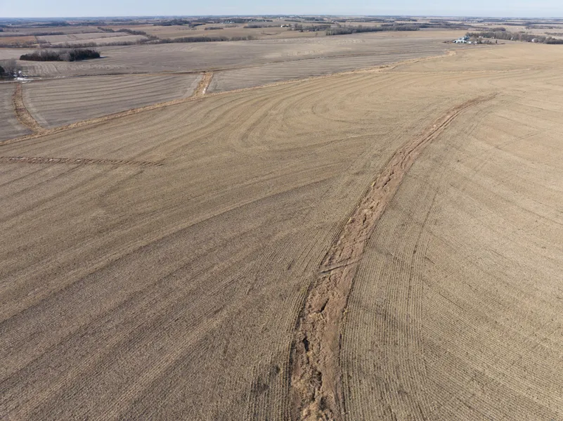
Here is an excellent opportunity to own a high producing, top notch tillable farm in a competitive area. This farm boasts highway frontage with access to two highways a short distance from any field exit. The gently rolling topography on this farm is covered with primarily Wymore and Aksarben silty clay loam soils. Minimal waterways and a high ratio of tillable acres add to the appeal of this farm. Buyer to reimburse 2022 tenant for 2023 inputs at closing. *Contact Agent(s) for details* If youve been looking for a top producing farm with excellent access and is in a great area, look no further!
Tract 1 Description:
Tract #: 1
Deeded acres: 160 +/- Acres
FSA Farmland Acres: 148+/-
Soil Types: Wymore Silty Clay Loam, Askarben silty clay loam
Soil PI/NCCPI/CSR2: Average NCCPI 60.6
CRP Acres/payment: 5.87+/- Acres CRP, $286.80/ac, exp. 9/2025
Taxes: $5,058.66 (2022)
Lease Status: Open for 2023
Possession: At Closing
Survey needed: If Tracts 1&2 are purchased individually
Brief Legal: NE1/4 S10 T2N R14E, Richardson County
PIDs: 740039881
Lat/Lon: 40.1563, -95.8269
Tract 2 Description:
Tract #: 2
Deeded acres: 152.61 +/- Acres
FSA Farmland Acres: 125.12 +/-
Soil Types: Wymore Silty Clay Loam and Aksarben Silty Clay Loam
Soil PI/NCCPI/CSR2: Average NCCPI 60.6
CRP Acres/payment: 2.3 +/- Acres CRP, $286.80/ac, exp. 9/2025
Taxes: 5,808 (2022 w/ acreage included)
Lease Status: Open 2023
Possession: At Closing
Survey needed: If Tracts 1&2 are purchased individually
Brief Legal: SE 1/4 less acreage, S10 T2N R14E
PIDs: 740039938
Lat/Lon: 40.1497, -95.8269
From elevation to risk assessment
Search for detailed parcel information including; Elevation & Vegetation Maps, Ownership Information, Detailed Parcel Information, Crop History Map, Soil Survey Productivity Data, and more.
Research Parcel InformationEnvironmental Factors
Resources
Richardson County Properties By Type
- Farms for Sale in Richardson County, Nebraska
- Hunting Land for Sale in Richardson County, Nebraska
- Residential Property for Sale in Richardson County, Nebraska
- Commercial Property for Sale in Richardson County, Nebraska
- Undeveloped Land for Sale in Richardson County, Nebraska
- Recreational Property for Sale in Richardson County, Nebraska
- Horse Property for Sale in Richardson County, Nebraska
- Lakefront Property for Sale in Richardson County, Nebraska
- Riverfront Property for Sale in Richardson County, Nebraska
- Ranches for Sale in Richardson County, Nebraska
- Timberland for Sale in Richardson County, Nebraska
- Beachfront Property for Sale in Richardson County, Nebraska
Properties for Sale Nearby Counties
Richardson County Properties By City
- Dawson, Nebraska Land for Sale
- Falls City, Nebraska Land for Sale
- Humboldt, Nebraska Land for Sale
- Rulo, Nebraska Land for Sale
- Salem, Nebraska Land for Sale
- Shubert, Nebraska Land for Sale
- Stella, Nebraska Land for Sale
- Verdon, Nebraska Land for Sale
- Barada, Nebraska Land for Sale
- Preston, Nebraska Land for Sale
- Nim City, Nebraska Land for Sale
- Straussville, Nebraska Land for Sale