315 acres in Kimball County, Nebraska
Description
Location: 10 miles north of Bushnell, Nebraska on CR 17 to CR 54. This property starts at the northwest corner of this intersection.
Legal
Description: S1/2 of Section 6 - T16N - R57W of the 6th P.M., Kimball County, Nebraska.
Acres: 315 Tax Assessed Acres.
Taxes: $4,158.96 for 2009.
Land Use: 292.2 Cropland acres; 249.9 Center Pivot Irrigated acres, 42.3 Non-Irrigated Crop acres and balance in pasture.
FSA Info: Wheat base—138.9 acres at 40 bu. yield. Corn base—6 acres at 44 bu. yield.
Sunflowers—21 acres at 506 lbs. yield. Barley base—29.1 acres at 44 bu. yield. Farm #3008, Tract #939.
Water: 249.9 Certified Irrigated Acres in the South Platte Natural Resource District. 20 inches per year allocation for 2009-2012 with 70.32 inches remaining. Nebr. well #G-060320 drilled in 1978.
Soils: 71.4% Class II Altvan-Satanta loams, 23.3% Class IV Tassel-Blanche sandy loams, 1% Class III Rosebud-Canyon loams.
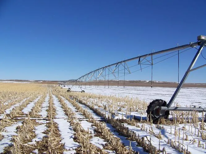
Irrigation
Equipment: 2004 - 7 Tower Reinke and 1978 - 9 Tower Lockwood; 150 HP Johnston Turbine Pump.
Price: $389,900
Contact: Jerry Sloan, Listing Agent—308-631-5520, Roger Luehrs, 308-631-2506, Mike Polk, Loren Johnson, Bruce Dodson, Jerry Weaver, Duane McClain at 308-534-9240.
From elevation to risk assessment
Search for detailed parcel information including; Elevation & Vegetation Maps, Ownership Information, Detailed Parcel Information, Crop History Map, Soil Survey Productivity Data, and more.
Research Parcel InformationDirections
10 miles north of Bushnell, Nebraska on CR 17 to CR 54. This property starts at the northwest corner of this intersection.
Environmental Factors
Resources
Kimball County Properties By Type
- Farms for Sale in Kimball County, Nebraska
- Ranches for Sale in Kimball County, Nebraska
- Hunting Land for Sale in Kimball County, Nebraska
- Commercial Property for Sale in Kimball County, Nebraska
- Recreational Property for Sale in Kimball County, Nebraska
- Horse Property for Sale in Kimball County, Nebraska
- Timberland for Sale in Kimball County, Nebraska
- Undeveloped Land for Sale in Kimball County, Nebraska
- Residential Property for Sale in Kimball County, Nebraska
- Lakefront Property for Sale in Kimball County, Nebraska
- Beachfront Property for Sale in Kimball County, Nebraska
- Riverfront Property for Sale in Kimball County, Nebraska