Prime Tillable Cropland in a Great Farming Area
Description
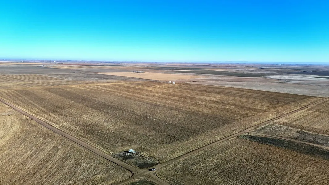
Cheyenne County, NE 160
Here is some prime cropland that is turn-key ready for the farmer looking to add to an existing operation or an investor looking to add to their portfolio. Consisting of mostly Alliance Loam 0-1 percent slope Class (2c) & Alliance Loam 1-3 percent slope Class (2e) soils. The cropland has good proven history with good base acres. Crops grown on the property and in the area include Wheat, Milo, Millet, and Corn. Currently, all of the tillable cropland is in a 2025 corn stubble. There are several local tenants in the area who would cash rent for tillable acres, creating a nice possible annual income. Wildlife found in the area includes Deer, Antelope, Pheasants, Waterfowl, and Small Game. The parcels have well maintained county road frontage on multiple sides creating easy access and is in a great farming area. FSA information is available upon request. Included in the sale are 100% of the Seller's Owned Mineral Rights are included (if any). Please contact the local Land Professional for additional information or to schedule a showing. Showings by appointment only!!!
Property Details:
- Located South of Lodgepole, Nebraska
- Mostly Prime Tillable Cropland with Mostly Class II Soils
- Potential Cash Rent
- Wheat, Corn, & Sunflower FSA Base Acres
- High Potential Return on Investment (ROI)
- County Road Frontage on Multiple Sides
- Hunting Opportunities or Hunting Lease Possible Income
When purchasing a property listed by Great Plains Land Company, a Buyer's Broker, if applicable, must be identified on first contact and present at the initial showing of the property to participate in a real estate commission. If these conditions are not met, compensation if any will be at the sole discretion of Great Plains Land Company
From elevation to risk assessment
Search for detailed parcel information including; Elevation & Vegetation Maps, Ownership Information, Detailed Parcel Information, Crop History Map, Soil Survey Productivity Data, and more.
Research Parcel InformationEnvironmental Factors
Resources
Cheyenne County Properties By Type
- Farms for Sale in Cheyenne County, Nebraska
- Ranches for Sale in Cheyenne County, Nebraska
- Hunting Land for Sale in Cheyenne County, Nebraska
- Residential Property for Sale in Cheyenne County, Nebraska
- Commercial Property for Sale in Cheyenne County, Nebraska
- Timberland for Sale in Cheyenne County, Nebraska
- Riverfront Property for Sale in Cheyenne County, Nebraska
- Horse Property for Sale in Cheyenne County, Nebraska
- Recreational Property for Sale in Cheyenne County, Nebraska
- Undeveloped Land for Sale in Cheyenne County, Nebraska
- Lakefront Property for Sale in Cheyenne County, Nebraska
- Beachfront Property for Sale in Cheyenne County, Nebraska
Properties for Sale Nearby Counties
Cheyenne County Properties By City
- Dalton, Nebraska Land for Sale
- Gurley, Nebraska Land for Sale
- Lodgepole, Nebraska Land for Sale
- Potter, Nebraska Land for Sale
- Sidney, Nebraska Land for Sale
- Brownson, Nebraska Land for Sale
- Colton, Nebraska Land for Sale
- Lorenzo, Nebraska Land for Sale
- Sunol, Nebraska Land for Sale
- Huntsman, Nebraska Land for Sale
- Mount Vernon, Nebraska Land for Sale
- Point of Rocks, Nebraska Land for Sale