Auction Information
319 acres in Garfield County, Oklahoma
Description
* 2 Tracts of Land & 4 Tracts of Minerals *
Date: Thursday, October 13, 2011
Time: 10:00 A.M.
Location: The Fairview Community Center, 206 E. Broadway, Fairview OK
Sellers: Beth and Randy Rider; Larry and Carolyn Maddox; Charles Mike McCaslin
Auction Manager: Perry Wiggins * 580-233-3066
LAND
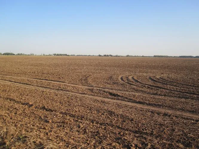
Farm #1: 159 +/- acres located approximately 1/2 mile north of the Homestead Elevator. From Okeene, go 4 miles west on S.H. 51 and 3 miles north. According to the F.S.A. there are 118.1 acres of cropland with a full wheat base and 33 bu. per acre yield. Principle soil type of the cropland is Kirkland silt loam, Class II with a lesser amt of McClain silty clay loam, Class I. The balance of the land is in grass. Improvements include an older home, outbuildings, and fences. Farm has excellent location on blacktop just a half mile from the grain elevator.
Legal: S/2 of SW/4 and Lots 7 & 8 in Blaine Co., and Lots 1 & 2 in Major Co., all in Sec.33, Twp 20N, R11W.
Farm #2: 160 +/- acres located from the southwest corner of Farm #1, 1 mile west and 1/2 mile north. According to the F.S.A., there are 107.4 acres of cropland with a full base and 33 bu. per acre yield. Principle soil types of the cropland are Canadian fine sandy loam, Classes I and II with a lesser amt of Reinach very fine sand, Class I. The balance of the land is in grass, timber, and creek. Improvements include fences. Access is by good county road.
Legal: NW/4 of 32-20-11, Major Co., OK
GENERAL STATEMENTS
These are good small grain/livestock farms situated on good roads very near a grain terminal and with good access to all surrounding communities. Taxes: will be prorated to closing. Crop: 1/3 (the landlords share) of the 2010-2011 wheat crop sells w/the surface. Possession: will be given at closing subject to the current agricultural lease which expires following completion of the harvest of the 2011-2012 wheat crop. Minerals: will be auctioned after the auction of the land. Terms: 10% down the day of the auction with balance due on delivery of merchantable title.
MINERALS
Tract #1: (159 +/- acres currently producing) All of the minerals in and to Farm #1 described above. Sellers net revenue for 2010 was approx. $2,856.11. Sellers net revenue Jan. through June, 2011 was approx. $1,081.43.
Tract #2: (160 +/- acres currently producing) All of the minerals in and to Farm #2 described above. Sellers net revenue for 2010 was approx. $4,737.15. Sellers net revenue Jan. through June, 2011 was $1,346.07.
Sellers of the Above Land and Minerals: Beth & Randy Rider
Tract #3: 40 +/- mineral acres located 5 1/2 miles east and 4 1/2 miles south of Ames. Minerals are currently not producing and are open for lease.
Legal: An undivided 1/2 of the minerals in and to the W/2 of the SW/4 of 20-20-8, Garfield Co., OK
Sellers: Larry & Carolyn Maddox
Tract #4: 160 +/- mineral acres located approximately 14 miles west of Fairview on U.S. 60, then 1/2 mile south. There is some production that appears to be from one producing well in the section (the Classen #1-17 in the C of the NW/4).
Legal: NE/4 17-20-14, Major Co., OK.
Seller: Charles Mike McCaslin
Terms for Mineral Interests: 10% down day of auction. Buyers will have 15 days to research records and satisfy themselves as to title. Balance due at closing.
Announcements made day of auction take precedence over advertising
Online Bidding by/through Proxibid
877-505-7770
--------------------------------------------------------------------------------
Wiggins Auctioneers: One Grand Center, 201 N. Grand, Ste 600, Enid, Oklahoma 73701
Phone: (580) 233-3066 or (800) 375-3773
Copyright 2007-2008. Wiggins Auctioneers L.L.C. All Rights Reserved.
From elevation to risk assessment
Search for detailed parcel information including; Elevation & Vegetation Maps, Ownership Information, Detailed Parcel Information, Crop History Map, Soil Survey Productivity Data, and more.
Research Parcel InformationGarfield County Properties By Type
- Farms for Sale in Garfield County, Oklahoma
- Ranches for Sale in Garfield County, Oklahoma
- Horse Property for Sale in Garfield County, Oklahoma
- Undeveloped Land for Sale in Garfield County, Oklahoma
- Commercial Property for Sale in Garfield County, Oklahoma
- Timberland for Sale in Garfield County, Oklahoma
- Residential Property for Sale in Garfield County, Oklahoma
- Lakefront Property for Sale in Garfield County, Oklahoma
- Hunting Land for Sale in Garfield County, Oklahoma
- Recreational Property for Sale in Garfield County, Oklahoma
- Beachfront Property for Sale in Garfield County, Oklahoma
- Riverfront Property for Sale in Garfield County, Oklahoma
Properties for Sale Nearby Counties
Garfield County Properties By City
- Bison, Oklahoma Land for Sale
- Carrier, Oklahoma Land for Sale
- Covington, Oklahoma Land for Sale
- Douglas, Oklahoma Land for Sale
- Drummond, Oklahoma Land for Sale
- Enid, Oklahoma Land for Sale
- Fairmont, Oklahoma Land for Sale
- Garber, Oklahoma Land for Sale
- Hillsdale, Oklahoma Land for Sale
- Hunter, Oklahoma Land for Sale
- Kremlin, Oklahoma Land for Sale
- Lahoma, Oklahoma Land for Sale
- More
- Waukomis, Oklahoma Land for Sale
- Barr, Oklahoma Land for Sale
- Blanton, Oklahoma Land for Sale
- Breckinridge, Oklahoma Land for Sale
- Callahan, Oklahoma Land for Sale
- Cropper, Oklahoma Land for Sale
- Etna, Oklahoma Land for Sale
- Hayward, Oklahoma Land for Sale
- Imo, Oklahoma Land for Sale
- Ituna, Oklahoma Land for Sale
- Jonah, Oklahoma Land for Sale
- North Enid, Oklahoma Land for Sale
- Shea, Oklahoma Land for Sale