320 acres in Briscoe County, Texas
Energy Farm II
State: Texas
Region: Panhandle
County: Briscoe
Property Type: CRP/Stock Farm with Energy Production Potential
Acres: 320 acres more or less
Taxes: Approximately $978.75
Location: 8 miles South and 2 miles west of Silverton, Texas
Major wind-energy projects are anticipated to be completed in Briscoe County within the next few years. Briscoe County is part of the Panhandle A CREZ (Competitive Renewable Energy Zone) and will have a collection station (approximately four miles southwest of Silverton) and four 345kV transmission lines that are scheduled to be constructed by the end of 2013. Beginning in 2006, several major wind-energy companies paid substantial amounts for 7-year options to lease large acreages in the Silverton area for the placement of wind turbines. These wind turbines are expected to begin coming online as soon as the construction of the collection station and transmission lines is completed.
Shell Wind Energy, Inc signed a 7-year option agreement to lease this property on April 25, 2007. Details of this option agreement will be provided to qualified buyers who sign a non-disclosure agreement with Shell Wind Energy. The owner of the property is willing to convey all wind energy rights except for 50% of the royalty interest. In addition, the owner has all mineral rights to the property and is willing to convey 50% of these rights.
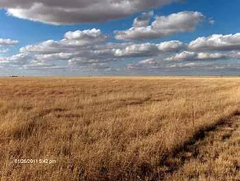
This property is an excellent stock farm that includes 158 acres of improved grass, 66 acres of native grass and 94.9 acres that has recently been enrolled in the Conservation Reserve Program (CRP) for 10 years for an annual rental rate of $39.13 per acre. There are two wells for livestock water with submersible electric motors and pumps and three other wells previously used for irrigation. There is a nice 30x60 barn with a covered shed on its south side. There is also a good set of cattle pens and another small building. The property has excellent fencing and cross fencing part of which is new. The property is located 8 miles south of Silverton on Hwy 207 and 2 miles west on CR C.
From elevation to risk assessment
Search for detailed parcel information including; Elevation & Vegetation Maps, Ownership Information, Detailed Parcel Information, Crop History Map, Soil Survey Productivity Data, and more.
Research Parcel InformationLand for Sale by Ben G. Scott
Briscoe County Properties By Type
- Ranches for Sale in Briscoe County, Texas
- Farms for Sale in Briscoe County, Texas
- Hunting Land for Sale in Briscoe County, Texas
- Residential Property for Sale in Briscoe County, Texas
- Recreational Property for Sale in Briscoe County, Texas
- Undeveloped Land for Sale in Briscoe County, Texas
- Lakefront Property for Sale in Briscoe County, Texas
- Horse Property for Sale in Briscoe County, Texas
- Commercial Property for Sale in Briscoe County, Texas
- Timberland for Sale in Briscoe County, Texas
- Beachfront Property for Sale in Briscoe County, Texas
- Riverfront Property for Sale in Briscoe County, Texas