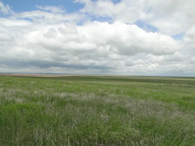
320 acres in Weld County, Colorado
LEGAL DESCRIPTION:
E/2 of 35-10-56
LOCATION: From the intersection of Hwys 14 and 71 in Stoneham, go 13 miles North to Road 112, and 4 miles East to the NW corner of the property. SIGNS ARE POSTED!
CRP INFO: The current CRP contract expires on 9/30/11. The Seller will retain 100% of the 2011 CRP payment.
FSA INFORMATION: Cropland acres - 321.7
Base Acres DCP Yld
Wheat 172.9* 24
Barley 14.4* 34
*These base acres will return after the CRP contract expires pursuant to information from Weld County FSA. Buyer will receive 100% of all FSA payments associated with the 2012 crop year, if any.
POSSESSION: Date of closing.
MINERAL RIGHTS: Mineral rights are subject to a prior reservation of record.
REAL ESTATE TAXES: Seller will pay taxes for 2010 and prior years. Taxes for 2011 will be prorated to the date of closing. (2010 Taxes - $170.95)
PRICE: $176,000
From elevation to risk assessment
Search for detailed parcel information including; Elevation & Vegetation Maps, Ownership Information, Detailed Parcel Information, Crop History Map, Soil Survey Productivity Data, and more.
Research Parcel InformationResources
Land for Sale by Donald L. Hazlett
Weld County Properties By Type
- Undeveloped Land for Sale in Weld County, Colorado
- Farms for Sale in Weld County, Colorado
- Ranches for Sale in Weld County, Colorado
- Commercial Property for Sale in Weld County, Colorado
- Residential Property for Sale in Weld County, Colorado
- Horse Property for Sale in Weld County, Colorado
- Lakefront Property for Sale in Weld County, Colorado
- Hunting Land for Sale in Weld County, Colorado
- Riverfront Property for Sale in Weld County, Colorado
- Recreational Property for Sale in Weld County, Colorado
- Timberland for Sale in Weld County, Colorado
- Beachfront Property for Sale in Weld County, Colorado
Properties for Sale Nearby Counties
- Adams County, Colorado Land for Sale
- Boulder County, Colorado Land for Sale
- Broomfield County, Colorado Land for Sale
- Kimball County, Colorado Land for Sale
- Laramie County, Colorado Land for Sale
- Larimer County, Colorado Land for Sale
- Logan County, Colorado Land for Sale
- Morgan County, Colorado Land for Sale
Weld County Properties By City
- Ault, Colorado Land for Sale
- Briggsdale, Colorado Land for Sale
- Carr, Colorado Land for Sale
- Dacono, Colorado Land for Sale
- Eaton, Colorado Land for Sale
- Erie, Colorado Land for Sale
- Evans, Colorado Land for Sale
- Firestone, Colorado Land for Sale
- Fort Lupton, Colorado Land for Sale
- Frederick, Colorado Land for Sale
- Galeton, Colorado Land for Sale
- Gilcrest, Colorado Land for Sale
- More
- Gill, Colorado Land for Sale
- Greeley, Colorado Land for Sale
- Grover, Colorado Land for Sale
- Hereford, Colorado Land for Sale
- Hudson, Colorado Land for Sale
- Johnstown, Colorado Land for Sale
- Keenesburg, Colorado Land for Sale
- Kersey, Colorado Land for Sale
- La Salle, Colorado Land for Sale
- Lucerne, Colorado Land for Sale
- Mead, Colorado Land for Sale
- Milliken, Colorado Land for Sale
- New Raymer, Colorado Land for Sale
- Nunn, Colorado Land for Sale
- Pierce, Colorado Land for Sale
- Platteville, Colorado Land for Sale
- Roggen, Colorado Land for Sale
- Severance, Colorado Land for Sale
- Stoneham, Colorado Land for Sale
- Windsor, Colorado Land for Sale
- Garden City, Colorado Land for Sale
- Raymer, Colorado Land for Sale
- Adna, Colorado Land for Sale
- Alden, Colorado Land for Sale
- Auburn, Colorado Land for Sale
- Avalo, Colorado Land for Sale
- Barnesville, Colorado Land for Sale
- Bracewell, Colorado Land for Sale
- Bruce, Colorado Land for Sale
- Buckingham, Colorado Land for Sale
- Buda, Colorado Land for Sale
- Bunyan, Colorado Land for Sale
- Canton, Colorado Land for Sale
- Cloverly, Colorado Land for Sale
- Comer, Colorado Land for Sale
- Cornish, Colorado Land for Sale
- Dearfield, Colorado Land for Sale
- Dent, Colorado Land for Sale
- Dick, Colorado Land for Sale
- Dover, Colorado Land for Sale
- East La Salle, Colorado Land for Sale
- Elm, Colorado Land for Sale
- Elwell, Colorado Land for Sale
- Evanston, Colorado Land for Sale
- Farmers, Colorado Land for Sale
- Fosston, Colorado Land for Sale
- Gates, Colorado Land for Sale
- Gowanda, Colorado Land for Sale
- Greeley Junction, Colorado Land for Sale
- Hambert, Colorado Land for Sale
- Hardin, Colorado Land for Sale
- Hardman, Colorado Land for Sale
- Harney, Colorado Land for Sale
- Highland Lake, Colorado Land for Sale
- Hillsboro, Colorado Land for Sale
- Houston, Colorado Land for Sale
- Hurrich, Colorado Land for Sale
- Idaho Creek, Colorado Land for Sale
- Jackson Field, Colorado Land for Sale
- Jessum, Colorado Land for Sale
- Johnson, Colorado Land for Sale
- Kahler, Colorado Land for Sale
- Keota, Colorado Land for Sale
- Kirkland, Colorado Land for Sale
- Krauss, Colorado Land for Sale
- Kuner, Colorado Land for Sale
- Lowe, Colorado Land for Sale
- Maloy, Colorado Land for Sale
- Mason Corner, Colorado Land for Sale
- Masters, Colorado Land for Sale
- Matthews, Colorado Land for Sale
- Mumper Corner, Colorado Land for Sale
- Peckham, Colorado Land for Sale
- Plumbs, Colorado Land for Sale
- Powars, Colorado Land for Sale
- Prospect Valley, Colorado Land for Sale
- Pulliam, Colorado Land for Sale
- Purcell, Colorado Land for Sale
- Puritan, Colorado Land for Sale
- Rinn, Colorado Land for Sale
- Rockport, Colorado Land for Sale
- Rosedale, Colorado Land for Sale
- Roy, Colorado Land for Sale
- Saint Vrains, Colorado Land for Sale
- Sloan, Colorado Land for Sale
- South Roggen, Colorado Land for Sale
- Spanish Village, Colorado Land for Sale
- Stage, Colorado Land for Sale
- Tampa, Colorado Land for Sale
- Tonville, Colorado Land for Sale
- Vollmar, Colorado Land for Sale
- Walker, Colorado Land for Sale
- Warren, Colorado Land for Sale
- Wattenberg, Colorado Land for Sale
- Welty, Colorado Land for Sale
- Wildcat, Colorado Land for Sale