Auction Information

Land Auction - 331.3 +/- Acre Combination Farm in Merrick County, NE
Live & Online Land Auction
Tuesday, February 27th
10:00 a.m. CST
Clarks Lions Club
305 Green Street
Clarks, Nebraska 68628
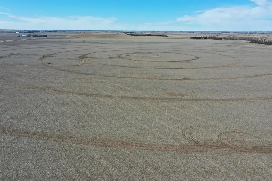
This excellent tract of land consists mainly of irrigated farmland with some pasture on the eastern and northern sections. This highly productive piece of farmland is in the ideal location for anyone looking to expand their farming operation. The farm is situated on a primary road, making it easily accessible to various elevators and ethanol plants. If you're looking for an acreage to build on, the southeast corner of the farm is an excellent choice.
Legal Description
South Half Section 3, Township 15 North, Range 4 West
Lease Information
Under lease for the 2024 growing season.
FSA Information
Total Cropland Acres 273.05 +/-
Corn Base Acres 253.7 PLC Yield 143
Total Base Acres 253.7
Other Information
Tenant-owned pivot.
Located in the Central Platte Natural Resource District and has certified irrigation rights for 273.12 acres.
Machine shed & 3 grain bins with roughly 21,000-bushel storage.
Good/fair barbed wire fence around the pasture.
All mineral rights owned by seller, if any, to convey to buyer.
Well Information
Well 1 - G041610
Drilled 3/30/1974, 1,005 GPM, static level 29', pumping level 51', well depth 81'
Well 2 - G024587
Drilled 6/10/1965, 1,200 GPM, static level 20', pumping level 70', well depth 84'
Well 3 - G010915
Drilled 4/1/1957, 490 GPM, static level 28', pumping level 80', well depth 97'
Well 4 - G010914
Drilled 9/18/1957, 750 GPM, static level 25', well depth 63'
Well 5 - G035456
Drilled 9/5/1984, 350 GPM, static level 25', pumping level 45', well depth 82'
Well 6 - G039607
Drilled 4/18/1973, 1,000 GPM, static level 24', pumping level 53', well depth 53'
Well 7 - G129029
Drilled 4/9/2004, 400 GPM, static level 31', pumping level 60', well depth 65'
From elevation to risk assessment
Search for detailed parcel information including; Elevation & Vegetation Maps, Ownership Information, Detailed Parcel Information, Crop History Map, Soil Survey Productivity Data, and more.
Research Parcel InformationDirections
Take Highway 30 east through Clarks to 29th Road. Turn and go north 2 miles to Z Road. The property is located northwest of this intersection.
Environmental Factors
Resources
Land for Sale by Jeff Moon
Merrick County Properties By Type
- Farms for Sale in Merrick County, Nebraska
- Lakefront Property for Sale in Merrick County, Nebraska
- Commercial Property for Sale in Merrick County, Nebraska
- Riverfront Property for Sale in Merrick County, Nebraska
- Recreational Property for Sale in Merrick County, Nebraska
- Ranches for Sale in Merrick County, Nebraska
- Residential Property for Sale in Merrick County, Nebraska
- Hunting Land for Sale in Merrick County, Nebraska
- Undeveloped Land for Sale in Merrick County, Nebraska
- Horse Property for Sale in Merrick County, Nebraska
- Timberland for Sale in Merrick County, Nebraska
- Beachfront Property for Sale in Merrick County, Nebraska
Properties for Sale Nearby Counties
Merrick County Properties By City
- Archer, Nebraska Land for Sale
- Central City, Nebraska Land for Sale
- Chapman, Nebraska Land for Sale
- Clarks, Nebraska Land for Sale
- Palmer, Nebraska Land for Sale
- Silver Creek, Nebraska Land for Sale
- Riverside Park, Nebraska Land for Sale
- Havens, Nebraska Land for Sale
- Heber, Nebraska Land for Sale
- Hord, Nebraska Land for Sale
- Lockwood, Nebraska Land for Sale