LAND FOR SALE NEAR ALPENA, MI!
FINANCING AVAILABLE!!! REQUIRES ONE TIME $250 DOCUMENT FEE!
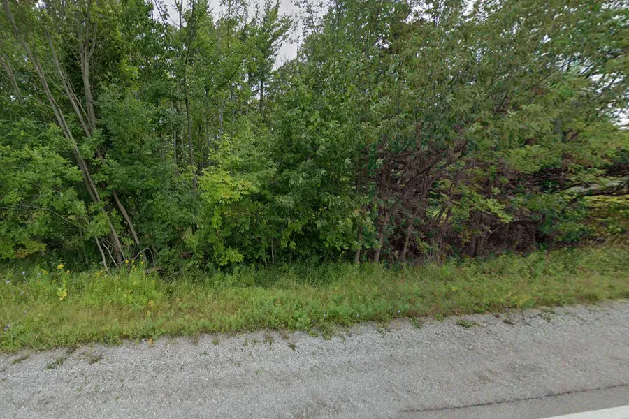
QUARTER ACRE PLUS NEAR SEVERAL PARKS AND NATIONAL FORESTS! PERFECT RETREAT FOR NATURE LOVERS!
ABOUT THE PARCEL:
Access: 360 LAKE WINYAH RD, ALPENA, MI 49707
County: ALPENA
City: ALPENA, MI (MAPLE RIDGE TOWNSHIP).
Parcel#: 043-095-000-090-00
Acres: 0.26
X/Y Coordinates:
Center: 45.095687, -83.521032
NE: 45.095687, -83.521062
NW: 45.095794, -83.521306
SE: 45.096007, -83.520773
SW: 45.096118, -83.521000
Zoned: RESIDENTIAL
Taxes: $31.00/year.
Wetlands: NO.
Flood zone: NO
---DISCLOSURE: U.S. RECLAND L.L.C. HAS THIS LOT UNDER CONTRACT DIRECT TO SELLER.AND IS SELLING THE PROPERTY AS IS. SIGNED AGREEMENT BETWEEN SELLER AND U.S. RECLAND HAS BEEN ESTABLISHED. This information contained herein is deemed reliable, but not guaranteed. U.S. RECLAND, L.L.C. (Seller) and its affiliates are not responsible for the accuracy of the information. The Buyer is responsible for verifying all information with the County. Sizes advertised are approximate. Pictures of rural land contained in this listing may or may not represent pictures of the actual parcel being sold. Seller has not seen this property in person. Other than our express Guarantees contained herein, all land is being sold as-is with no other warranties either expressed or implied as to the location, condition, accessibility, terrain, build-ability, or information contained in this listing. Buyer(s) understands that the Seller is conveying the above described property as-is and Buyer agrees to purchase property as such. No representations as to fitness for a particular purpose have been made. No verbal claims or promises have been made to Buyer which do not appear in writing. If the above described property is not situated on a public road, then Buyer hereby acknowledges such, and agrees to hold Seller harmless for maintenance and improvements to existing easement(s). Buyer also agrees that any improvement or utility bonds will be assumed by the Buyer, and Buyer agrees that if he/she/they did not physically inspect the above property, then Buyer understands that will not constitute grounds for termination of This contract.
From elevation to risk assessment
Search for detailed parcel information including; Elevation & Vegetation Maps, Ownership Information, Detailed Parcel Information, Crop History Map, Soil Survey Productivity Data, and more.
Research Parcel InformationLand for Sale by Josh Miller
Alpena County Properties By Type
- Hunting Land for Sale in Alpena County, Michigan
- Lakefront Property for Sale in Alpena County, Michigan
- Riverfront Property for Sale in Alpena County, Michigan
- Undeveloped Land for Sale in Alpena County, Michigan
- Farms for Sale in Alpena County, Michigan
- Residential Property for Sale in Alpena County, Michigan
- Beachfront Property for Sale in Alpena County, Michigan
- Recreational Property for Sale in Alpena County, Michigan
- Timberland for Sale in Alpena County, Michigan
- Ranches for Sale in Alpena County, Michigan
- Horse Property for Sale in Alpena County, Michigan
- Commercial Property for Sale in Alpena County, Michigan
Properties for Sale Nearby Counties
Alpena County Properties By City
- Alpena, Michigan Land for Sale
- Herron, Michigan Land for Sale
- Hubbard Lake, Michigan Land for Sale
- Lachine, Michigan Land for Sale
- Ossineke, Michigan Land for Sale
- Alpena Junction, Michigan Land for Sale
- Ashland, Michigan Land for Sale
- Bolton, Michigan Land for Sale
- Cathro, Michigan Land for Sale
- Emerson Station, Michigan Land for Sale
- Flanders, Michigan Land for Sale
- Leer, Michigan Land for Sale
- More