Buchanan Pivots (whole)
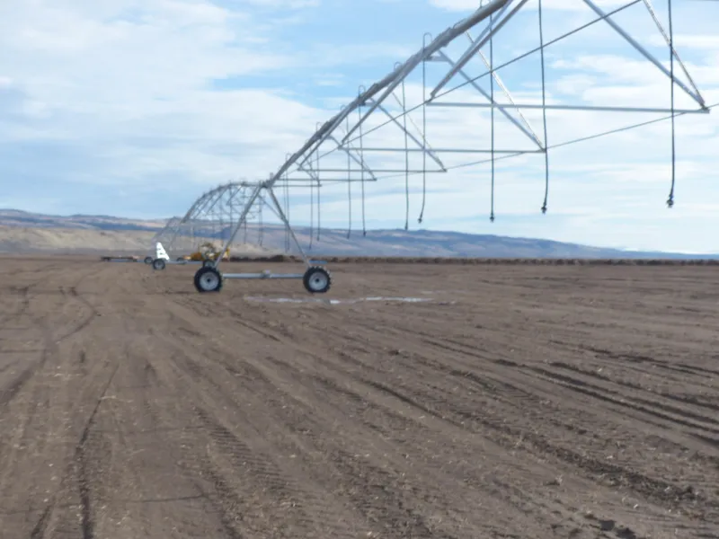
This property has one Pierce Pivot with good water source and quality. They have drilled another well and it is ready to put in another pivot that could cover 140 acres. Great location with highway frontage.
Location: Approx. 26 miles east of Burns Oregon on Hwy 20
Acreage: 387.01 deeded acres consisting of the following:
- 125 +/- ac. irrigated by Pierce Pivot
- 262 +/- ac. pivots corners
Water Rights:
256.80 acres
Wells:
3 irrigation
1 stock/potential irrigation
Irri. Equip:
1 Pierce Pivot
Crops:
125 +/- acres planted in Triticale
Taxes:
$1,731.69 (2017/2018) farm deferral
From elevation to risk assessment
Search for detailed parcel information including; Elevation & Vegetation Maps, Ownership Information, Detailed Parcel Information, Crop History Map, Soil Survey Productivity Data, and more.
Research Parcel InformationResources
Land for Sale by Curt Blackburn
Harney County Properties By Type
- Ranches for Sale in Harney County, Oregon
- Undeveloped Land for Sale in Harney County, Oregon
- Farms for Sale in Harney County, Oregon
- Residential Property for Sale in Harney County, Oregon
- Hunting Land for Sale in Harney County, Oregon
- Lakefront Property for Sale in Harney County, Oregon
- Riverfront Property for Sale in Harney County, Oregon
- Commercial Property for Sale in Harney County, Oregon
- Recreational Property for Sale in Harney County, Oregon
- Timberland for Sale in Harney County, Oregon
- Horse Property for Sale in Harney County, Oregon
- Beachfront Property for Sale in Harney County, Oregon
Properties for Sale Nearby Counties
Harney County Properties By City
- Burns, Oregon Land for Sale
- Crane, Oregon Land for Sale
- Diamond, Oregon Land for Sale
- Drewsey, Oregon Land for Sale
- Fields, Oregon Land for Sale
- Frenchglen, Oregon Land for Sale
- Hines, Oregon Land for Sale
- Princeton, Oregon Land for Sale
- Riley, Oregon Land for Sale
- Lawen, Oregon Land for Sale
- Andrews, Oregon Land for Sale
- Buchanan, Oregon Land for Sale
- More
- Dunnean, Oregon Land for Sale
- Frost Mill, Oregon Land for Sale
- Harney, Oregon Land for Sale
- Indian Village, Oregon Land for Sale
- Narrows, Oregon Land for Sale
- New Princeton, Oregon Land for Sale
- Suntex, Oregon Land for Sale
- Trout Creek, Oregon Land for Sale
- Van, Oregon Land for Sale
- Venator, Oregon Land for Sale
- Voltage, Oregon Land for Sale
- Wagontire, Oregon Land for Sale