Auction Information
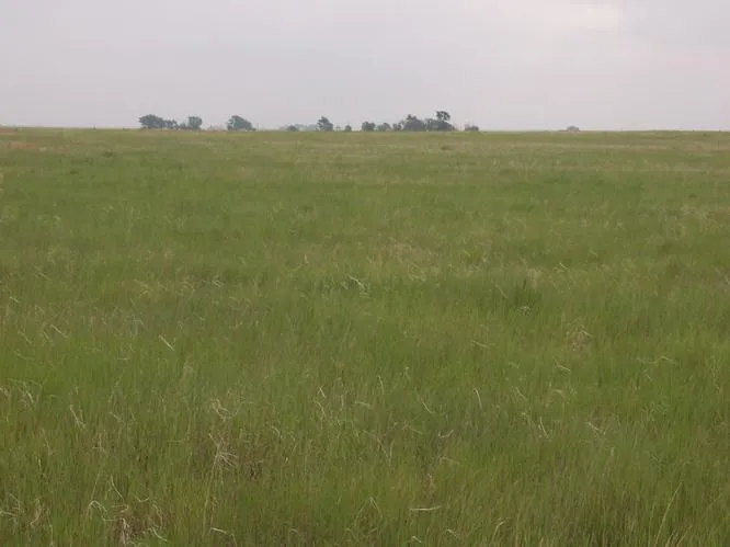
398 acres in Yuma County, Colorado
398 Acres
CRP & GRASSLAND
Yuma County, Colorado
Wednesday, July 27, 2011 2:00 pm MT
Grassroots Community Building
Hwy 36 Joes, Colorado
Tract 1 - 160 Total Acres
4S-4; Sec. 32: NE/4
(156.5 Ac. CRP)
CRP contract from 10-1-08 to 9-30-18
$34.24/Ac./Yr. Payment
Approx. 2010 Taxes: $192.60
Tract 2 - 160 Total Acres
4S-47; Sec. 32: SE/4 less tract
(84 Ac. Grass with stock well;
71.4 Ac. CRP)
CRP contract from 10-1-06 to 9-30-16
$33.78/Ac./Yr. Payment
Approx. 2010 Taxes: $128.75
Tract 3 - 80 Total Acres
4S-47; Sec. 33: W/2NW/4
(77.8 Ac. CRP)
CRP contract from 10-1-08 to 9-30-18
$34.24/Ac./Yr. Payment
Approx. 2010 Taxes: $96.30
MANNER OF SALE
Sale is absolute with the property selling to the highest bidder auction day without minimum or reserve. Real estate will be offered in individual tracts, combinations of tracts and as a whole. The property will sell in the manner which produces the highest price for the Seller.
TERMS
15% of the contract price will be due immediately after the auction, with the balance due at closing, on or before August 26, 2011. Personal and corporate checks are acceptable for the down payment with the final payment in good funds. Purchase is not contingent upon financing, appraisals, surveys or inspections. Financing, if necessary, should to be approved prior to the auction. Each successful bidder will be required to enter into a Purchase Contract immediately following the auction. Example copies of the contract will be available prior to the sale.
EVIDENCE OF TITLE
Seller will provide title insurance to Buyer in the amount of the purchase price. Title insurance policy commitments will be provided on sale day.
INSPECTIONS
There is no inspection period in the contract, therefore, each potential bidder is responsible for conducting his own independent inspections and due diligence concerning pertinent facts about the property prior to the auction. All information is deemed to be from reliable sources. Neither the Seller nor Shay Realty, Inc. is making any warranties about the property, either expressed or implied. To schedule inspections of land or improvements, contact Shay Realty, Inc.
ACREAGES
All acreages are considered to be approximate and tracts will be sold by acres advertised. The acreage figures are from sources believed to be reliable. All FSA information is subject to change. The FSA acres may not be the same as deeded acres.
LEASES
The grass on Tract 2 is leased for the 2011 grazing season. Purchase is subject to the lease. Seller shall receive the 2011 grass rent when due.
TAXES
All taxes are considered approximate. Seller will pay the 2010 and prior years taxes with the taxes for 2011 to be paid by the Buyer.
CRP CONTRACT & PAYMENTS
Buyer shall assume the position and the responsibilities of the Seller in all FSA and CRP contracts and obligations. Buyer shall receive all 2011 and future CRP payments.
MINERAL RIGHTS
All of Sellers oil, gas and mineral rights shall transfer to Buyer.
EASEMENTS
Sale is subject to all rights of way and easements, whether recorded or not, and subject to any oil and gas leases of record.
SURVEYS
There have been no surveys on the individual tracts. Neither the Seller nor Shay Realty, Inc. is making any warranties as to the exact location of tract boundaries. The property will sell by legal description only; Seller will not provide any surveys. Surveys, if desired, shall be the responsibility of the Buyer.
WATER
All water rights owned by Seller shall go to the Buyer. All Bidders should satisfy themselves as to their individual water concerns. Neither the Seller nor Shay Realty, Inc. is making any warranties pertaining to water or its availability, either expressed or implied.
AGENCY
The Listing Broker with Shay Realty, Inc. is the Sellers Agent. No compensation for other agents available for this transaction. Announcements made at the auction take precedence over any printed material or prior representations.
From elevation to risk assessment
Search for detailed parcel information including; Elevation & Vegetation Maps, Ownership Information, Detailed Parcel Information, Crop History Map, Soil Survey Productivity Data, and more.
Research Parcel InformationResources
Yuma County Properties By Type
- Farms for Sale in Yuma County, Colorado
- Hunting Land for Sale in Yuma County, Colorado
- Undeveloped Land for Sale in Yuma County, Colorado
- Recreational Property for Sale in Yuma County, Colorado
- Ranches for Sale in Yuma County, Colorado
- Commercial Property for Sale in Yuma County, Colorado
- Lakefront Property for Sale in Yuma County, Colorado
- Horse Property for Sale in Yuma County, Colorado
- Residential Property for Sale in Yuma County, Colorado
- Timberland for Sale in Yuma County, Colorado
- Beachfront Property for Sale in Yuma County, Colorado
- Riverfront Property for Sale in Yuma County, Colorado
Properties for Sale Nearby Counties
Yuma County Properties By City
- Eckley, Colorado Land for Sale
- Idalia, Colorado Land for Sale
- Joes, Colorado Land for Sale
- Kirk, Colorado Land for Sale
- Vernon, Colorado Land for Sale
- Wray, Colorado Land for Sale
- Yuma, Colorado Land for Sale
- Hale, Colorado Land for Sale
- Laird, Colorado Land for Sale
- Abarr, Colorado Land for Sale
- Alvin, Colorado Land for Sale
- Armel, Colorado Land for Sale
- More