4 Acres for Sale in Lunenburg County Virginia for $299 a month!!
4 Acres for Sale in Lunenburg County Virginia for $299 a month!!
Owner Financing May Be Available!
Contact us Today!! Or BUY NOW On our website!!
This property does not have a Buy Now button, if you want to purchase it, you will need to get in touch with us directly to arrange payment via wire transfer, money order or cashiers check, thanks! Owner financing may be available upon transfer of title.
Please note, there are no refunds on cash sales, we WILL refund the down payment portion of the deposit within 30 days of when deposit was made, but the $100 document fee portion of deposit is NOT refundable.
Address: Lunenburg County Virginia, USA
Cash Discount Price: $14,900.00
Financed Price: $22,840.00
Owner financing Terms: $4,900 down and $299 per month for 60 months
County: Lunenburg
Acres: 4 Acres (Raw Land)
Coordinates: 36.92465 -78.44181
Parcel #: 6687
Yearly Taxes: $66.12
Legal Description: TMP: 040-03-0-10 / RPC 6687
ALL THAT CERTAIN TRACT, piece or parcel of land, with the buildings and improvements thereon, located on the Western side of Virginia Secondary Highway No. 623, situate, lying and being in Rehoboth Magisterial District, Lunenburg County, Virginia, containing 4.00 acres and known and designated as Lot No. 10 as shown on that certain Plat entitled "Plat of two parcels of land in Rehoboth District of Lunenburg County, Virginia, known as the Macon Fears Land, etc." said Plat is dated December 7, 1972, made by D. L. Bowman, C. L. S., and is bounded and described as follows:
BEGINNING at a point in the Western edge of Virginia Secondary Highway No, 623, which said point is in the dividing line of the property hereby conveyed and Parcel No. 11 as shown on said Plat; thence running due West 525.95 ft. to a point; thence running North 20 deg. 37 min. East a distance of 281.3 ft. to a point; thence running North 54 deg. 20 min, East a distance of 412.16 ft. to a point in the edge of said Highway; thence running South 19 deg, 59 min. East a distance of 151.4 ft. along the edge of said Highway to a point; thence running South 9 deg, 09 min. East a distance of 236.10 ft. to a point; thence running South 1 deg. 00 min. East a distance of 129.1 ft. to the point of BEGINNING.
Zoning: R-1
Elevation: 595 ft.
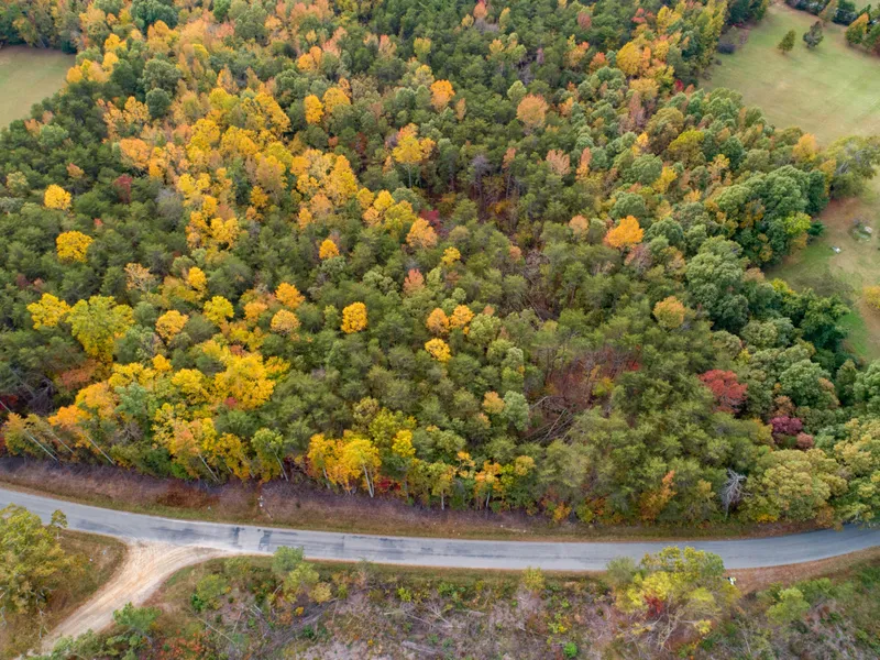
The photos in this ad were taken near the property, but may not be of the actual property.
From elevation to risk assessment
Search for detailed parcel information including; Elevation & Vegetation Maps, Ownership Information, Detailed Parcel Information, Crop History Map, Soil Survey Productivity Data, and more.
Research Parcel InformationDirections
Fort Mitchell
Virginia 23937
Head east on State Rte 630 toward State Rte 760
1.0 mi
Turn left to stay on State Rte 630
0.7 mi
Turn left onto State Rte 688
1.3 mi
Turn right onto State Rte 623
Destination will be on the right
0.2 mi
Resources
Land for Sale by Luke Harris
Lunenburg County Properties By Type
- Undeveloped Land for Sale in Lunenburg County, Virginia
- Farms for Sale in Lunenburg County, Virginia
- Hunting Land for Sale in Lunenburg County, Virginia
- Residential Property for Sale in Lunenburg County, Virginia
- Ranches for Sale in Lunenburg County, Virginia
- Timberland for Sale in Lunenburg County, Virginia
- Lakefront Property for Sale in Lunenburg County, Virginia
- Commercial Property for Sale in Lunenburg County, Virginia
- Riverfront Property for Sale in Lunenburg County, Virginia
- Recreational Property for Sale in Lunenburg County, Virginia
- Horse Property for Sale in Lunenburg County, Virginia
- Beachfront Property for Sale in Lunenburg County, Virginia
Properties for Sale Nearby Counties
Lunenburg County Properties By City
- Fort Mitchell, Virginia Land for Sale
- Kenbridge, Virginia Land for Sale
- Lunenburg, Virginia Land for Sale
- Victoria, Virginia Land for Sale
- Arvins Store, Virginia Land for Sale
- Bacons Fork, Virginia Land for Sale
- Bagleys Mills, Virginia Land for Sale
- Bishops Corner, Virginia Land for Sale
- Blevins Corner, Virginia Land for Sale
- Bruceville, Virginia Land for Sale
- Gary, Virginia Land for Sale
- Gills Corner, Virginia Land for Sale
- More
- Kells Corner, Virginia Land for Sale
- Lochleven, Virginia Land for Sale
- Loves Mill, Virginia Land for Sale
- Nutbush, Virginia Land for Sale
- Oral Oaks, Virginia Land for Sale
- Plantersville, Virginia Land for Sale
- Plymouth, Virginia Land for Sale
- Rehoboth, Virginia Land for Sale
- Rubermont, Virginia Land for Sale
- Simplicity, Virginia Land for Sale
- Sneads Corner, Virginia Land for Sale
- Wattsboro, Virginia Land for Sale
- Wilburn, Virginia Land for Sale