4659 - Tompkins 40
Description
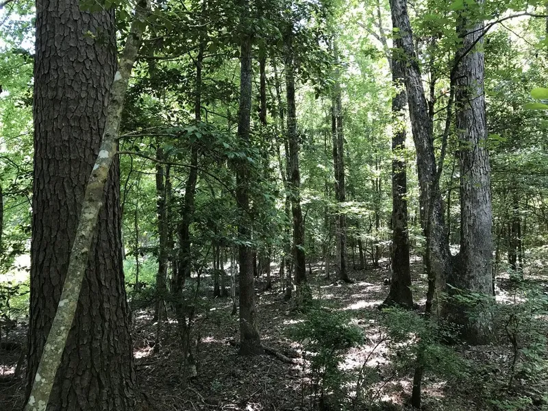
The Tompkins 40 and Black Creek 40 Tracts will be offered by lump sum sealed bid on Friday, September 13, 2019, at 10:00 a.m. Bids may be submitted for either or both tracts. The tracts are located about six (6) miles east of Rosston. The tracts have immediate timber income potential and excellent hunting. Pine and hardwood sawtimber of good quality.
The Tompkins 40 Tract (Listing #4659) is described as SW of NW, Section 15, Township 13 South, Range 20 West, containing 40 acres, more or less, Nevada County, Arkansas. 29 acres of mature native pine hardwood and 11 acres around Cypress Creek. Access is woods road through adjacent landowners. Site index for loblolly pine (base age 50) averages eighty -five (85) feet on silt loam and fine sandy loam soils. Based on Kingwoods August, 2018 inventory on 29 timbered acres, estimated tree counts & timber volumes are as follows*:
Pine Sawtimber: 319 Tons
Pine Pulpwood: 78 Tons
Oak Sawtimber: 472 Tons
Misc. Sawtimber: 32 Tons
Hardwood Pulpwood: 1,532 Tons
Based on estimates, Pine Sawtimber averages 18.9 dbh and 297 BF / Tree; Oak Sawtimber 17.1 dbh and 124 BF / Tree.
The Black Creek 40 Tract (Listing #4658) is described as NW of NW, Section 9, Township 14 South, Range 20 West, containing 40 acres, more or less, Nevada County, Arkansas. Good quality mature native pine and hardwood. Access is oil well road to the north portion of property and woods road to the south portion. Site index for loblolly pine (base age 50) averages eighty-five (85) feet on silt loam and fine sandy loam soils. Based on Kingwoods August, 2018 inventory on 16 timbered acres, estimated tree counts & timber volumes are as follows*:
Pine Sawitmber: 596 Tons
Pine CNS: 39 Tons
Pine Pulpwood: 98 Tons
Oak Sawtimber: 235 Tons
Misc. Sawtimber: 60 Tons
Hardwood Pulpwood: 228 Tons
Based on estimates, Pine Sawtimber averages 16.4 dbh and 138 BF / Tree; Oak Sawtimber 18.9 dbh and 173 BF / Tree.
*Due to variations in cruising methods, utilization standards, and scaling practices, tree counts and volume estimates cannot be guaranteed. Volume reports in Tons and Board Feet are attached; additional timber volume reports (tree counts by species, diameter, height) are available by clicking "Brochure & Maps" button.
From elevation to risk assessment
Search for detailed parcel information including; Elevation & Vegetation Maps, Ownership Information, Detailed Parcel Information, Crop History Map, Soil Survey Productivity Data, and more.
Research Parcel InformationDirections
Tompkins 40 Tract DRIVING DIRECTIONS: In Rosston, at the intersection of Highway 278, 200, and 371, drive east on Highway 200 for 4.0 miles and turn right (east) on Nevada
County Road 10. Drive .9 mile and veer right (east), staying on County Road 10. Drive 1.5 miles and turn left (north) on Nevada County Road 47. Drive .3 mile and turn right (northeast) on woods road, marked with Land For Sale arrow sign. Follow blue flags along woods road for .9 mile to southwest corner of tract, marked with Land For Sale sign, pink KFS flagging, and yellow line.
Environmental Factors
Resources
Nevada County Properties By Type
- Residential Property for Sale in Nevada County, Arkansas
- Hunting Land for Sale in Nevada County, Arkansas
- Lakefront Property for Sale in Nevada County, Arkansas
- Farms for Sale in Nevada County, Arkansas
- Ranches for Sale in Nevada County, Arkansas
- Riverfront Property for Sale in Nevada County, Arkansas
- Commercial Property for Sale in Nevada County, Arkansas
- Timberland for Sale in Nevada County, Arkansas
- Undeveloped Land for Sale in Nevada County, Arkansas
- Recreational Property for Sale in Nevada County, Arkansas
- Horse Property for Sale in Nevada County, Arkansas
- Beachfront Property for Sale in Nevada County, Arkansas
Properties for Sale Nearby Counties
Nevada County Properties By City
- Bluff City, Arkansas Land for Sale
- Cale, Arkansas Land for Sale
- Emmet, Arkansas Land for Sale
- Prescott, Arkansas Land for Sale
- Rosston, Arkansas Land for Sale
- Willisville, Arkansas Land for Sale
- Laneburg, Arkansas Land for Sale
- Ames, Arkansas Land for Sale
- Azor, Arkansas Land for Sale
- Bodcaw, Arkansas Land for Sale
- Boughton, Arkansas Land for Sale
- Cummings Springs, Arkansas Land for Sale
- More
- Delta, Arkansas Land for Sale
- Dills Mills, Arkansas Land for Sale
- Falcon, Arkansas Land for Sale
- Glenville, Arkansas Land for Sale
- Gum Grove, Arkansas Land for Sale
- Irma, Arkansas Land for Sale
- Iron Springs, Arkansas Land for Sale
- Mendenhall, Arkansas Land for Sale
- Morris, Arkansas Land for Sale
- Nevark, Arkansas Land for Sale
- Redland, Arkansas Land for Sale
- Sanders, Arkansas Land for Sale
- Stockton, Arkansas Land for Sale
- Sutton, Arkansas Land for Sale
- Waterloo, Arkansas Land for Sale
- Young, Arkansas Land for Sale