Auction Information
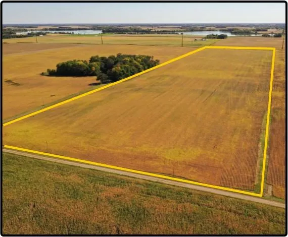
Sibley Co., MN 40.00 Ac., m/l (190-0053-02)
40.00 acres, m/l, located east of Arlington, Minnesota on the south side of 216th Lane.
This level to gently rolling farm has 37.79 FSA/Eff. crop acres with a CPI of 91.90.
There is some tile on this property with a drainage agreement in place. Private main begins in 16" tile ending in 36' culvert at private open ditch eventually flowing into Silver Lake.
Only Registered Bidders May Attend Auction
From elevation to risk assessment
Search for detailed parcel information including; Elevation & Vegetation Maps, Ownership Information, Detailed Parcel Information, Crop History Map, Soil Survey Productivity Data, and more.
Research Parcel InformationDirections
From Arlington: take MN-5 north out of
town, turn east on 230th St. for 2.6 miles,
then north on 371st Ave. for 0.2 miles. Go
east on 228th St. and follow the road for
0.8 miles, then turn onto 365th Ave. and
follow road north for 1.1 miles. Turn east
on 216th Lane for 0.4 miles. Property is
on the south side of 216th Lane.
Resources
Land for Sale by Hertz Real Estate Services
Sibley County Properties By Type
- Farms for Sale in Sibley County, Minnesota
- Lakefront Property for Sale in Sibley County, Minnesota
- Riverfront Property for Sale in Sibley County, Minnesota
- Commercial Property for Sale in Sibley County, Minnesota
- Hunting Land for Sale in Sibley County, Minnesota
- Undeveloped Land for Sale in Sibley County, Minnesota
- Residential Property for Sale in Sibley County, Minnesota
- Recreational Property for Sale in Sibley County, Minnesota
- Timberland for Sale in Sibley County, Minnesota
- Ranches for Sale in Sibley County, Minnesota
- Horse Property for Sale in Sibley County, Minnesota
- Beachfront Property for Sale in Sibley County, Minnesota
Properties for Sale Nearby Counties
Sibley County Properties By City
- Arlington, Minnesota Land for Sale
- Gaylord, Minnesota Land for Sale
- Gibbon, Minnesota Land for Sale
- Green Isle, Minnesota Land for Sale
- Henderson, Minnesota Land for Sale
- New Auburn, Minnesota Land for Sale
- Winthrop, Minnesota Land for Sale
- Allansons Park, Minnesota Land for Sale
- Assumption, Minnesota Land for Sale
- Jessenland, Minnesota Land for Sale
- New Rome, Minnesota Land for Sale
- Rush River, Minnesota Land for Sale