Secluded 40-Acre Tract Ready to be Your New Hunting Camp!
Description
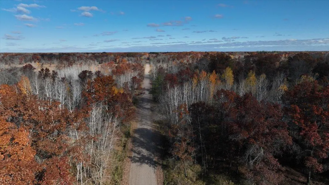
This hard-to-find 40.41-acre affordable tract is ready to become your new hunting camp! Set in northern Adams County, it rests along a quiet gravel road surrounded by nothing but vast deer country. It features a driveway, camping area (camping permitted), and 2 small waterfowl ponds.
Convenient access is afforded by a driveway that leads to a perfect spot to establish your new deer camp. Should you not need a camp, this area offers potential to be converted to a small food plot (potentially complemented by planting apples, pear, or other soft mast species).
Departing camp, a trail currently bisects the property permitting easy navigation from the west, all the way to the east side. The quarter mile of road frontage affords creative ingress/egress opportunities as well.
The landscape is an intertwining blend of wetland habitat with oak/maple hardwood islands resulting in a mixture of bedding cover, hard mast, and woody browse. Subtle rises in the marsh create natural funnels for deer travel. Depending on the time of year and seasonal conditions, the waterfowl ponds fill up with ducks and geese as well.
While the rustic nature of the area creates a nearly perfect deer camp setting, please note, power is over a half mile away (per Adams-Columbia Elec.). Local zoning ordinances do permit accessory buildings (sheds) and potentially a cabin/residence. Local roads are ATV/UTV friendly with several off-road trails available nearby!
Highlights:
40.41 Acres $149,000
Driveway
Quiet Gravel Road Setting
Camping Area
Recorded Survey (CSM)
Camping Permitted
Accessory Building (Shed) Potential
2 Small Waterfowl Ponds
Local Roads UTV/ATV Friendly- Off-Road Trails Nearby
Established Trail Crossing Property from West to East
22 Acres Enrolled in MFL Closed in 2024
Within 20 minutes of Lakes Arrowhead, Sherwood, Camelot, and Petenwell
From elevation to risk assessment
Search for detailed parcel information including; Elevation & Vegetation Maps, Ownership Information, Detailed Parcel Information, Crop History Map, Soil Survey Productivity Data, and more.
Research Parcel InformationEnvironmental Factors
Resources
Adams County Properties By Type
- Lakefront Property for Sale in Adams County, Wisconsin
- Riverfront Property for Sale in Adams County, Wisconsin
- Beachfront Property for Sale in Adams County, Wisconsin
- Recreational Property for Sale in Adams County, Wisconsin
- Undeveloped Land for Sale in Adams County, Wisconsin
- Hunting Land for Sale in Adams County, Wisconsin
- Residential Property for Sale in Adams County, Wisconsin
- Farms for Sale in Adams County, Wisconsin
- Ranches for Sale in Adams County, Wisconsin
- Timberland for Sale in Adams County, Wisconsin
- Horse Property for Sale in Adams County, Wisconsin
- Commercial Property for Sale in Adams County, Wisconsin
Properties for Sale Nearby Counties
Adams County Properties By City
- Adams, Wisconsin Land for Sale
- Arkdale, Wisconsin Land for Sale
- Dellwood, Wisconsin Land for Sale
- Friendship, Wisconsin Land for Sale
- Grand Marsh, Wisconsin Land for Sale
- Big Flats, Wisconsin Land for Sale
- Monroe Center, Wisconsin Land for Sale
- Big Spring, Wisconsin Land for Sale
- Cottonville, Wisconsin Land for Sale
- Easton, Wisconsin Land for Sale
- New Rome, Wisconsin Land for Sale
- Plainville, Wisconsin Land for Sale
- More