Auction Information
455 acres in Dunn County, North Dakota
Description
LAND AUCTION
455 +/- Acres - Dunn County, ND
Tuesday, September 24, 2019 7:00 p.m. (MT)
Auction Location: Grand Dakota Lodge (Ramada) - Dickinson, ND
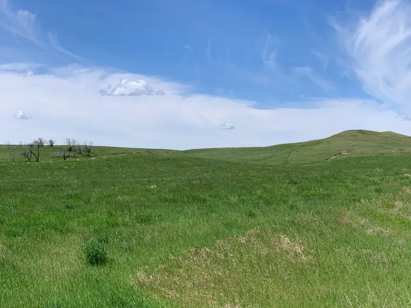
Auction Note: This is exceptional contiguous crop and pastureland in Dunn County, North Dakota. Parcel 1 features strong producing cropland which is currently in alfalfa and grass, while parcels 2-3 were previously enrolled in Conservation Reserve Program (CRP). The CRP has been terminated. The pastureland offers rolling hills and prominent dugouts as a water source.
Contact: Kevin Pifer at 701.238.5810 or Steve Miller at 701.471.3288 for more information or Pifers Auction & Realty at 877.700.4099 for a complete catalog.
Parcel 1:
Acres: 148 +/-
Legal: SW 31-144-93 (Dunn County, ND)
Cropland Acres: 138.84 +/-
Taxes (2018): $308.76
This parcel features 138.84 +/- acres of exceptional cropland currently in alfalfa and grass. The balance of the land is in grass. This parcel has a Soil Productivity Index of 69.4 with some index numbers in the 80s and 90s.
Parcel 2:
Acres: 159 +/-
Legal: NE 1-143-94 (Dunn County, ND)
Crop Acres: 115.74 +/- (Previously in CRP)
Pasture Acres: 40 +/-
Taxes (2018): $231.99
This is a diverse parcel with approximately 115.74 +/- acres previously in CRP and approximately 40 +/- acres of pastureland. The cemetery is not part of this transaction.
Parcel 3:
Acres: 148 +/-
Legal: NW 6-143-93 (Dunn County, ND)
Crop Acres: 108.75 +/- (98.19 +/- acres were previously in CRP)
Pasture Acres: 31.18 +/-
Taxes (2018): $300.53
This is an exceptional parcel with approximately 98.19 +/- acres previously in CRP, 10.66 acres of cropland and 31.18 +/- acres of pasture. The pastureland has a prominent dugout as a water source.
OWNER: Lois M. Wetsch Trust
From elevation to risk assessment
Search for detailed parcel information including; Elevation & Vegetation Maps, Ownership Information, Detailed Parcel Information, Crop History Map, Soil Survey Productivity Data, and more.
Research Parcel InformationDirections
Driving Directions:
(Parcels 1-3): From Halliday, ND, drive west on Hwy. #200 approximately 8 miles to 97th Ave. Turn south on 97th Ave. for 7 miles to 12th St. SW. Parcel 1 is north of 12th St. SW and Parcels 2 & 3 are south of 12th St. SW.
Environmental Factors
Resources
Dunn County Properties By Type
- Ranches for Sale in Dunn County, North Dakota
- Commercial Property for Sale in Dunn County, North Dakota
- Undeveloped Land for Sale in Dunn County, North Dakota
- Farms for Sale in Dunn County, North Dakota
- Hunting Land for Sale in Dunn County, North Dakota
- Recreational Property for Sale in Dunn County, North Dakota
- Residential Property for Sale in Dunn County, North Dakota
- Horse Property for Sale in Dunn County, North Dakota
- Lakefront Property for Sale in Dunn County, North Dakota
- Beachfront Property for Sale in Dunn County, North Dakota
- Riverfront Property for Sale in Dunn County, North Dakota
- Timberland for Sale in Dunn County, North Dakota
Properties for Sale Nearby Counties
Dunn County Properties By City
- Dodge, North Dakota Land for Sale
- Dunn Center, North Dakota Land for Sale
- Halliday, North Dakota Land for Sale
- Killdeer, North Dakota Land for Sale
- Manning, North Dakota Land for Sale
- Marshall, North Dakota Land for Sale
- Twin Buttes, North Dakota Land for Sale
- Werner, North Dakota Land for Sale
- Emerson, North Dakota Land for Sale
- Fayette, North Dakota Land for Sale
- Hirschville, North Dakota Land for Sale
- Medicine Hole, North Dakota Land for Sale
- More