Live Free Where the Stars Meet the Desert
OWNER FINANCING AVAILABLE:
$150 down (plus the $250 doc fee)
$125/mo for 72 months
---------------------------------
Life in the city can feel suffocating. The constant noise, light pollution blocking out the stars, and neighbors watching your every move. The daily grind leaves you yearning for something more authentic, more free.
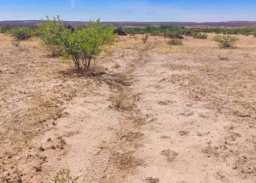
But there's a solution: a 5.14-acre paradise in Hudspeth County, 144 miles from El Paso, Texas. This pristine desert land offers the freedom and tranquility you've been seeking. With no zoning restrictions or HOA rules, you can build your ideal sanctuary - from a cozy cabin to a modular home.
This piece of Texas desert opens the door to true independence. Whether you dream of self-sufficiency or simply need a private recreational haven, this land empowers you to live authentically. Your opportunity for a life of freedom and adventure awaits in this unspoiled natural setting.
The choice is yours - continue feeling trapped in urban confines, or embrace the boundless potential of your own private desert sanctuary. Contact us to begin your journey toward the independent lifestyle you deserve.
SUBDIVISION: T&P GUNSIGHT RANCH
STREET ADDRESS: N/A, Sierra Blanca, TX 79851
STATE: TX
COUNTY: Hudspeth County, TX
ZIP: 79851
SIZE: 5.14 acres
LOT DIMENSIONS: 512 feet x 475 feet
APN: 72603
LEGAL DESCRIPTION: Being a tract of land out of Tract 9 and 10 of Section 18, Block 71, Township 6, T&P RR Co. Survey, Hudspeth County, Texas and being more particularly described as follows: BEGINNING: At a point 1457.20 feet N 00 33 12" W and 1772.74 feet N 90 00 00 W from the southeast corner of this Section, and also known as the northeast corner of Lot 3; THENCE: N 00 33 12 W 475.73 feet to the northeast corner of the lot; THENCE: N 90 00 00 W 470.21 feet to the northwest corner of the lot; THENCE: S 00 33 12 E 475.73 feet to the southwest corner of the lot; THENCE: S 90 00 00 E 470.21 feet to the Point of Beginning at the southeast corner of the above referenced lot and containing 5.14 acres of land, more or less. The foregoing description is based upon metes and bounds data provided by the owner, the Texas Railroad Commission, Texas Natural Resources Information System, and the Texas General Land Office, and has not been surveyed as of this date.
LAT/LONG COORDINATES:
NW: 31.3800, -105.4734
NE: 31.3800, -105.4719
SW: 31.3786, -105.4734
SE: 31.3786, -105.4719
ELEVATION: 4,806 feet
ANNUAL TAXES: Approx. $80 per year
ZONING: No Zoning - There is no zoning at this time in Hudspeth County (it is unincorporated), except in the City of Dell City.There are no building restrictions at this time in Hudspeth County. You can camp on your own property. You must have a proper way to dispose of sewage. You can bring your RV on your lot and stay there upon building a home. You just need to dispose of sewage properly and legally. Mobile homes are allowed as there are no building restrictions. Contact (915) 369-4118 for more information.
LAND USE:
***BUILDING INFORMATION***
* Time Limit to Build: no time limit to build
* Site Built Homes Allowed: Yes
* Modular Homes Allowed: Yes
* Manufactured Homes Allowed: Yes
* Mobile Homes Allowed: Yes
* Tiny Homes Allowed: Yes
***ALLOWABLE USES***
* Full-Time RV Living: No
* RV on the property while you build: Yes, with proper way to dispose sewage
* Camping in a RV: Yes
* Tent Camping: Yes
Notes: This is a general restriction as long as there is no deed restrictions or covenants on the property.
FLOOD ZONE: Unsure
HOA/POA: No
IMPROVEMENTS: None
ACCESS: The nearest dirt road is about 1,500 to the West of this property.
WATER: Would be a well, water haul and holding tank or other similar option
SEWER: Would be by Septic
UTILITIES: Power by solar, wind or generator, Phone by cellular, satellite TV/Internet/Phone
From elevation to risk assessment
Search for detailed parcel information including; Elevation & Vegetation Maps, Ownership Information, Detailed Parcel Information, Crop History Map, Soil Survey Productivity Data, and more.
Research Parcel InformationDirections
ACCESS: The nearest dirt road is about 1,500 to the West of this property.
Environmental Factors
Resources
Land for Sale by Landopia
Hudspeth County Properties By Type
- Ranches for Sale in Hudspeth County, Texas
- Undeveloped Land for Sale in Hudspeth County, Texas
- Hunting Land for Sale in Hudspeth County, Texas
- Farms for Sale in Hudspeth County, Texas
- Recreational Property for Sale in Hudspeth County, Texas
- Residential Property for Sale in Hudspeth County, Texas
- Riverfront Property for Sale in Hudspeth County, Texas
- Commercial Property for Sale in Hudspeth County, Texas
- Lakefront Property for Sale in Hudspeth County, Texas
- Horse Property for Sale in Hudspeth County, Texas
- Beachfront Property for Sale in Hudspeth County, Texas
- Timberland for Sale in Hudspeth County, Texas
Properties for Sale Nearby Counties
Hudspeth County Properties By City
- Dell City, Texas Land for Sale
- Fort Hancock, Texas Land for Sale
- Salt Flat, Texas Land for Sale
- Sierra Blanca, Texas Land for Sale
- Acala, Texas Land for Sale
- Allamoore, Texas Land for Sale
- Arispe, Texas Land for Sale
- Brownfeld Corner, Texas Land for Sale
- Cornudas, Texas Land for Sale
- Coyote Place, Texas Land for Sale
- Crusher, Texas Land for Sale
- Eagle Flat, Texas Land for Sale
- More
