Auction Information
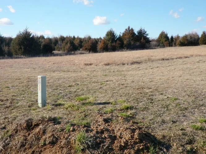
50 acres in Creek County, Oklahoma
Description
PELICAN POINT * KEYSTONE KEYS * PARK VIEW * 3-SUB-DIVISIONS
KEYSTONE LAKE * MANNFORD, OK.
50 ACRES NORTH PEORIA * TURLEY, OK.
TULSA AREA
ABSOLUTE AUCTION
No Minimums No Reserves
THURSDAY APRIL 5th, 2012
AUCTION LOCATION: ON SITE, CHECK EACH LOCATION AND TIME!!
PELICAN POINT- MANNFORD, OK. Sells at 10:00am
Seller: Keystone Construction, Inc.
Auction Location: Cummins Park (corner of Salt Creek Dr. & Elk Ridge Dr.)
Directions to Sub-Division: From Mannford, OK. take Hwy 51 east 1 mile to 289th Street (Eagle Drive), then approx... 1 mile south to Pelican Point (S 297th W. Ave.)
Overview: all properties are vacant building or expansion lots!
Title: will be conveyed by Warranty Deed
Zoning: RS-1 Single Family Residential
Lot sizes: the developable lots average size is approx... 15,345 sqft with frontages from 48 to 212
Tract # 1- Lot (1) Block (1), Pelican Point I (corner of Salt Creek Dr. & Elk Ridge Dr.) across the street from auction location. Lot size: 94 curb side x 139 northwest x 149 southwest x 80
Tract # 2- Lots (5, 6, 7, 8) Block (2), Pelican Point II (corner of Craven Dr. & Elk Ridge Dr. block south.) Lot size: 455 curbside x 175 deep x 396 backside
Tract # 3- Lot (12) Block (2), Pelican Point II (end of cul-de-sac Craven Dr.) Lot size: 40 curb side x 159 west side x 198 east side x 146 backside
Tract # 4- Lot (25) Block (2), Pelican Point II (corner of Elk Ridge & S 297th W. Ave, go 2 lots south.) Lot size: 172 north side, x 212 street side x 50 south side, x 227 west side.
Tract # 5- Lot (1) Block (1), Pelican Point III (corner of Eagle Dr. & Craven Ct.) Lot size: 128frontage x 251 south side angle x 155 north side,
Tract # 6- Lot (7) Block (1), Pelican Point III (corner of Craven Dr. & Eagle Dr.).
PARK VIEW ADDITION-MANNFORD, OK. Sells at 11:30am
Seller: Keystone Construction Inc.
Auction Location: Corner of Hillside Dr. & Elm St. (Tract # 1) 120 S. Elm, Mannford, OK 74044
Directions to Sub-Division: From Hwy 51 & Coonrod Street in Mannford, OK. Go approx. 1 mile north to Keystone Dr., then east to Hillside Street, then turn right to Elm Street (Auction Location).
Overview: all properties are vacant building or expansion lots! Lot sizes are approximate only!
Title: will be conveyed by Warranty Deed
Zoning: RS-1 Single Family Residential
Lot sizes: average 9,612 sqft with frontages ranging from 50 to 136
Tract # 1- Lot (1) Block (1) Park View Addition (auction location) Lat: 36-6-59N Long: -96-19-32W
Tract # 2- Lots (6 & 7), Block (1) Park View Addition (120 Elm St.) Lat: 36-6-57N Long: -96-19-36W
Tract # 3- Lot (28), Block (2) Park View Addition (219 Craven Dr., Mannford OK) Lat: 36-6-52N Long: -96-19-35W
Tract # 4- Lot (1) Block (3) Park View Addition (121 Craven Dr. Mannford OK) Lat: 36-6-57N Long: -96-19-32W
Tract # 5- Lot (19) Block (3) Park View Addition (101 Cedar Street) Lat: 36-7-9N Long: -96-19-42W
Tract # 6- Lot (17) Block (3) Park View Addition (105 Cedar Street) Lat: 36-7-7N Long: -96-19-35W
Tract # 7- Lot (15) Block (3) Park View Addition (109 Cedar Street)
KEYSTONE KEYS SUB-DIVISION-MANNFORD, OK. Sells at 2:30pm
Seller: Robert L. Cummins QTIP Trust
Auction Location: (Tract # 1)
Directions to Sub-Division: From Hwy 412 & Cleveland/Mannford Exit (west of Tulsa, OK.), take exit to Hwy 65, go north on Hwy 64, 2.1 miles to Dal-Roc Rd (N3700 Rd), then 1 mile north to 5200 Rd, then mile east to property.
Overview: all properties are vacant building or expansion lots, heavy timber.
Zoning: None
Legal Description: all in SE/4 25-21N-8E.I.N. Pawnee County, Oklahoma
Title: will be conveyed by a Quit Claim Deed. 100% of total purchase price will be placed in escrow day of the auction with a Quit Claim Deed provided within 7 business days.
Lot sizes: vary from 50 to 400 frontages.
Tract # 1- Lot (1) Block (7) Keystone Keys (auction location, entrance)
Tract # 2- Lots (14 & 15) Block (5) Keystone Keys (corner of Key Dr. & Keystone Rd)
Tract # 3- Lots (2-10, & 12-15, & 17) Block (2) Keystone Keys (corner of Key Dr. & Rockridge Rd)
Tract # 4- Lots (16-20) Block (1) Keystone Keys (Lakeshore Dr)
Tract # 5- Lots (23-30, & 33, & 36-60) Block (1) & Lots (2, 4, 6-8, 10-16, 23-32, 34-36) Block 8 Keystone Keys (Latch Ln & Sooner Rd)
Tract #6- Lots (1-8, 22-27 ) Block (5) Keystone Key (Sooner Rd. & Latch Ln)
TURLEY, OK 50.6 N. PEORIA TULSA Sells at 6:00pm
Seller: Robert L. Cummins QTIP Trust
Auction Location: Corner of North Peoria and E 76th St.
Directions: north edge of Turley, Oklahoma (north side of Tulsa, Ok.) on the corner of North Peoria and E 76th St.
Legal Description: Government Lot (3) and Lot (1) and (2), Block (1) North Turley Mobile Home Park, located in SW/4 of Section (30), T21N- R13E, Tulsa Co. OK.
Overview: property is 7 miles north of downtown Tulsa, OK. Property offers good class II & III bottomland ground for cropland, but currently in grass pasture.
Zoning: Tract # 1 AG, Agricultural; Tract # 2 RMH, residential manufactured home..
Taxes: $320.27
Title: will be conveyed by Warranty Deed.
Tract # 1- 39.73 acres of land, (Lot 3 of Section 30, Township 21N- Range 13E Tulsa County, OK.
Tract # 2- 10.914 acres of land,(South 430 of Lot 4 of Section 30, Township 21N, Range 13E Tulsa County, OK. in North Turley Mobile Home Park.
Terms/Conditions on Properties, Except Keystone Keys Addition:
Internet Bidding: will be available by logging on to proxibid. Neither Auction Company nor Seller is responsible in the event of loss of signal.
Possession: will be given at closing.
Terms on Real Estate: 10% Buyers Premium will be added to the high bid price to establish the total contract price. 10% of the total contract price will be placed in escrow the day of the auction with the balance being due upon delivery of marketable title. All information is taken from sources believed reliable; however, no guarantee is made by the Auction Company or the Seller. Buyers should satisfy themselves as to any inspections prior to bidding. Any announcements made the day of the auction supersede all advertising.
From elevation to risk assessment
Search for detailed parcel information including; Elevation & Vegetation Maps, Ownership Information, Detailed Parcel Information, Crop History Map, Soil Survey Productivity Data, and more.
Research Parcel InformationEnvironmental Factors
Creek County Properties By Type
- Undeveloped Land for Sale in Creek County, Oklahoma
- Farms for Sale in Creek County, Oklahoma
- Ranches for Sale in Creek County, Oklahoma
- Hunting Land for Sale in Creek County, Oklahoma
- Recreational Property for Sale in Creek County, Oklahoma
- Timberland for Sale in Creek County, Oklahoma
- Riverfront Property for Sale in Creek County, Oklahoma
- Lakefront Property for Sale in Creek County, Oklahoma
- Residential Property for Sale in Creek County, Oklahoma
- Horse Property for Sale in Creek County, Oklahoma
- Commercial Property for Sale in Creek County, Oklahoma
- Beachfront Property for Sale in Creek County, Oklahoma
Properties for Sale Nearby Counties
Creek County Properties By City
- Bristow, Oklahoma Land for Sale
- Depew, Oklahoma Land for Sale
- Drumright, Oklahoma Land for Sale
- Kellyville, Oklahoma Land for Sale
- Kiefer, Oklahoma Land for Sale
- Mannford, Oklahoma Land for Sale
- Milfay, Oklahoma Land for Sale
- Mounds, Oklahoma Land for Sale
- Oilton, Oklahoma Land for Sale
- Sapulpa, Oklahoma Land for Sale
- Shamrock, Oklahoma Land for Sale
- Slick, Oklahoma Land for Sale
- More
- Edna, Oklahoma Land for Sale
- Newby, Oklahoma Land for Sale
- Silver City, Oklahoma Land for Sale
- Tuskegee, Oklahoma Land for Sale
- Aron, Oklahoma Land for Sale
- Bellvue, Oklahoma Land for Sale
- Bowden, Oklahoma Land for Sale
- Frey, Oklahoma Land for Sale
- Gypsy, Oklahoma Land for Sale
- Heyburn, Oklahoma Land for Sale
- Hilton, Oklahoma Land for Sale
- Lawrence Creek, Oklahoma Land for Sale
- Markham, Oklahoma Land for Sale
- New Mannford, Oklahoma Land for Sale
- Pemeta, Oklahoma Land for Sale
- Player, Oklahoma Land for Sale
- Pulaski, Oklahoma Land for Sale
- Ritts Junction, Oklahoma Land for Sale
- Tabor, Oklahoma Land for Sale