Auction Information
516 acres in Logan County, North Dakota
LAND AUCTION
516 +/- Acres - Logan County, ND
Thursday, May 2, 2019 - 7:00 p.m.
Auction Location: Wishek Civic Center - Wishek, ND
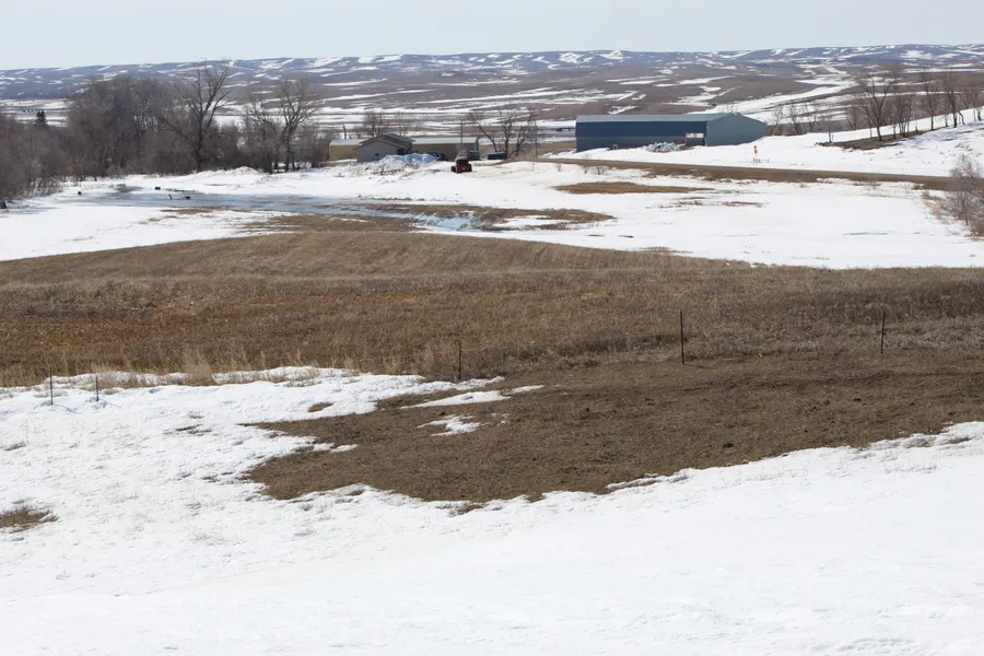
Auction Note: This auction features excellent crop and pastureland, along with a farmstead in Logan County, North Dakota. There are 280 +/- acres of cropland with an average Soil Productivity Index (SPI) of 73 and higher, including 140+/- acres with an SPI over 92. The cropland was planted to corn in 2018. This cropland is subject to a 2019 crop lease, with rent being paid to the buyer. The average SPI for the remaining pasture acreage is nearly 50. According to the U.S. Fish & Wildlife Service, there are no wetland or grassland easements in place. The farmstead includes a 4-bedroom, 3.5 bath home built in 1993 and several outbuildings. This property is also conveniently located within miles of Beaver Lake State Park, a popular outdoor recreation area.
Contact: Darin Peterson at 701.220.5396 or Pifers Auction & Realty at 877.700.4099 for more information and a complete catalog.
Parcel 1:
Acres: 96 +/-
Legal: W1/2NW1/4 20-134-71 & 20+/- acres within NE1/4 19-134-71
Crop Acres: 23 +/-
Pasture Acres: 73 +/-
Taxes (2019): $600.00 (Estimate)
Parcel Note: This parcel features excellent crop and hayland and the farmstead which features a ranch-style home, two-stall garage, barn, and several other outbuildings.
Parcel 2:
Acres: 148 +/-
Legal: NE1/4 19-134-71
Pasture Acres: 148 +/-
Taxes (2019): $680.00 (Estimate)
Parcel Note: This parcel features fantastic pasture land with up to date fences and great access.
Parcel 3:
Acres: 192 +/-
Legal: SE1/4 18-134-71 & 32+/- acres within NE1/4 19-134-71
Crop Acres: 175 +/-
Taxes (2019): $970.00 (Estimate)
Parcel Note: This parcel features excellent crop land with a strong cropping history.
Parcel 4:
Acres: 80 +/-
Legal: E1/2NW1/4 20-134-71
Crop Acres: 79 +/-
Taxes (2019): $490.00 (Estimate)
Parcel Note: This parcel features excellent crop land with an average SPI of almost 90!
OWNERS: Kelly & Autumn Horner
From elevation to risk assessment
Search for detailed parcel information including; Elevation & Vegetation Maps, Ownership Information, Detailed Parcel Information, Crop History Map, Soil Survey Productivity Data, and more.
Research Parcel InformationDirections
Driving Directions: From Napoleon: Drive 7.5 miles south on Hwy #3, turn east on 71st St SE for 6.5 miles, go north on Long St and drive through Burnstad for 1 mile, go west on 70th St SE for .2 mile, now go back north on 37th Ave SE for .5 mile. Here you will be at Parcel #1.
Resources
Land for Sale by Kevin Pifer
Logan County Properties By Type
- Farms for Sale in Logan County, North Dakota
- Commercial Property for Sale in Logan County, North Dakota
- Undeveloped Land for Sale in Logan County, North Dakota
- Residential Property for Sale in Logan County, North Dakota
- Hunting Land for Sale in Logan County, North Dakota
- Lakefront Property for Sale in Logan County, North Dakota
- Recreational Property for Sale in Logan County, North Dakota
- Horse Property for Sale in Logan County, North Dakota
- Ranches for Sale in Logan County, North Dakota
- Timberland for Sale in Logan County, North Dakota
- Beachfront Property for Sale in Logan County, North Dakota
- Riverfront Property for Sale in Logan County, North Dakota