Auction Information
553 acres in Clay County, Minnesota
Description
LAND AUCTION
553 +/- Acres - Clay County MN
Wednesday, November 2, 2016 - 11:00 a.m. (CT)
Auction Location: Pifers Cooperate Office 1506 29th Ave South, Moorhead, MN 56560
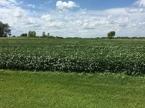
Property Note:
This property features 339.53+/- acres of cropland & 223.10 +/- acres of CRP. Great Location only 20 minutes from Fargo-Moorhead with an excellent Return on Investment opportunity along with fabulous hunting!
Rental agreement in place for 2017!
Parcel 1
Deeded Acres: 160 (to be surveyed)
Tillable Acres: 153.5 +/-
Legal: SW1/4 of 12-138-46 320 acres +/-
Parcel ID #: 05.012.0200
Taxes: $13.90 / acre (2016)
Parcel 2
Deeded Acres: 160 (to be surveyed)
Tillable Acres: 153.5 +/-
Legal: NW1/4 of 12-138-46 320 acres +/-
Parcel ID #: 05.012.0200
Taxes: $13.90 / acre (2016)
Parcel 3
Deeded Acres: 32.36 +/-
Legal: 32.36 +/- acres in the NE1/4
of the NE1/2 of 11-138-46
(to be surveyed)
Parcel ID #: 05.011.0400
Taxes: $19.32 / acre (2016 estimate)
Parcel 4
Deeded Acres: 166.71 +/-
Legal: E1/2 of 11-138-46 less 32.36 +/- acres (to be surveyed)
Parcel ID #: 05.011.0400
Taxes: $19.32 / acre (2016 estimate)
Owner: Tim Schlauderaff
This sale is managed by Pifers Auction & Realty Company, Kevin Pifer, MN #14-106. All Statements made the day of the auction take precedence over all printed materials. This property is subject to prior sale. The seller reserves the right to accept or reject any and all bids.
From elevation to risk assessment
Search for detailed parcel information including; Elevation & Vegetation Maps, Ownership Information, Detailed Parcel Information, Crop History Map, Soil Survey Productivity Data, and more.
Research Parcel InformationDirections
Driving Directions: From the Interstate Hwy 94 & Clay County Hwy 10 Intersection travel east 3 miles to Clay County Hwy 71 then turn left and drive north 1 mile to the SE corner of Parcel #1 and the SW corner of Parcel #2.
Environmental Factors
Resources
Clay County Properties By Type
- Farms for Sale in Clay County, Minnesota
- Lakefront Property for Sale in Clay County, Minnesota
- Residential Property for Sale in Clay County, Minnesota
- Undeveloped Land for Sale in Clay County, Minnesota
- Hunting Land for Sale in Clay County, Minnesota
- Ranches for Sale in Clay County, Minnesota
- Riverfront Property for Sale in Clay County, Minnesota
- Recreational Property for Sale in Clay County, Minnesota
- Commercial Property for Sale in Clay County, Minnesota
- Horse Property for Sale in Clay County, Minnesota
- Timberland for Sale in Clay County, Minnesota
- Beachfront Property for Sale in Clay County, Minnesota
Properties for Sale Nearby Counties
Clay County Properties By City
- Barnesville, Minnesota Land for Sale
- Comstock, Minnesota Land for Sale
- Dilworth, Minnesota Land for Sale
- Felton, Minnesota Land for Sale
- Georgetown, Minnesota Land for Sale
- Glyndon, Minnesota Land for Sale
- Hawley, Minnesota Land for Sale
- Hitterdal, Minnesota Land for Sale
- Moorhead, Minnesota Land for Sale
- Sabin, Minnesota Land for Sale
- Ulen, Minnesota Land for Sale
- Averill, Minnesota Land for Sale
- More
- Baker, Minnesota Land for Sale
- Dale, Minnesota Land for Sale
- Downer, Minnesota Land for Sale
- Kragnes, Minnesota Land for Sale
- Rollag, Minnesota Land for Sale
- Finkle, Minnesota Land for Sale
- Greenwood Communities, Minnesota Land for Sale
- Manitoba Junction, Minnesota Land for Sale
- Muskoda, Minnesota Land for Sale
- Rustad, Minnesota Land for Sale
- Tansem, Minnesota Land for Sale
- Winnipeg Junction, Minnesota Land for Sale