9456 0.23 557 Frederick Dr Howardwick, TX 79226
$ 5000
151 Sadie Dr Howardwick, TX 79226
Property ID:2039
Lot Size: 10018.8 sq ft
Parcel ID: 9456
Size: 0.23 acres
Dimensions: 100' x 102' x 100' x 101'
County: Donley
State: Texas
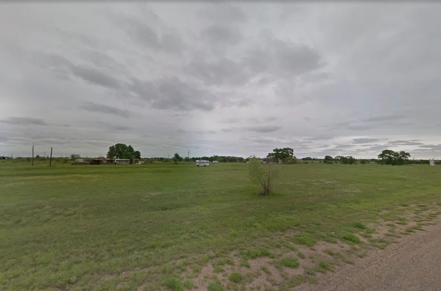
Build your dream home on the open Texas prairie. This 0.23 acres of level property in Howardwick .
There are power and water nearby and septic will be required. Zoned residential for a single-family home. Near
areas for camping, hunting, fishing, and boating. Minutes away from Clarendon Country Club, Prospect Park, and Greenbelt Reservoir.
Red River Water Authority provides water services in the area. 1 (940) 723-8697
Greenbelt Electric Cooperative, Inc. serves all and parts of 9 counties in the
Texas panhandle-Armstrong, Collingsworth, Donley, Wheeler, parts of Childress, Gray, Hemphill, Randall and Roberts 1 806-447-2536
Status: Available
GPS (Center) at the road: 35.035, -100.9036
NW Corner: 35.035, -100.9038
NE Corner: 35.035, -100.9034
SW Corner: 35.0347, -100.9038
SE Corner: 35.0347, -100.9034
Legal Description: LOTS 151-152 ARROWHEAD
Road Access: Dirt Road
Power: Greenbelt Electric Cooperative, Inc. serves all and parts of 9 counties in the Texas panhandle-Armstrong, Collingsworth, Donley, Wheeler, parts of Childress, Gray, Hemphill, Randall and Roberts - 1 806-447-2536
Water: Red River Water Authority provides water services in the area. - 1 (940) 723-8697
Sewer: needs septic
Zoning: Single Family Residential
RV Living Allowed?: YES
Mobile Home Living Allowed?: YES
Manufactured Home Living Allowed?: YES
Taxes Per Year?: 0.23
Conveyance: Warranty Deed
Type: TEXAS
From elevation to risk assessment
Search for detailed parcel information including; Elevation & Vegetation Maps, Ownership Information, Detailed Parcel Information, Crop History Map, Soil Survey Productivity Data, and more.
Research Parcel InformationDirections
GPS (Center) at the road: 35.035, -100.9036
NW Corner: 35.035, -100.9038
NE Corner: 35.035, -100.9034
SW Corner: 35.0347, -100.9038
SE Corner: 35.0347, -100.9034
Resources
Land for Sale by Owen D Trice
Donley County Properties By Type
- Ranches for Sale in Donley County, Texas
- Farms for Sale in Donley County, Texas
- Hunting Land for Sale in Donley County, Texas
- Commercial Property for Sale in Donley County, Texas
- Undeveloped Land for Sale in Donley County, Texas
- Lakefront Property for Sale in Donley County, Texas
- Recreational Property for Sale in Donley County, Texas
- Residential Property for Sale in Donley County, Texas
- Timberland for Sale in Donley County, Texas
- Horse Property for Sale in Donley County, Texas
- Riverfront Property for Sale in Donley County, Texas
- Beachfront Property for Sale in Donley County, Texas