Rock Creek Pivot Ranch
Description
Property:
Benefit from a well-diversified property that historically was the first established ranch in Gillam County Oregon. The Rock Creek Pivot Ranch consisting of 590+/- deeded acres spans across varied topography of rolling canyon hills, flat bottom meadow acres and upper flat tillable land. The property is used as a working cattle and hay operation and supports approximately 40-60 pairs annually. Primary and supplemental water rights allow for water to be pumped and distributed throughout the irrigated acres to grow a variety of forage crops from year to year. Rock Creek runs through the middle of the property and meanders approximately 2+/- miles providing seasonal water for livestock while also providing habitat for a variety of wildlife in the area. The ranch headquarters includes two homes, two large shops, livestock working facilities with semi truck access, a big barn, gain silos and various machine/storage sheds. The property overall provides a well-rounded opportunity for livestock producers alike.
-Quick Facts-
- 590+/- Total Deeded Acres
- 81 +/- Irrigated acres
- 135 +/- Dryland Tillable Acres put into pasture
- 374 +/- Rangeland and or improvement ground
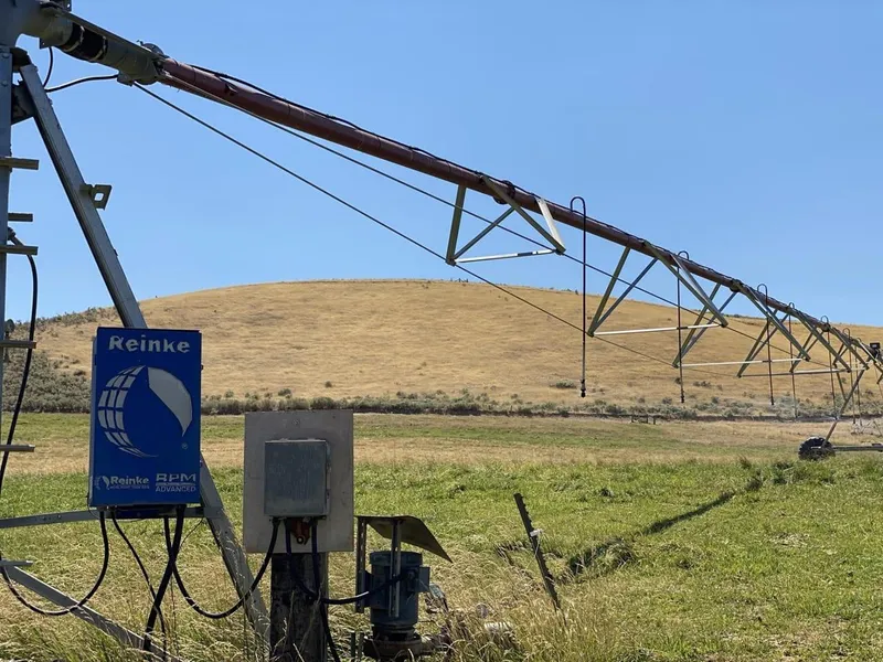
- 6 Total Pivots- 5 are solar/battery powered, 1 is 3 phase powered
- Some meadow spots still irrigated with handline
- Main House- 4 bedrooms 2 bath w/ Heat pump as well as Air Conditioning
- Small House- 3 bedrooms 2.5 bath w/ Heat pump as well as Air Conditioning
- Two Shops one of which is approximately two years old
- Two barns
- Two Equipment sheds
- One old chicken house
- 40-60 Pairs annually
-Perimeter fenced
- Approximately 3-cuttings of grass hay
- Seasonal Creek
- Power: Columbia Basin
- The grass hay is orchard grass and Max Q fescue mix.
- Upland bird Recreational opportunities abound
- Two- LOP Tags within the Biggs Unit
="msonormal">
From elevation to risk assessment
Search for detailed parcel information including; Elevation & Vegetation Maps, Ownership Information, Detailed Parcel Information, Crop History Map, Soil Survey Productivity Data, and more.
Research Parcel InformationResources
Gilliam County Properties By Type
- Undeveloped Land for Sale in Gilliam County, Oregon
- Farms for Sale in Gilliam County, Oregon
- Residential Property for Sale in Gilliam County, Oregon
- Ranches for Sale in Gilliam County, Oregon
- Recreational Property for Sale in Gilliam County, Oregon
- Commercial Property for Sale in Gilliam County, Oregon
- Riverfront Property for Sale in Gilliam County, Oregon
- Lakefront Property for Sale in Gilliam County, Oregon
- Horse Property for Sale in Gilliam County, Oregon
- Hunting Land for Sale in Gilliam County, Oregon
- Beachfront Property for Sale in Gilliam County, Oregon
- Timberland for Sale in Gilliam County, Oregon