6 acres in Titus County, Texas
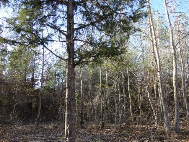
Nice 6+- acres situated just west of Lake Monticello and 5+- miles from the new loop. The property has rolling terrain with approx 30 feet change in elevation across the tract. The property is wooded with a seasonal creek and approx 400 feet of county road frontage offering several home sites as well. The property has community water and electricity along the road. Call Kerry Wells for more information 903-720-0387
From elevation to risk assessment
Search for detailed parcel information including; Elevation & Vegetation Maps, Ownership Information, Detailed Parcel Information, Crop History Map, Soil Survey Productivity Data, and more.
Research Parcel InformationDirections
Directions: From Mt Pleasant Take hwy 271 south, right on Fm 3417 to Fm 127. Left on Fm 127 for approx 4 miles. Right on county road 2600 for 1.2 mile property on left, tract is flagged in orange flagging along the CR 2600.
Environmental Factors
Land for Sale by Susan W. Jackson, REALTOR
Titus County Properties By Type
- Ranches for Sale in Titus County, Texas
- Farms for Sale in Titus County, Texas
- Undeveloped Land for Sale in Titus County, Texas
- Hunting Land for Sale in Titus County, Texas
- Lakefront Property for Sale in Titus County, Texas
- Residential Property for Sale in Titus County, Texas
- Timberland for Sale in Titus County, Texas
- Riverfront Property for Sale in Titus County, Texas
- Horse Property for Sale in Titus County, Texas
- Recreational Property for Sale in Titus County, Texas
- Commercial Property for Sale in Titus County, Texas
- Beachfront Property for Sale in Titus County, Texas
Properties for Sale Nearby Counties
Titus County Properties By City
- Cookville, Texas Land for Sale
- Mount Pleasant, Texas Land for Sale
- Winfield, Texas Land for Sale
- Argo, Texas Land for Sale
- Bridges Chapel, Texas Land for Sale
- Farmers Academy, Texas Land for Sale
- Green Hill, Texas Land for Sale
- Maple Springs, Texas Land for Sale
- Marshall Springs, Texas Land for Sale
- Millers Cove, Texas Land for Sale
- Monticello, Texas Land for Sale
- Roeder, Texas Land for Sale
- More