Auction Information
613 acres in Buffalo County, Nebraska
Procedures
Sheen Farm is located in Buffalo County, west of Kearney, Nebraska in the Platte River Valley. The property is offered as parcels & combinations at Absolute Auction. Excellent access is provided by county gravel roads, with US#30 to Parcel 3. The Farm includes gravity irrigated cropland, valley pasture and upland rangeland - excellent for housing development. The Title Insurance Commitment, Purchase Agreement, and additional information is available from Agri Affiliates.
Parcel 1 : SE1/4 Section 5-T8N-R16W, except railroad right-of-way and except building site in northeast corner. 18th Street on north, 46th Ave on east. Assessed as 144 acres, 2014 taxes $7,033. Irrigated soils 100% Class I Hord silt loam. 78.98 certified irrigated with CPNRD. Irrigation water provided by 80 acres of appropriated water rights from the Nebraska Pub-lic Power & Irrigation District (NPPID) - Kearney Canal (no equipment included). Balance of remaining acres as pasture. 93.3 acres FSA cropland. FSA base acres: Corn 22.6 acres at 124 bu/acre; Grain Sorghum 3.6 acres at 60 bu/acre; Soybeans 2.7 acres at 30 bu/acre.
Parcel 2 : Surveyed Lots 1 through 9 of LW Sheen Meadowlark Val-ley sub-division Section 6-T8N-R16W, 18th Street on north side. Assessed as 27 acres. 2014 taxes $1,168. Wood River and Silver Creek silt loam soils. Currently utilized as hayland.
Parcel 3 : Approximately 23 acres in SW portion of Section 31-T9N-R16W lying south of the Kearney Canal, bordering US#30. Estimated 2014 taxes $2,027 Soils are 100% Class I Hord silt loam. 20.52 certified irrigated with CPNRD. Irrigation water provided by 20 acres of appropriated water rights from the NPPID - Kearney Canal (no equipment included). 20.5 FSA cropland acres. FSA base acres to be determined.
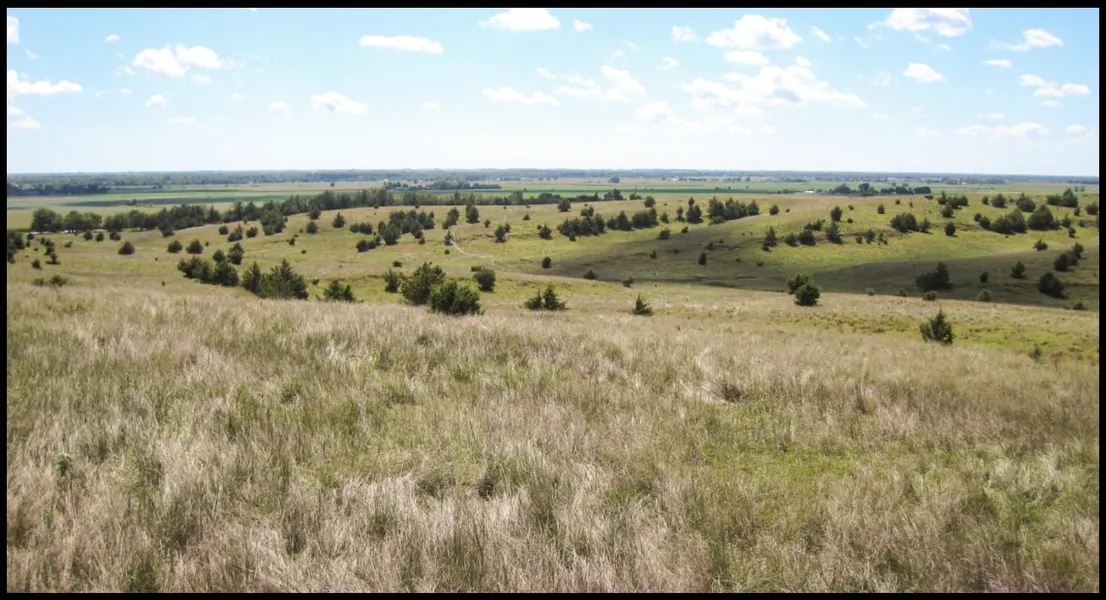
Parcel 4 : Approximately 240 acres in Section 31-T9N-R16W lying north of the Kearney Canal, except (4) existing surveyed building sites. Evergreen Road on the west. Estimated 2014 taxes $4,920. Approximately 17.4 +/- acres of gravity irrigated cropland. Irrigated soils are 100% Class I Hord silt loam. Certified irrigated acres, FSA cropland acres and FSA base acres to be determined. Irrigation water provided by the NPPID - Kearney Canal (no equipment included). 223 +/- acres rolling rangeland (no source of livestock water) with excellent access. Property includes 6,000 and 10,000 bushel grain bins. Owners of adjoining surveyed tracts to construct border fences.
Parcel 5 : Surveyed building site in Section 31-T9N-R16W bordering Ever-green Road, reserving an access easement for the benefit of Parcel 4. Assessed as 12 acres. Estimated 2014 taxes $2,000. Building improvements include a 1,528 sq. ft. 3 bedroom home with attached garage, 36 x 63quonset building, 26 x 36 livestock barn, 30 x 26 granary, 24 x 72 open front livestock shed and other small outbuildings.
Combination A (Parcels 4 & 5 - 252 Acres)
Parcel 6 : Approximately 64 acres in SE1/4 Section 36-T9N-R17W north of Kearney canal, bordering Evergreen Road. Estimated 2014 taxes $3,937. Soils are Class I & II Hord silt loam. 58.15 certified irrigated with CPNRD. Irrigation water provided by 58 acres of appropriated water rights from the NPPID - Kearney Canal (no equipment included). 58.15 FSA cropland acres. FSA base acres to be determined. See survey provision - Page 1.
Parcel 7 : Approximately 103 acres in S1/2NE1/4, SE1/4 Section 36-T9N-R17W bordering Evergreen Road. Estimated 2014 taxes $1,473. Consists entire-ly of rolling rangeland with great access. Livestock water provided by a well equipped with an electric submersible pump. Three phase electric line along east boundary. See survey provision - Page 1.
Outstanding opportunity for housing site development.
From elevation to risk assessment
Search for detailed parcel information including; Elevation & Vegetation Maps, Ownership Information, Detailed Parcel Information, Crop History Map, Soil Survey Productivity Data, and more.
Research Parcel InformationResources
Land for Sale by Tony Eggleston
Buffalo County Properties By Type
- Farms for Sale in Buffalo County, Nebraska
- Ranches for Sale in Buffalo County, Nebraska
- Commercial Property for Sale in Buffalo County, Nebraska
- Riverfront Property for Sale in Buffalo County, Nebraska
- Recreational Property for Sale in Buffalo County, Nebraska
- Hunting Land for Sale in Buffalo County, Nebraska
- Timberland for Sale in Buffalo County, Nebraska
- Lakefront Property for Sale in Buffalo County, Nebraska
- Residential Property for Sale in Buffalo County, Nebraska
- Undeveloped Land for Sale in Buffalo County, Nebraska
- Horse Property for Sale in Buffalo County, Nebraska
- Beachfront Property for Sale in Buffalo County, Nebraska
Properties for Sale Nearby Counties
Buffalo County Properties By City
- Amherst, Nebraska Land for Sale
- Elm Creek, Nebraska Land for Sale
- Gibbon, Nebraska Land for Sale
- Kearney, Nebraska Land for Sale
- Miller, Nebraska Land for Sale
- Odessa, Nebraska Land for Sale
- Pleasanton, Nebraska Land for Sale
- Ravenna, Nebraska Land for Sale
- Riverdale, Nebraska Land for Sale
- Shelton, Nebraska Land for Sale
- Denman, Nebraska Land for Sale
- Poole, Nebraska Land for Sale
- More