Correction Line Road, Lot#WP001, Rozel, KS 67574 - Pawnee County
Cropland Section In Pawnee County, Kansas
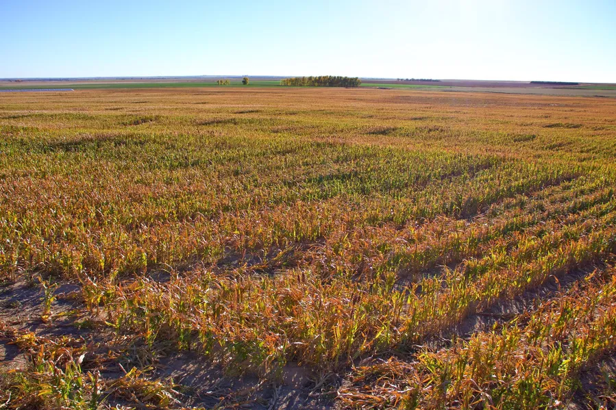
If you’ve shopped around for farm ground anywhere in Kansas, you know just how hard it is to come by a full section without several landowners owning parcels within the section. Offered here is a full mile-by-mile tract with nearly 75% pure cropland with the balance being fenced grassland with water. This property is located on Correction Line Road approximately 4 miles north and 3 miles west of Rozel, Kansas. Currently, 220 acres are planted to wheat, 236.2 acres are freshly cut milo stalks and 140 acres are fenced pastureland with windmill water. A written farm lease exists on this property, details include: 1/3 – 2/3 crop sharing agreement, 1/3 of fertilizer, insecticide, fungicide, and crop insurance will be paid by the landowner. Pasture lease includes 20$/acre. This current farm lease will expire on December 31, 2024. All the seller’s mineral rights will pass to a new buyer upon the date of closing. With the lack of farm ground for sale throughout the state, this is a rare opportunity to purchase a large section at a great price! Call one of the listing agents Mitch Keeley or Adam Hann today to set up a viewing of this property before it sells.
Property Features:
- Located on Correction Line Road in Pawnee County. Northwest of Rozel, Northeast of Burdett
- 236.2-acres milo stalks, 220-acres planted to wheat, 140.4-acres fenced pasture grass
- County road access on all four sides. Full section, one mile by one mile
- Farm lease exists until December of 2024. Crop sharing agreement
- Legal Description: All of Section 31, Township 20, Range 19 Pawnee County Kansas
- Sellers mineral rights will pass to new buyer upon date of closing
- Soil type: Harney Silt Loam, 380 acres; Roxbury Silt Loam, 59.02 acres; Wakeen Silt Loam, 55.72 acres; Nibson-Wakeen Silt Loam, 48.15 acres; Harney Silty Clay Loam, 41.93 acres; Uly Silt Loam, 34.76 acres; Harney-Uly Complex, 19.21 acres
From elevation to risk assessment
Search for detailed parcel information including; Elevation & Vegetation Maps, Ownership Information, Detailed Parcel Information, Crop History Map, Soil Survey Productivity Data, and more.
Research Parcel InformationEnvironmental Factors
Resources
Land for Sale by Mitch Keeley
Pawnee County Properties By Type
- Farms for Sale in Pawnee County, Kansas
- Hunting Land for Sale in Pawnee County, Kansas
- Commercial Property for Sale in Pawnee County, Kansas
- Ranches for Sale in Pawnee County, Kansas
- Residential Property for Sale in Pawnee County, Kansas
- Riverfront Property for Sale in Pawnee County, Kansas
- Lakefront Property for Sale in Pawnee County, Kansas
- Recreational Property for Sale in Pawnee County, Kansas
- Undeveloped Land for Sale in Pawnee County, Kansas
- Horse Property for Sale in Pawnee County, Kansas
- Timberland for Sale in Pawnee County, Kansas
- Beachfront Property for Sale in Pawnee County, Kansas
Properties for Sale Nearby Counties
Pawnee County Properties By City
- Burdett, Kansas Land for Sale
- Garfield, Kansas Land for Sale
- Larned, Kansas Land for Sale
- Rozel, Kansas Land for Sale
- Radium, Kansas Land for Sale
- Ash Valley, Kansas Land for Sale
- Bert Wettar, Kansas Land for Sale
- Frizell, Kansas Land for Sale
- Hamburg, Kansas Land for Sale
- Ray, Kansas Land for Sale
- Sanford, Kansas Land for Sale
- Vaughn, Kansas Land for Sale
- More