Auction Information

HANCOCK & HENDERSON COUNTY, IL LAND AUCTION - MYERS
HANCOCK & HENDERSON COUNTY, IL LAND AUCTION - MYERS
Monday, November 18, 2024 - 10:00 AM Central
Auction to be conducted as a virtual, online auction. If you need assistance with internet bidding, please contact our office at (844) 847-2161
LOCATION
Hancock & Henderson County, Illinois
The Myers land is located north of LaHarpe, IL in Sections 6 & 8 of LaHarpe Township, Section 12 of Durham Township, Hancock County and Sections 23 & 29 of Terre Haute Township and Section 31 of Raritan Township, Henderson County, Illinois. Land is generally located 25 miles northwest of Macomb, Illinois or 25 miles southeast of Burlington, Iowa. Be watching for tract and directional signage off IL State Hwy 94.
SELLER
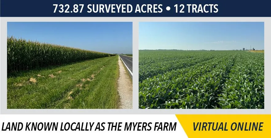
Land known locally as the Myers Farm
Scott L. Myers
Kathy F. Myers Life Estate
MANAGED BY
Jim Sullivan (217) 440-8172
GENERAL INFORMATION
732.87 surveyed acres 12 tracts
Land represents productive "Class A" farmland along with grain storage and machine sheds (Tract 12).
TRACT INFORMATION
Tract 1 55.61 surveyed acres
FSA figures should indicate 55.28 cropland acres
Productivity Index (PI): 125.4
Soil types include Muscatune, Greenbush, Elco-Ursa, Rozetta, Assumption and Atterberry
Access on the east by State Highway 94
Tract 2 58.37 surveyed acres
FSA figures should indicate 58.89 cropland acres or which 2.0 acres are currently enrolled in CRP at $300.00/ac through 9-30-2032
Productivity Index (PI): 144.1 (CLASS A)
Soil types include Muscatune and Sable
Access on the east by State Highway 94 and on the north by Co Hwy 14 (ECR 2900)
Tract 3 88.09 surveyed acres
FSA figures should indicate 86.43 cropland acres of which 2.08 acres are currently enrolled in CRP at $300.00/ac through 9-30-2032
Productivity Index (PI): 142 (CLASS A)
Soil types include Muscatune, Sable, Assumption, Rozetta, Greenbush and Osco
Access on the north by Co Hwy 14 (ECR 2900)
Tract 4 57.35 surveyed acres
FSA figures should indicate 57 cropland acres
Productivity Index (PI): 142.9 (CLASS A)
Soil types include Muscatune, Sable, Rubio and Atterberry
Improvements include a grain bin and a storage building
Access on the south by Co Hwy 14 (ECR 2900)
Tract 5 58.80 surveyed acres
FSA figures should indicate 58 cropland acres
Productivity Index (PI): 141.3 (CLASS A)
Soil types include Muscatune, Atterberry, Sable and Rozetta
Access on the south by Co Hwy 14 (ECR 2900)
Tract 6 86.63 surveyed acres
FSA figures should indicate 85.12 cropland acres
Productivity Index (PI): 137.8 (CLASS A)
Soil types include Muscatune, Atterberry, Rozetta and Sable
Access on the north by Co Hwy 14 (ECR 2900) and on the east by NCR 2500
Tract 7 41.24 surveyed acres
FSA figures should indicate 33.45 cropland acres
Productivity Index (PI): 112.1
Soil types include Rozetta, Fayette, Osco, Stronghurst and Muscatune
There is a 30 ingress egress easement along the east 30 of this tract which provides access to the adjoining landowner to the south
Access on the north by TWP RD 200 N
Tract 8 82.94 surveyed acres
FSA figures should indicate 82.01 cropland acres
Productivity Index (PI): 144.5 (CLASS A)
Soil types include Muscatune, Osco and Rozetta
Access on the noth by St Route 94 and on the west by CR 1300 E
Tract 9 82.94 surveyed acres
FSA figures should indicate 81.13 cropland acres of which 2.01 acres are currently enrolled in CRP at $300.00/ac through 9-30-2027
Productivity Index (PI): 143.8 (CLASS A)
Soil types include Musatune and Osco
Access on the north by St Route 94
Tract 10 54.11 surveyed acres
FSA figures should indicate 54 cropland acres
Productivity Index (PI): 144.7 (CLASS A)
Soil types include Muscatune, Osco and Rozetta
Access at the southwest corner by RD 000 N
Tract 11 57.33 surveyed acres
FSA figures should indicate 56.19 cropland acres of which 1.23 acres are enrolled in CRP at $361.49/ac through 9-30-2026
Productivity Index (PI): 143.9 (CLASS A)
Soil types include Muscatune, Osco and Sable
Access on the north by RD 50N and on the east by RD 1600 E
Tract 12 9.46 surveyed acres
Ideally located tract on St Hwy 94 with electricity, natural gas and public water!
Improvements include 5 grain bins (1) 30,000 bushel GSI; (1) 10,000 bushel+ Conrad; (3) 10,000 bushel bins (70,000 bushel total storage) 48 x 60 open front metal livestock building; 44 x 86 metal machine shed with 2 sliding doors (16 & 14); 40 x 40 wood barn; 20 x 36 wood barn; 24 x 32 garage with (2) 9 x 7 overhead doors; 16 x 24 garage with a 8 x 7 overhead door; Historic Prairie View wood frame barn
METHOD & TERMS
Tracts 1 11 will be sold on a price per acre basis, and offered through the marketing method of Buyers Choice, whereas the high bidder can elect any of the tracts for their high bid. Any remaining tracts will continue to be offered Buyers Choice until all tracts have been elected. Tract 12 will be sold last for the total dollar amount or lump sum. The tracts will NOT be offered in their entirety at the conclusion of the auction.
Immediately following the auction, the successful buyer will be required to sign a real estate sales contract and pay ten percent (10%) of the purchase price as a non-refundable down payment which will be held in escrow until closing. The balance of the purchase price will be due at closing which will take place on or before Wednesday, December 18, 2024.
The seller will provide title insurance in the full amount of the purchase price and pay the 2024 real estate taxes, due and payable in 2025. Provided the final closing has occurred possession will be granted the earlier of February 28th, 2025 or upon the removal of the 2024 growing crops. Possession on the grain bins and farm buildings will be on or before June 1, 2025.
Bidding is NOT subject to any contingencies, including but not limited to financing, an appraisal or inspection of the property.
All announcements made sale day take precedence over prior advertising either written or oral. The information in our brochure, in our advertisements and on our website is believed to be accurate; however, no liability for its accuracy, errors or omissions is assumed. All lines drawn on maps, photographs, drone video, etc. are approximate. Buyers should verify the information to their satisfaction. There are no expressed or implied warranties made by the seller or Sullivan Auctioneers, a BigIron company, pertaining to this property. Real estate is being sold AS IS.
Land known locally as the Myers Farm
Scott L. Myers
Kathy F. Myers Life Estate
Representing Attorney:
John McMillan | McMillan, Hennenfent & DeJoode, PC
402 E Jackson St, Macomb, IL 61455 | (309) 837-2904
Auction Manager:
Jim Sullivan (217) 440-8172
From elevation to risk assessment
Search for detailed parcel information including; Elevation & Vegetation Maps, Ownership Information, Detailed Parcel Information, Crop History Map, Soil Survey Productivity Data, and more.
Research Parcel InformationDirections
Hancock & Henderson County, Illinois
The Myers land is located north of LaHarpe, IL in Sections 6 & 8 of LaHarpe Township, Section 12 of Durham Township, Hancock County and Sections 23 & 29 of Terre Haute Township and Section 31 of Raritan Township, Henderson County, Illinois. Land is generally located 25 miles northwest of Macomb, Illinois or 25 miles southeast of Burlington, Iowa. Be watching for tract and directional signage off IL State Hwy 94.
Environmental Factors
Resources
Land for Sale by Sullivan Auctioneers
Hancock County Properties By Type
- Hunting Land for Sale in Hancock County, Illinois
- Farms for Sale in Hancock County, Illinois
- Lakefront Property for Sale in Hancock County, Illinois
- Undeveloped Land for Sale in Hancock County, Illinois
- Recreational Property for Sale in Hancock County, Illinois
- Residential Property for Sale in Hancock County, Illinois
- Riverfront Property for Sale in Hancock County, Illinois
- Commercial Property for Sale in Hancock County, Illinois
- Ranches for Sale in Hancock County, Illinois
- Horse Property for Sale in Hancock County, Illinois
- Timberland for Sale in Hancock County, Illinois
- Beachfront Property for Sale in Hancock County, Illinois
Properties for Sale Nearby Counties
Hancock County Properties By City
- Augusta, Illinois Land for Sale
- Basco, Illinois Land for Sale
- Bowen, Illinois Land for Sale
- Carthage, Illinois Land for Sale
- Colusa, Illinois Land for Sale
- Dallas City, Illinois Land for Sale
- Elvaston, Illinois Land for Sale
- Ferris, Illinois Land for Sale
- Hamilton, Illinois Land for Sale
- La Harpe, Illinois Land for Sale
- Nauvoo, Illinois Land for Sale
- Niota, Illinois Land for Sale
- More
- Plymouth, Illinois Land for Sale
- Sutter, Illinois Land for Sale
- Warsaw, Illinois Land for Sale
- West Point, Illinois Land for Sale
- Adrian, Illinois Land for Sale
- Bentley, Illinois Land for Sale
- Burnside, Illinois Land for Sale
- Colmar, Illinois Land for Sale
- Denver, Illinois Land for Sale
- Fountain Green, Illinois Land for Sale
- Harmony, Illinois Land for Sale
- La Crosse, Illinois Land for Sale
- Mccall, Illinois Land for Sale
- Pontoosuc, Illinois Land for Sale
- Stillwell, Illinois Land for Sale
- Tioga, Illinois Land for Sale
- Chili, Illinois Land for Sale
- Disco, Illinois Land for Sale
- Durham, Illinois Land for Sale
- Elderville, Illinois Land for Sale
- Joetta, Illinois Land for Sale
- Middle Creek, Illinois Land for Sale
- Old Niota, Illinois Land for Sale
- Powellton, Illinois Land for Sale
- Saint Mary, Illinois Land for Sale
- Wythe, Illinois Land for Sale